Clockwise from top left, photographs courtesy of bikeradar.com, lebelbicycles.com, cyclingnews.com and cyclingweekly.com
A web search for “Best Bicycle Upgrades” will produce suggestions with tyres at or close to the top of the list. It shouldn’t be surprising that tyre upgrades have been a “must have” since the bicycle was invented.
Illustration courtesy of bicyclehistory.net
Karl Drais invented his Laufmaschine (running machine) in 1817. Later known as a “draisine,” this vehicle had wooden wheels. Despite unpaved roads and solid wheels, Drais propelled his machine, Fred Flintstone fashion, nearly 16 kilometres in just over an hour.
Photograph courtesy of coimages.sciencemuseumgroup.org.uk
By 1866 Pierre Lallement received a US patent for a bicycle propelled by pedals attached to a slightly larger front wheel. These bicycles were called bone shakers because of the exceedingly uncomfortable ride caused by the stiff wrought-iron frame and wooden wheels surrounded by iron tyres.
Photograph courtesy of cars.bonhams.com
An upgrade, available since Charles Goodyear patented his vulcanisation process in 1844, was solid rubber tyres. Such tyres improved on solid wooden wheels or spoked wheels with iron rims, but they still gave a jarring ride.
Photograph courtesy of coimages.sciencemuseumgroup.org.uk
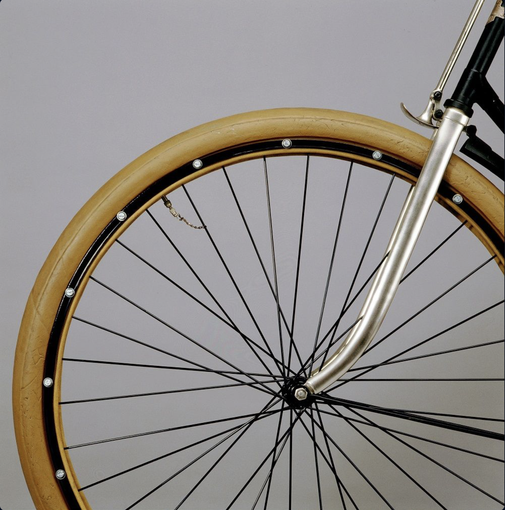
In 1885 John Kemp Starley and William Sutton introduced the Rover safety bicycle with a chain and sprocket drive and equally sized wheels. The Rover came with solid rubber tyres.
Photograph courtesy of heritage-print.com
Arguably the last major innovation in tyres came in 1887 when John Boyd Dunlop, in an attempt to smooth the bumpy ride of his son’s tricycle, nailed linen-wrapped inflated tubes to the solid wooden tricycle wheels. These were the first pneumatic, or air-filled, tyres.
The photograph above shows Johnny Dunlop riding his newly improved tricycle.
Photograph courtesy of progress-is-fine.blogspot.com
An improved version found immediate use among the growing number of enthusiastic bicycle riders. The first pneumatic tyre factory was started in 1889 to make tyres under Dunlop’s patent of 7th December 1888.
The photograph above shows Dunlop holding a bicycle fitted with pneumatic tyres.
Photograph courtesy of michelin.com
In 1891 André and Édouard Michelin introduced detachable pneumatic tyres for bicycles, and August Schrader invented his namesake Schrader valve. At the end of the 19th century, Etienne Sclaverand registered his patent for the Presta valve.
One can argue that the next step-change in bicycle tyres didn’t come until 1999 when Mavic introduced the first tubeless wheel and tyre system for mountain bikes. It was 2006 before Shimano and Hutchinson introduced a road tubeless standard.
Photograph courtesy of cdn.mos.cms.futurecdn.net
The next bit of bicycle tyre innovation came when Marianne Vos showcased self-inflating tyre technology while winning the 2024 UCI Gravel World Championships. The Gravaa system uses tiny compressors within the wheel hubs to increase or decrease tyre pressure.
Despite these innovations bicycle tyres are what they were 135 years ago. They are air-filled tubes inflated via a valve. Admittedly bicycle tyres are better designed and constructed today.
Photograph courtesy of smarttirecompany.com
That may be about to change. The SMART Tire Company aims to commercialise an airless alloy tyre called METL (Martensite Elasticized Tubular Loading). METL was invented for space exploration. SMART is an acronym for Shape Memory Alloy Radial Technology.
METL promises to revolutionise bicycle tyres. Airless, never flat, elastic like rubber yet strong like titanium. At launch, these tyres are expected to cost USD150 each. The tread is rated for 13,000 km and retreads will be available for about USD10 per tyre.
The key phrase is “at launch.” The initial launch was expected to be in Q2 2022. That slipped to June and ,then Q4 2024. Today you can visit the SMART Tire Company’s website and add your name to a 2025 Wait List.
Photographs courtesy of smarttirecompany.com
I hope the SMART Tire Company does launch METL at an affordable price. That would be a proper tyre upgrade. Perhaps there will be an option for sidewalls that match your bike.
Dr. Rainer Newberry, a geology professor at the University of Alaska, Fairbanks, invented the Fun Scale around 1985. Getting to the geologic study site in Alaska in those days involved hiking and climbing over challenging terrain. It could be raining or even snowing. He created the Fun Scale during one trip that was, in his words, “pretty hairy.”
The scale has 3 types of fun:
Type 1 fun is enjoyable while it’s happening. Also known as, simply, fun.
Type 2 fun is miserable while it’s happening but fun in retrospect.
Type 3 fun is not fun at all. Not even in hindsight.
The Fun Scale was quickly adopted by the mountaineering community as a simple mechanism for rating climbs and quantifying the fun-to-suffer ratio. Of course, where an effort falls on the Fun Scale depends on one’s tolerance for discomfort and risk. One person’s Type 2 fun may be another’s Type 3 fun.
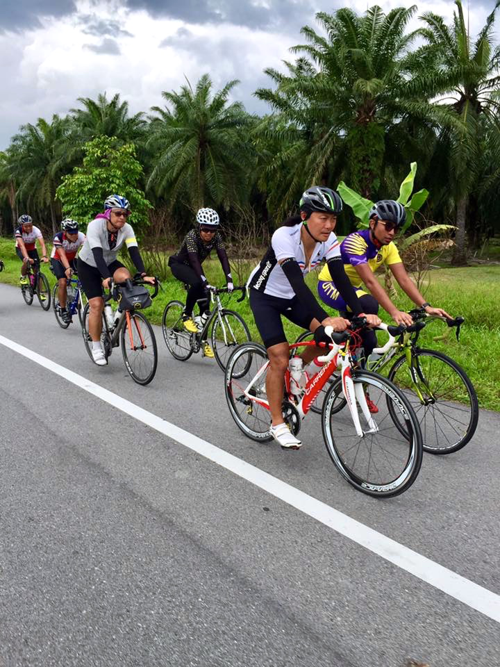
The scale has since been applied to other outdoor activities. When applied to cycling, Type 1 rides are leisurely, casual rides along a scenic route at a comfortable pace.
Photograph courtesy of M Lim
Type 2 rides are challenging rides that feel good to complete, like an Audax ride. I wouldn’t describe them as “miserable.” They can hurt, though. This photograph was taken during an Audax 300 km ride in 2017.
Photograph courtesy of M Lai
Type 3 rides are very difficult or dangerous, such as riding in extreme weather conditions or cycling through heavy traffic with significant danger.
I have not had any “What was I thinking?” Type 3 rides. I have done a few rides that were fun in parts, but I would not do them again. The Audax 400 km ride in 2016 is one of those. My friends and I remember
Photographs courtesy of M Lai and Audax Randonneurs Malaysia
Less memorable are particular incidents during that ride. Like the fall into a drain that led to this:
I do not have any 300 km or 400 km rides left in me. Not at my current level of fitness.
These days, my friends and I occasionally stray into Type 2 territory, like the 109 km Audax Pink Ride we did last January. Again, this ride was not miserable, but it was certainly uncomfortable at times.
Photograph courtesy of Audax Randonneurs Malaysia
We are mostly about Type 1 rides now.
Definitely heavy on the “enjoyable while it’s happening” side of the Fun Scale.
A bike is never just a bike – it’s a reflection of where you are, where you’ve been, and, sometimes, where you want to go.
Iain Treloar Bikes of the (Staff) Bunch: Iain’s Moots Vamoots CR Velo, Updated Oct 9, 2023
Iain wrote about how you can trace the changes in his life by what and where he has been riding. This made me think about all the bikes I have owned.
I started road cycling at the end of 2008, relatively late in my life. That is when I bought a Trek 7.5 FX and started exploring the streets of downtown Houston.
Photograph courtesy of viaciclante.com
Many posts in this blog trace my cycling journey from that hybrid bike through a succession of road bikes.
There were earlier times in my life when I owned a bicycle. My first bike was a Raleigh Chopper.
Photograph courtesy of wheredidtheygo.co.uk
I was eleven or twelve years old. That Chopper, with its stick shift and easy rider handlebars, was certainly cool. It also wasn’t very safe. The rearward centre of gravity made it easy to pop unintended wheelies. I still carry a scar on one knee from a fall after I stamped on the pedals and the front wheel went skyward.
I don’t remember what happened to that bike. There wasn’t anywhere to cycle to, and I don’t recall any other children in the neighborhood having bikes. I must have stopped riding it, and my parents got rid of it.
I was fifteen when I was given another bicycle. This time, it was a Raleigh Grand Prix road bike.
Photograph courtesy of sheldonbrown.com
It came with toe clips and straps on the pedals. If you flipped the pedals, the clips scraped on the ground on the downstroke. Speaking of scrapes, the cottered cranks regularly took skin off my ankle bones. I rode that bicycle a lot. I rode it to school. I rode it to evening football games. I rode it to visit friends in places like Petaling Jaya, a 25 km round trip.
I didn’t ride for fun as a teenager. I didn’t explore the city on my bicycle. I didn’t have any friends who cycled. My bicycle was purely a mode of transport to get to and from places. Again, I didn’t have friends who cycled, so there was no social aspect to enjoy.
I still had that bike when I went overseas to university. When I came home after graduating, I found that my father had given it away. At that stage of my life, getting settled and starting my first job took centre stage. Riding a bicycle never crossed my mind. I didn’t think much of it then, but I wish I still had that bike.
My career and family occupied most of my time through my thirties and into my forties. My main forms of exercise then were playing football, basketball and jogging. It wasn’t until work took me to England that I owned another bicycle. We lived in a cul de sac, and my neighbours had bicycles. They rode as a group on summer evenings. I bought a Carrera mountain bike to join them on those social rides. Mostly to a local pub! I rode it to work a few times, but it largely served a social purpose.
The only photograph I could find of what looks like that bike is in this mid-1990s advertisement.
Photograph courtesy of eBay.co.uk
That Carrera came to Kuala Lumpur with me at the end of my overseas posting. I occasionally rode it around the neighbourhood but depended upon football and squash for exercise. I recall a death-defying experience when I followed a mountain-biker friend at speed down a jungle trail to find an open ditch at the bottom of the hill. To this day, I do not know how I bunny-hopped that ditch and stayed upright. That was the last time I rode off-road.
A few years later, I accepted a job in Paris, and the Carrera came with me. I used it more to ride around the neighbourhood with my sons than anything else. My life was in turmoil at the end of that posting, and the bike got lost in the shuffle.
It was seven years before a bicycle entered my life again. The year was 2008. I was fifty-two, with a recent ACL replacement. You can read about it here.
Cycling has played a major role in my life since then. I ride for the physical challenge, to explore, and to enjoy the sights and sounds of nature. I also ride with friends for the shared experiences and camaraderie.
I still ride three of the four road bikes that came into my life after the Trek, starting in January 2010. My second road bike is accumulating miles with a friend in Canada.
There will come a time when an e-bike is a sensible option. I hope not for a while longer, though. I like where I am and where I want to go.
New Year, New Rides: Setting smart cycling goals for 2025 on welovecycling.com
Then there are the YouTube videos:
My CRAZY Cycling Goals for 2025? – New Year’s Q&A
What are your cycling goals for 2025?
Unpacking my cycling goals for 2025
Contrary to these, the YouTube video that reflects my attitude toward cycling goals today is titled No Cycling Goals This Year – And It Feels Great!
When I started cycling on a road bike in 2010, my goal was simple. Keep up with the much more experienced group of roadies I joined! That goal quickly changed to surviving the longer and longer rides I was roped into. I remember feeling thoroughly trashed during the last 20 km of the 98.4 km Gator Ride in March 2010. That was not quite my first metric-century ride. I didn’t have the energy to pedal another 1.6 km to make it a 100 km ride.
My first ride further than 100 km was almost an Imperial century. As with the Gator Ride, I didn’t have the energy to cover another 3.9 km to turn the 156.1 km Space Race in April 2010 into a 160 km ride.
AI image generated by WordPress
It wasn’t until 2012 that I completed a 160 km ride. Under a cold and grey early spring sky in South Holland.
Photograph courtesy of sleutelstad.nl
Things snowballed from there. I did progressively longer and longer rides. My first annual cycling goal was to ride 10,000 km in 2015. I increased that to 12,000 km in 2016 and 15,000 km in 2017.
Turning 60 at the end of 2017, along with the occasional medical issue and what life throws at you in general, coincides with an ongoing reduction in my annual distances. I rode 12,000 km in 2018 and 10,000 km in 2019, and the number has continued to fall. These days, I am pleased to ride 5,000 km in a year. Chasing kilometres has been replaced by rides to that day’s breakfast place.
This makes my non-cycling goal to weigh less at the end of 2025 than I do now particularly challenging!
Audax Randonneurs Malaysia (ARM) marked its 10th Anniversary with the eighth edition of the Pink Ride. The Pink Ride honours the power and spirit of lady cyclists. This now iconic ride is free for all ladies, encouraging more women to take on the challenge of long-distance cycling.
I did my first Pink ride, the BRM 200 km distance, in 2019. Read about that twenty-strong group ride here.
A dozen of us did the BRM 200 km distance again in 2020. Read about the Pink Ride 3.0 here.
It was 2023 before I did another Pink Ride. The Pink Ride 6.0 was the first edition that offered a Permanent 100 km distance as well as the usual BRM 200 km route. I opted for the 100 km event, which you can read about here.
Four of us planned to do the Permanent 100 km Pink Ride 7.0. Read about why only two of us did the ride here.
Four of us signed up for the Permanent 100 km Pink Ride 8.0. We all agreed that given our respective states of fitness, the BRM 200 km event was a step too far.
The start and finish was at MesaMall in Nilai. My Biker Chick and I were at the mall the afternoon before the ride to collect four ride packs.
Photograph courtesy of Audax Randonneurs Malaysia
Apart from some stickers, a discount coupon for cycling products, isotonic tablets and the all-important brevet card, we also got a super useful waterproof pouch. Perfect for holding a mobile phone and some cash.
The Pink Ride 3.0 in 2020 also started and finished at MesaMall. I stayed in a nearby hotel before that ride. Since then, apartment blocks integrated with the mall have been built. I booked two homestay apartments, one for my Biker Chick and one for G and V.
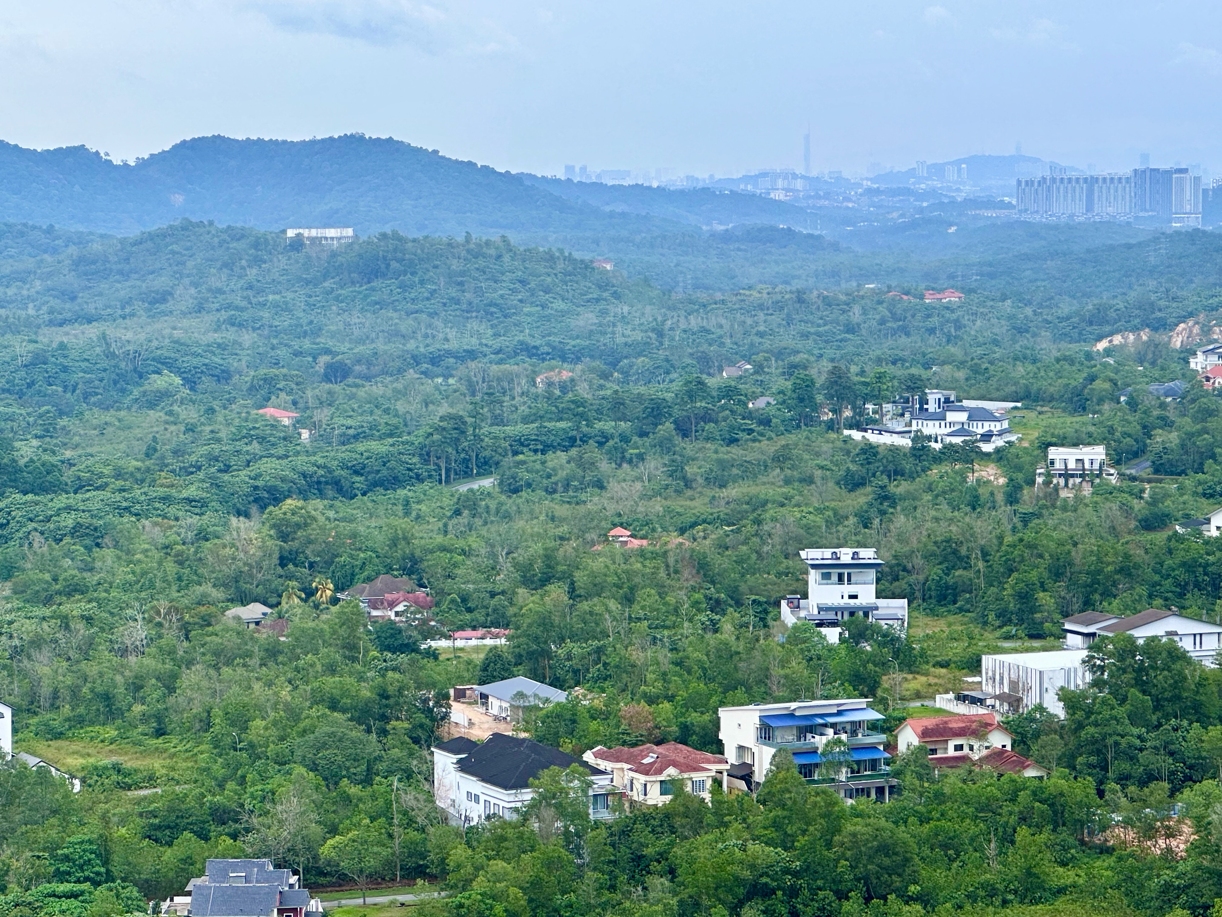
We had a nice view of the hills around Nilai.
G and V arrived that evening. We hit the mall right away, looking for food. Campur Campur Kitchen was a winner.
We walked off some of those calories by exploring the mall. We added calories by eating ice cream at Nice to CU. We bought drinks and nibbles for the morning at Jaya Grocer, and then it was time for bed. I set my alarm for 3:30 am.
G, V and I went downstairs to meet M at 4:30 am.
Photograph courtesy of ML
About 150 of us rode into the dark a little after 5:00 am.
The Permanent 100 km route took us from MesaMall through Bandar Baru Salak Tinggi, Sepang and over the Sungai Langat at Banting. It was very pleasant once dawn broke and we could see where we were going. The forecasted rain stayed away, and the air was cool.
Photograph courtesy of ML
We made our first extended stop at Kampung Batu Laut. Not counting the twelve-minute stop after just 9.6 km to fix my flat tire.
Photograph courtesy of VV
Photograph courtesy of ML
I refilled my 750 ml bidon for the second time at Pantai Batu Laut. I was making a concerted effort to drink a lot. I am sure the reason I struggled on past long rides is because I didn’t drink enough.
I had more to drink at our breakfast stop at Kafe Cikgu Kundang 2.5 km later. The bike racks caught our attention. The food was worth stopping for.
Photograph courtesy of VV
The first checkpoint was 3.5 km down the road at Tanjung Sepat. We met old cycling friends there.
Photograph courtesy of AL
From Tanjung Sepat, we rode to Sungai Pelek, where I refilled my bottle again. The weather continued to be kind to us.
Photographs courtesy of Audax Randonneurs Malaysia
The BRM 200 km riders turned right at Pekan Sepang and rode to Lukut, Port Dickson, Rantau, Sendayan and Bandar Baru Enstek.
We rode from Pekan Sepang straight to Bandar Baru Enstek and back to MesaMall.
Map courtesy of Audax Randonneurs Malaysia
About six and a half hours after we left MesaMall, we rolled back under the Start / Finish arch and into the mall to the final checkpoint.
Photographs courtesy of Audax Randonneurs Malaysia
We collected our medals and celebrated our successful metric century ride.
We all felt it in our legs the following day, but apart from that, we were none the worse for wear. I am sure drinking more than three litres during the ride made a positive difference for me.
There is another Pink Ride scheduled for May. Perhaps we will be fit enough to ride the BRM 200 distance.
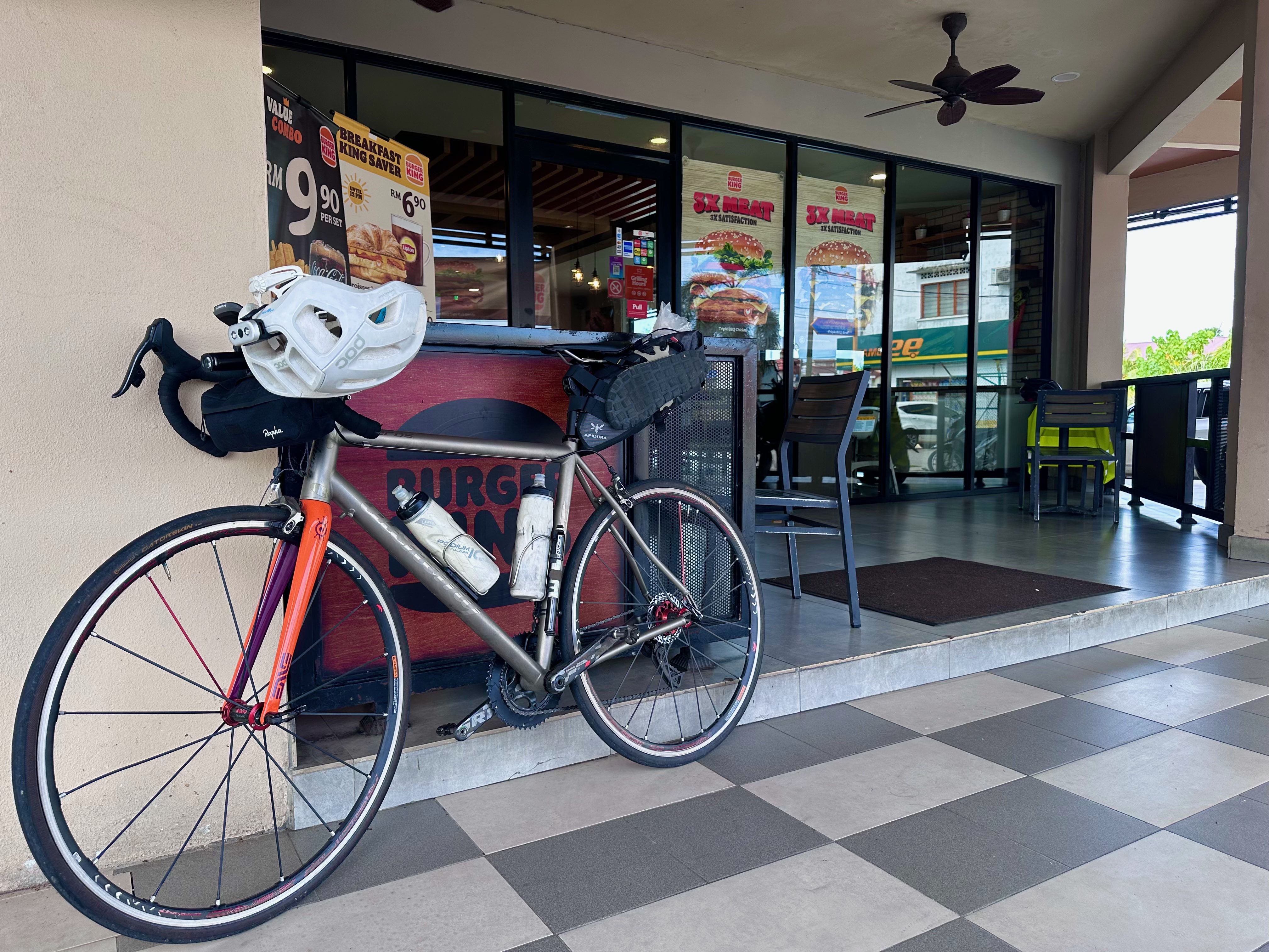
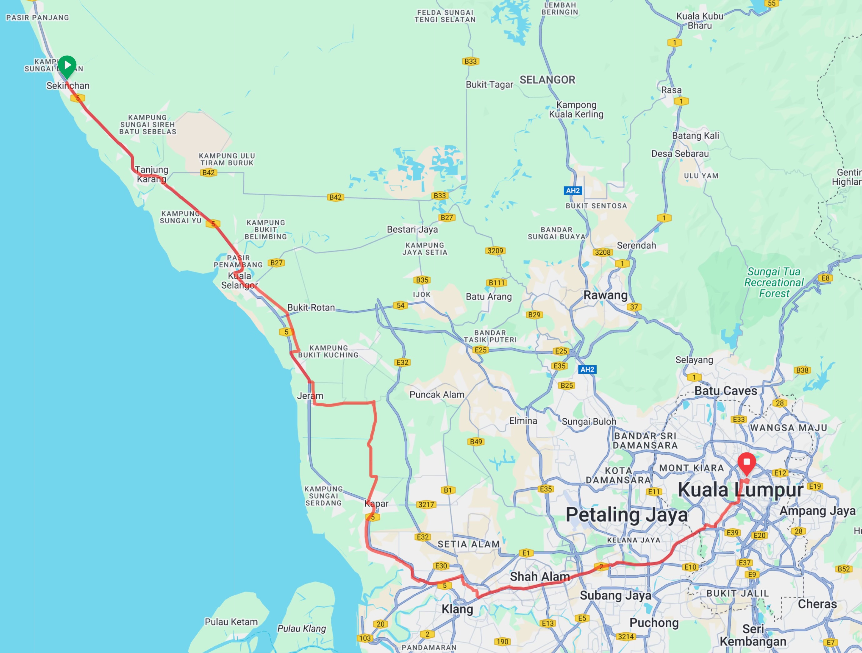
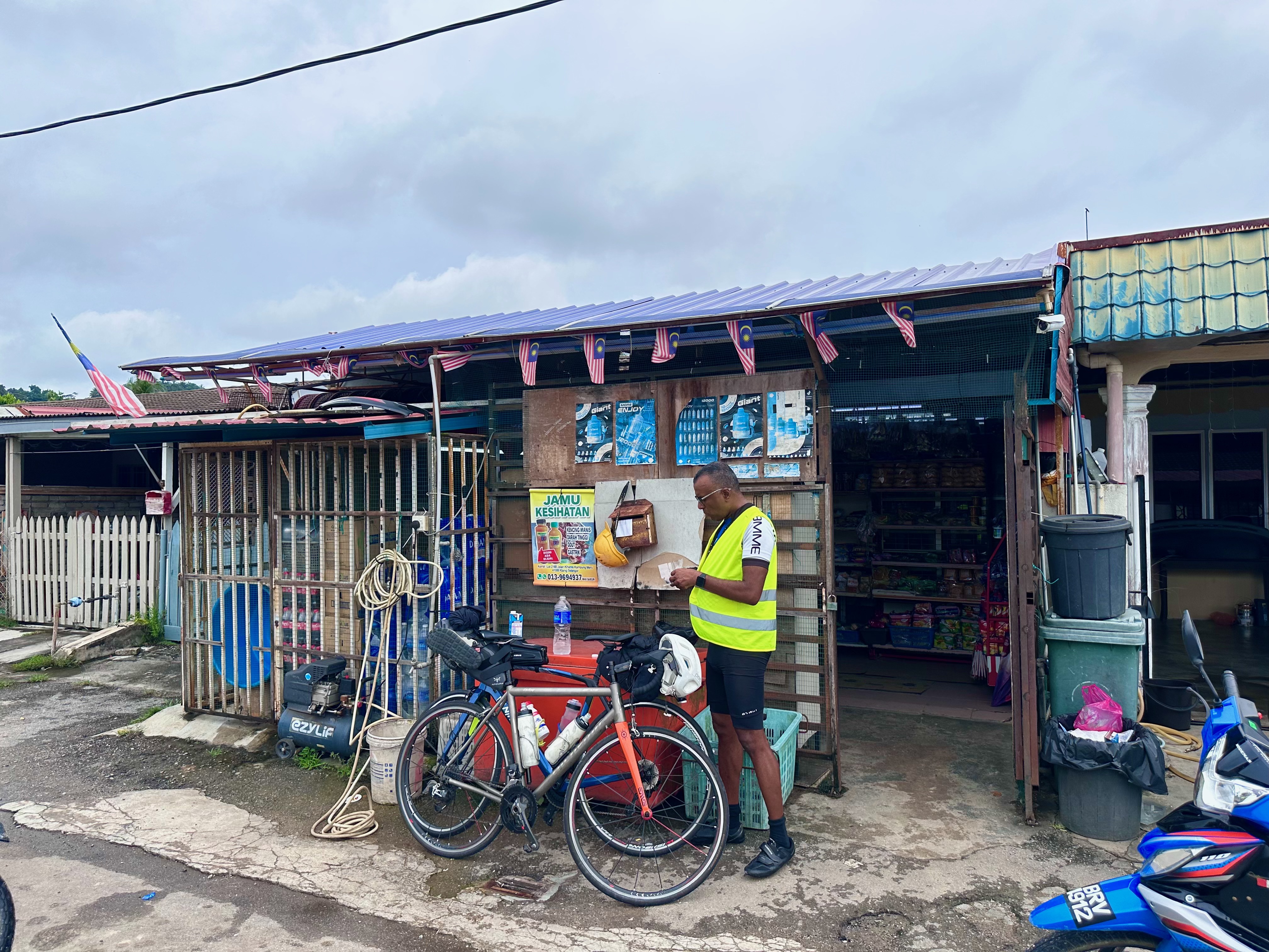
Last weekend Brian and I made an overnight trip to Sekinchan. I had a new Expedition Saddle Pack, courtesy of a generous discount coupon from Apidura. This time, I had a Rapha Explore Bar Bag rather than the Route Werks Handlebar Bag I used on my last multi-day ride with Brian. This unused piece of kit was gifted to me a long time ago. I can fit it on my bar without moving my Garmin mount. The Explore Bar Bag worked well on this ride.
Photographs courtesy of rapha.cc
Brian rode to meet me at Syed Bistro, across from where I live, for breakfast. We clipped in and were on our way at 7:25 am.
Map courtesy of Ride With GPS
We rode about 8 km to the Federal Highway and then 22 km to Klang along the motorcycle lane beside the highway. I had plotted a route from the end of the Federal Highway motorcycle lane to Kapar that avoided going through Klang. What I hadn’t realised is Klang is circled by highways.
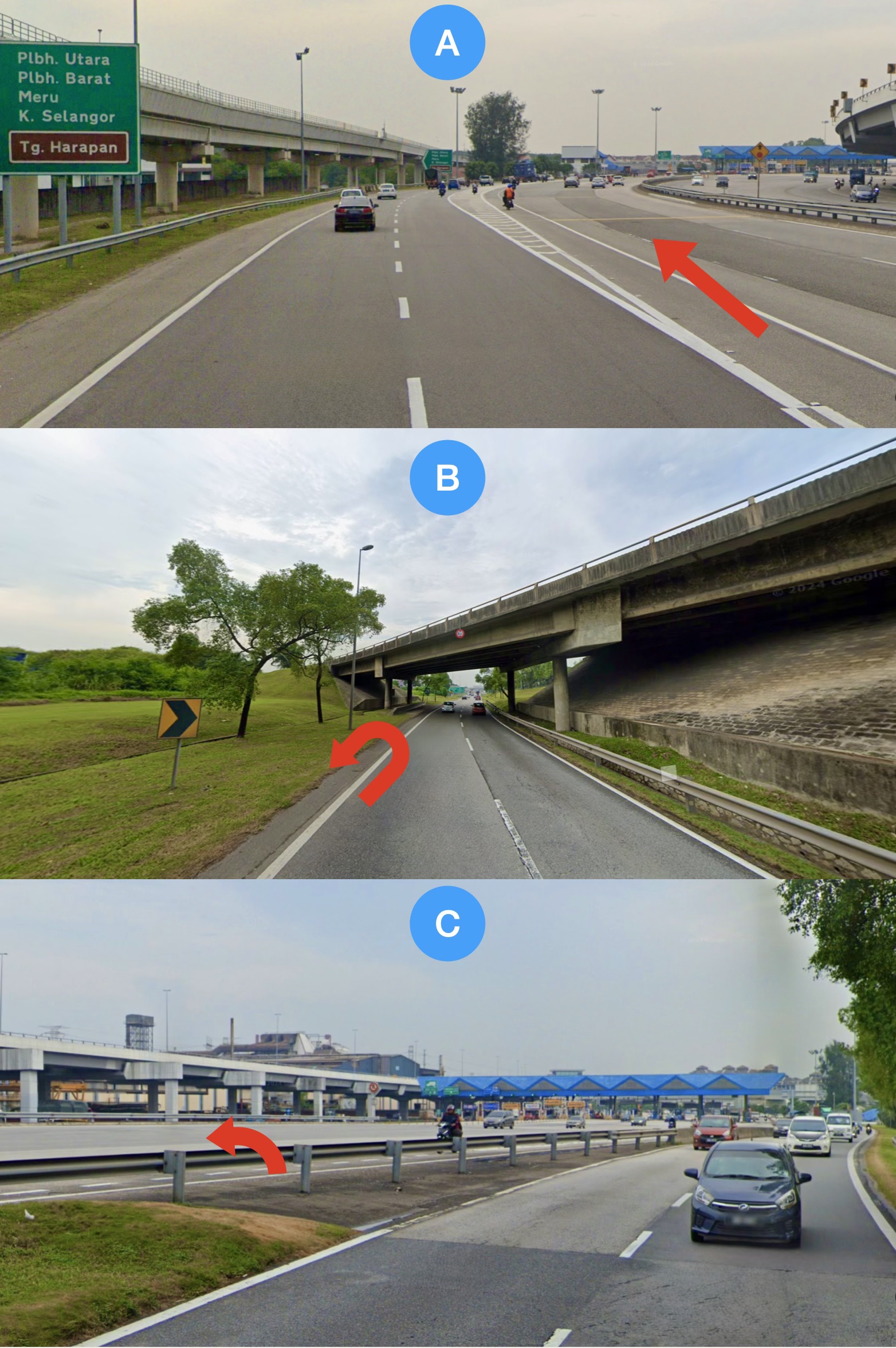
We turned off the Federal Highway onto the Selat Klang Highway. That road was busy but manageable on our bicycles. 3 km later the route map on my Garmin Edge pointed us toward a toll plaza (Photo A below). The Selat Klang Highway changes into the Shapadu Highway, also known as the New North Klang Straits Bypass at that toll plaza. Bicycles are not allowed on toll roads so we stuck to the left. Which was the direction we needed to go anyway.
500 metres later we came to an overpass that we were supposed to be on. I realised we had to get onto the Shapadu Highway to head left as planned. So we turned around (Photo B below).
We were able to cross the road and hop over the guardrail onto the Shapadu Highway without going through the toll plaza (Photo C below). 300 metres later we exited the highway and were back on course.
Photographs courtesy of Google Street View
That is a confusing web of highways. The road we took by mistake is also part of the Shapadu Highway that bypasses the toll plaza. It looks like the toll plaza is meant to ‘catch’ motorists who want to continue on the Selat Klang Highway as it heads west.
I know not to route that way next time.
Map courtesy of Ride With GPS
That highway mess was 35 km into our ride. By 50 km I was feeling a mess. My triceps and neck ached. I couldn’t get comfortable on my saddle. I thought “I must really be unfit.”
That was the start of frequent stops for me to rest and stretch to try and alleviate the aches. Eight minutes at 57 km. Forty minutes in the Burger King in Jeram at 67 km. Our discovery there was not to stop at that Burger King again.
The manager told us curtly that we could not lean our bikes against our table. “What is the difference between having the bikes against our table and two feet away on the walkway?” I asked.
“Nothing” she replied before turning on her heels and disappearing into the empty restaurant. We got the feeling that we were not welcome there. We won’t be going back.
A Mushroom Swiss burger and some iced lemon tea got me 18 km further down the road before I had to stop again. I rested once more at 93 km because my right knee had started hurting too. I sat down for thirty minutes 3 km later at the Petronas station at Tanjung Karang.
I took a couple of paracetamol tablets during that stop at the petrol station. As I waited for the painkillers to kick in I remembered that I took my prescription blood pressure medication before starting the ride. I check my blood pressure every morning. It is usually in the Normal to High-Normal range. When either my systolic or diastolic pressure creeps into the Grade 1 blood pressure (mild) range I take a telmisartan tablet. That happens about once every ten days.
I have never had a bad reaction to telmisartan. Sitting in the Petronas station I looked up the commonly occurring side effects, which are:
Fatigue
Flu-like symptoms like body aches
Muscle pains
Back pain
I think I discovered why I felt so awful. The extended physical activity must have triggered the side effects.
The paracetamol helped get me to the 109 km point. That was only 3 km from the hotel but I had to stop for a while.
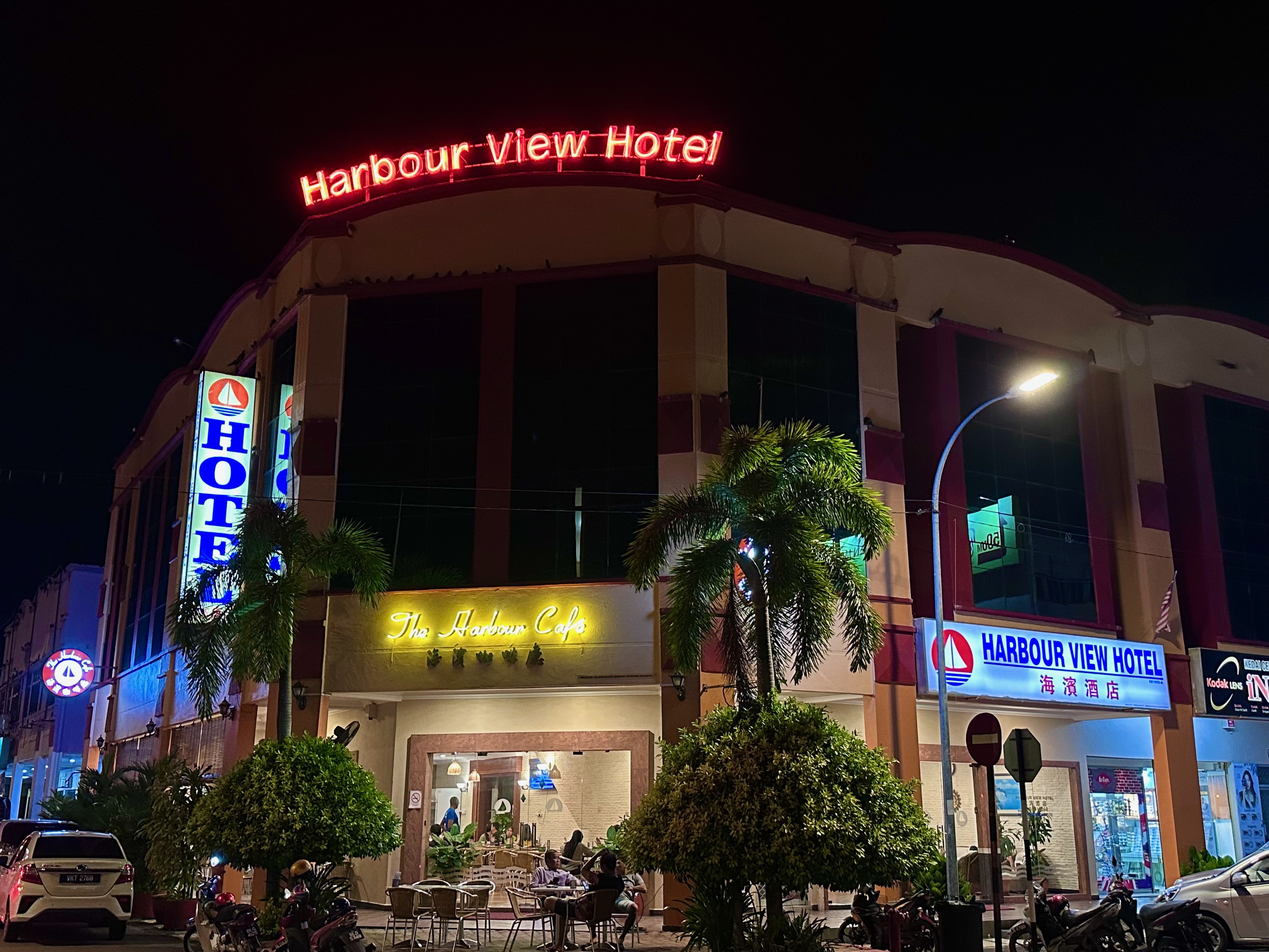
I chose the Harbour View Hotel because it has a café. Good ratings on booking.com and a reasonable room rate also helped. The hotel is excellent. There is a room behind the 24-hour reception desk where we parked our bicycles. Our room was clean and had comfortable beds. The air-conditioning and television worked. There was hot water and good water pressure in the shower. The windows are double-glazed. There is a hot and cold water dispenser in the hallway.
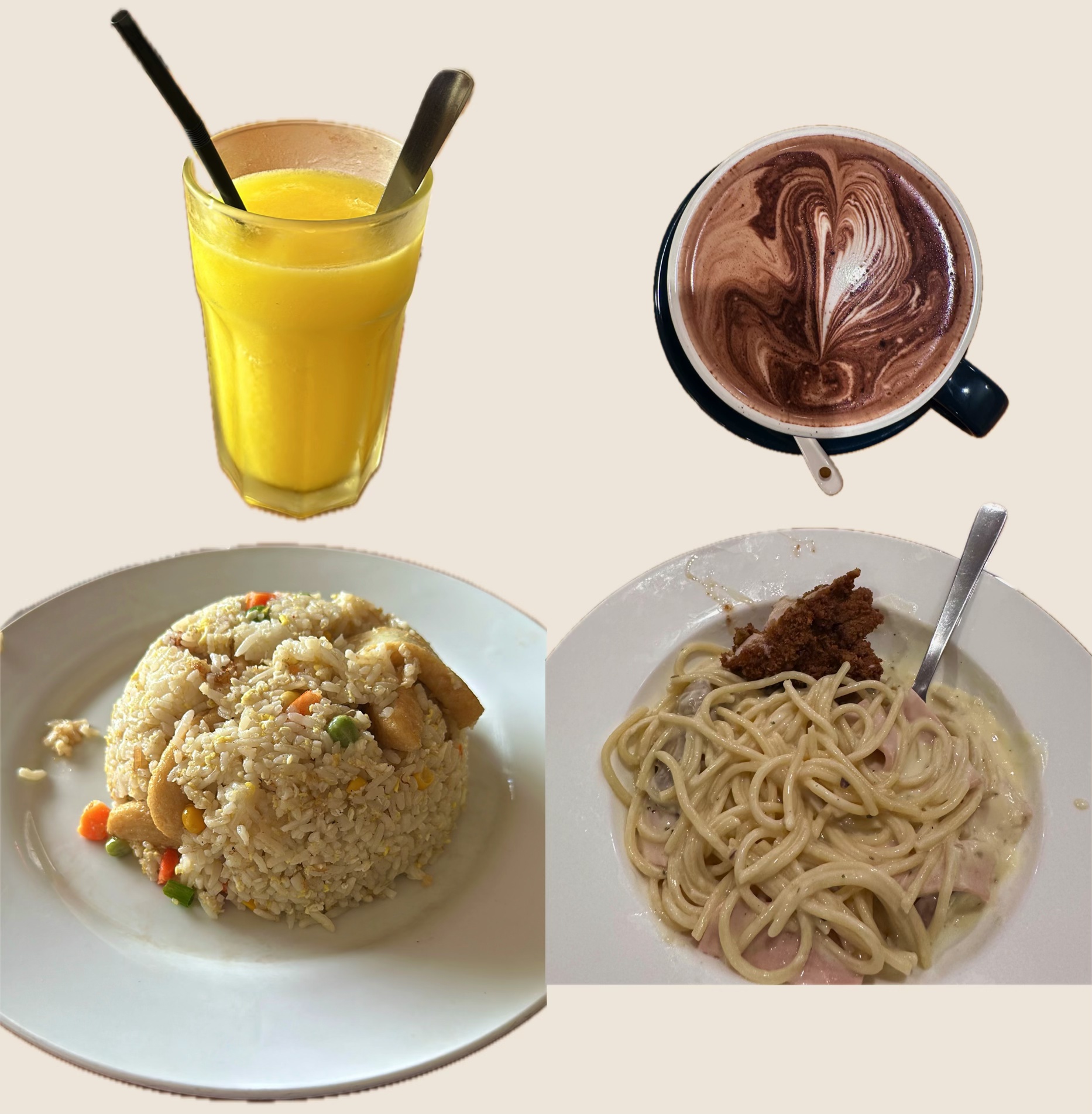
The café is excellent too. We were in the café right after dropping our stuff off in our room. The menu is extensive. I had two ice-blended mango drinks and seafood fried rice. Brian had black pepper fried rice.
We walked around the block after a shower and a long nap. We didn’t see any interesting restaurants so we returned to the Harbour Café for dinner. I had another ice-blended mango drink and spaghetti carbonara. Brian had a fried chicken chop. That is a bit of his chicken chop on my plate of spaghetti. We had complimentary bowls of mushroom soup and a couple of hot chocolates each to finish our meal.
The double-glazing in our room meant we had a quiet night, despite the proximity to Federal Route 5. We planned to head out at 5:30 am. It was pouring at 5:00 am so we went back to bed. The next thing we knew it was 7:50 am and drizzling.
The hotel café opens at 10:30 am so we wandered outside for breakfast. We both had masala thosai at Restoran Salsabeel.
We pedalled away from the hotel clad in waterproof gear. I had planned to ride through the padi fields that Sekinchan is famous for. The fields are divided into rectangles by narrow roads. As you can see from the photograph at the top of this post and the one below, some are gravel.
Photograph courtesy of Google Street View
We skipped the wet muddy roads through the padi fields and stuck to Federal Route 5 out of Sekinchan. The drizzle lightened and we were getting hot. We were out of our rain gear after fifteen minutes.
Map courtesy of Ride With GPS
I felt much better than the day before. We made our first stop at the FIVE petrol station in Tanjung Karang. I was drinking more than usual, thanks to Brian reminding me to stay hydrated. I had finished one 750 ml bottle in less than 50 minutes. I needed a refill and a restroom.
Our next stop was at a sundry shop in a converted house in Taman Permai. We were 50 km into the ride and had stopped to stretch our legs. There were no mini-markets or small restaurants that we could see. We asked a woman who was walking past and she pointed across the road. We didn’t see the shop until a young girl directed us down a side street.
The shop was like Aladdin’s cave. Hidden away and full of all sorts. We bought water, chocolate milk and three types of nuts.
We left Taman Permai and turned right onto Jalan Bukit Kerayong. There was very little traffic and the road surface was smooth, albeit wet in places. That changed 4 km later after we passed the Worldwide Landfills Jeram site. Worldwide Landfills is a waste management company. The road ahead was a steady stream of dump trucks heading towards and leaving the site.
We turned a corner and the road changed abruptly from tarmac to mud. The road was being upgraded from two to four lanes. A 3 km stretch had been dug up and was being relaid. We were lucky there was a 1 km length of fresh tarmac that had not been opened to traffic yet. Although that just meant 2 km of muddy road instead of 3 km of muddy road. This photo is of the less sloppy last 500 metres we traversed. The worst was around the corner ahead of the trucks in the distance.
There was a lot of sand and mud on our bikes, legs and saddle packs.
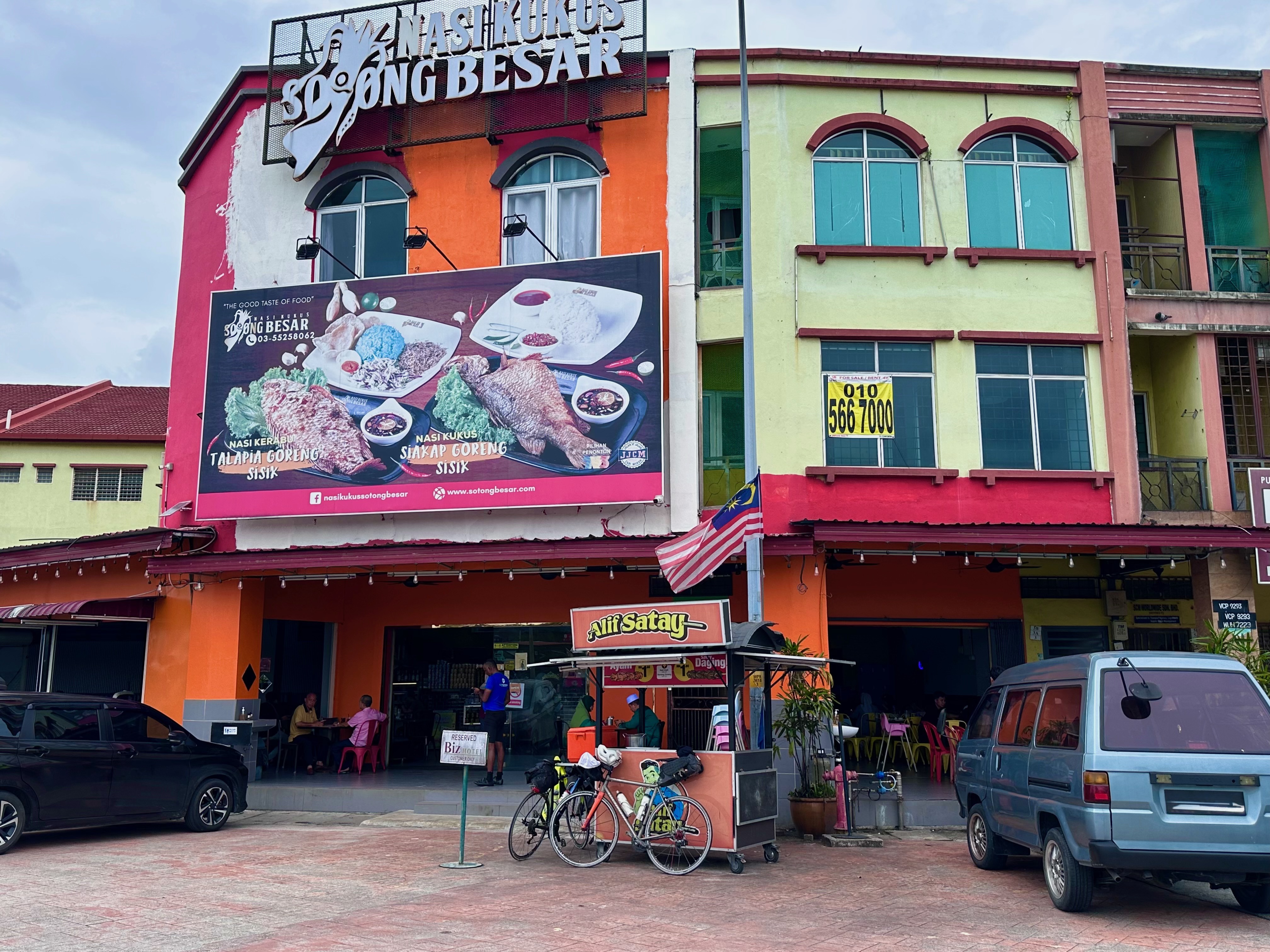
We stopped for lunch at Nasi Kukus Sotong Besar on the north side of Klang because there were a lot of people there. We could have done better. The food was so-so. Brian fed most of his fried chicken to a stray dog. I didn’t finish my nasi lemak.
Our ride from our lunch stop to the Federal Highway was much less fraught than the ride in the opposite direction the day before. I plotted a slightly different return route through Klang. There was no toll plaza to avoid this time. We were on the Selat Klang Highway for about 2 km but that section was benign compared to what we rode the day before.
Our lunch was at 75 km. We had to stop at 87.5 km to hop over the guardrail back onto the motorcycle lane after riding 1.5 km on the Federal Highway. The motorcycle lane is closed where the UiTM Shah Alam LRT 3 station is being built. We stopped for a selfie after 97.5 km.
Photograph courtesy of Brian F
Brian exited the motorcycle lane 1 km later to head home. I had 14 km to go. I had to walk my bicycle at Dataran Merdeka. The 300-metre stretch in front of the Sultan Abdul Samad building was closed for the Malaysia Auto Fest 2024.
Photograph courtesy of hub media.my
3 km later I was home and feeling good. I had to make six rest stops in the last 50 km to Sekinchan. I needed just one stop for lunch and to rest my feet in 63 km on the return ride. There were no hints of, let alone actual cramps in my upper thigh adductor muscles. Unlike during and after long rides in the past. No doubt better hydration helped. Thank you Brian for reminding me to drink regularly.
The big discoveries of the trip for me are:
Not to take telmisartan before a long ride, and
The Harbour View Hotel
A long late afternoon nap and a rainy morning meant we didn’t ride to Sekinchan beach or through the padi fields. If we do return to Sekinchan we will probably stay at the Harbour View Hotel again. There are things on the café menu I want to try!
P.S. If you want to stay at the Harbour View Hotel, call and book directly with the hotel. You will get a better room rate than is offered online.
It started raining in the early hours and was still drizzling when I awoke. That validated our decision the night before not to ride in the morning.
Leena and Brian were up and out early to church for morning service. I went for a walk in the drizzle to look for breakfast.
Business was very slow at this stall.
I stopped at a much busier stall for nasi lemak with chicken rendang.
An hour later Brian was back from church and hungry. We returned to the same stall for his breakfast. The sun was out. It promised to be another hot and humid day.
I spent the day lazing in my room. I needed a respite from being out in hot weather.
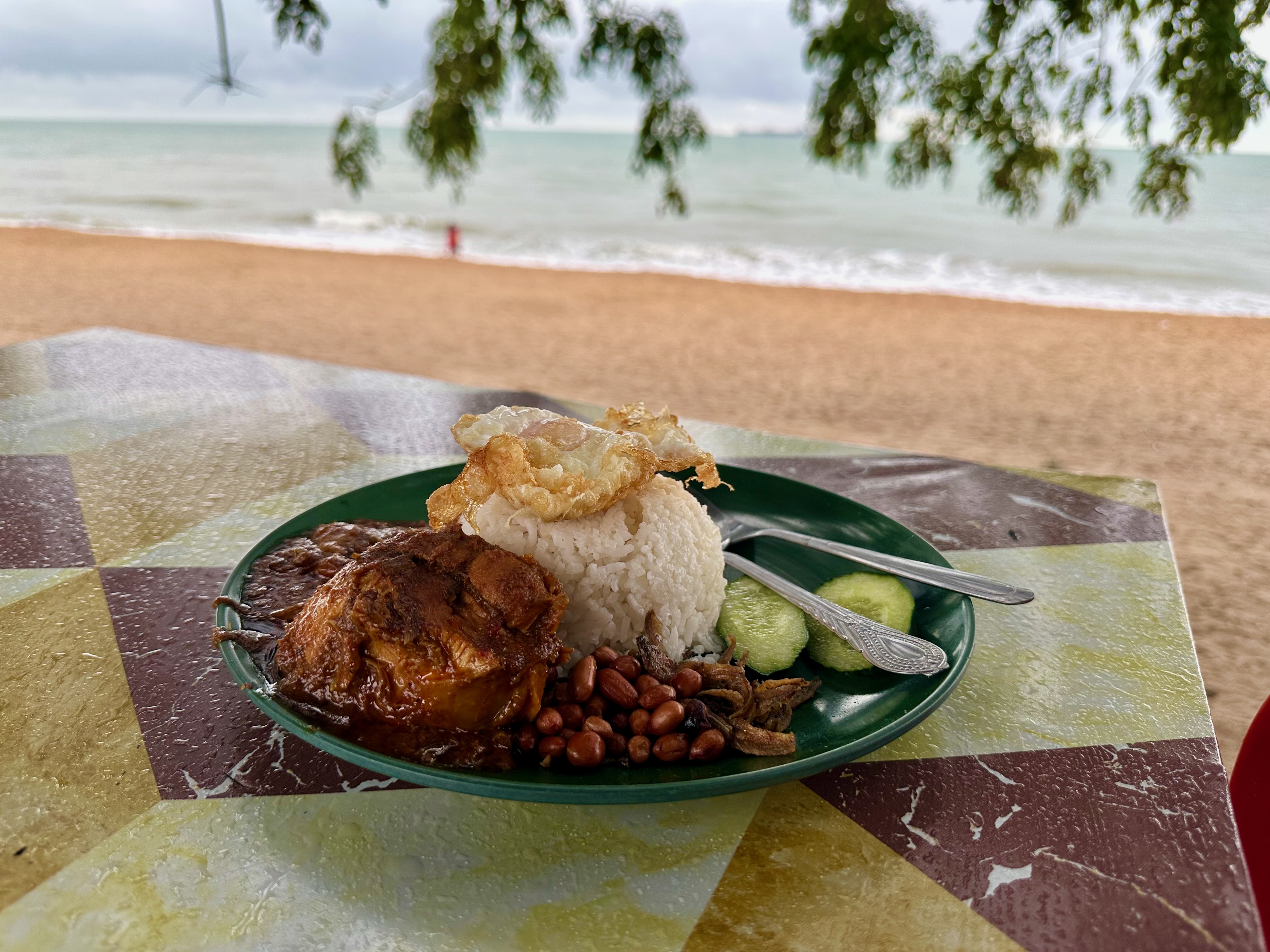
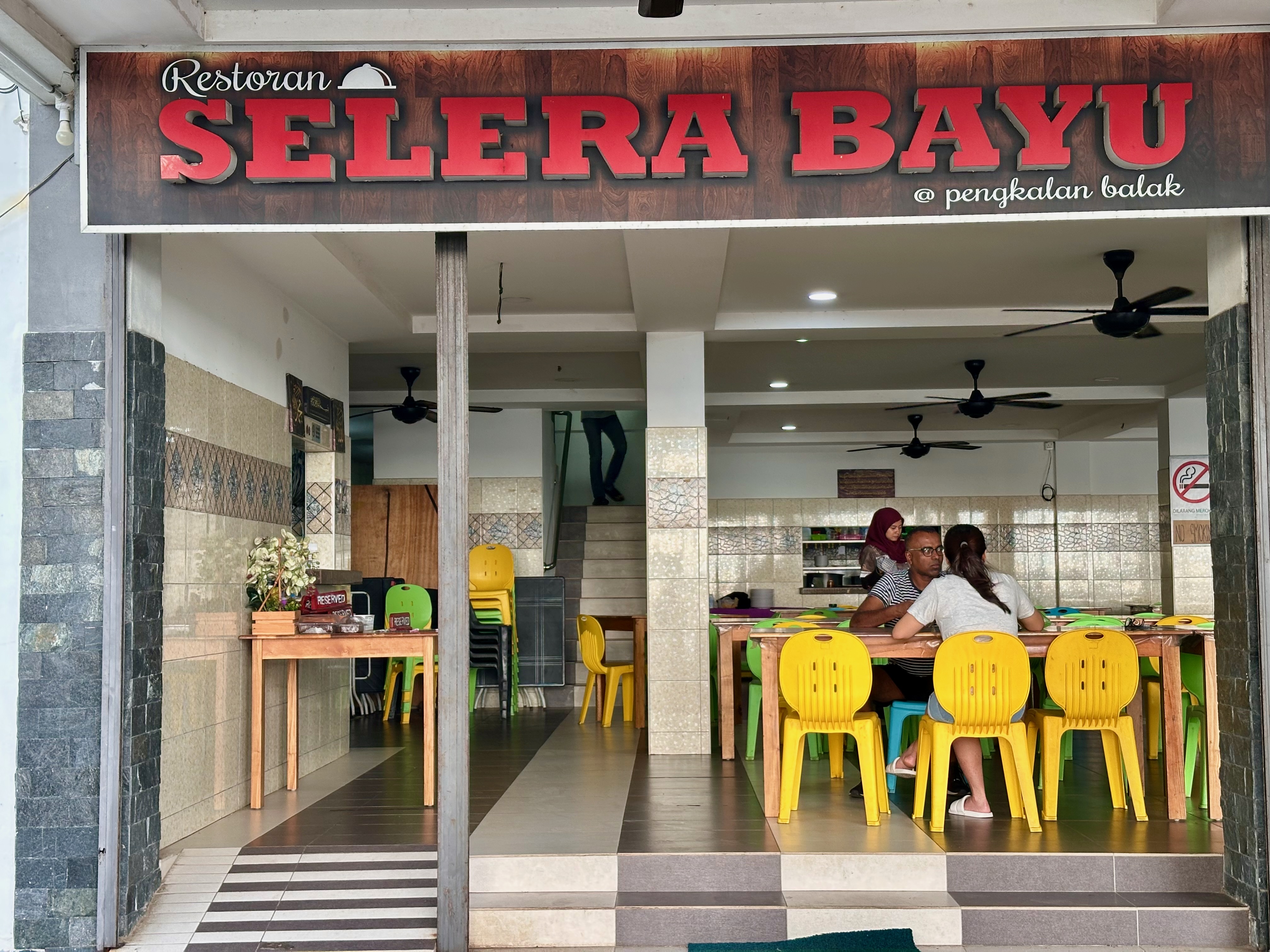
It was cooling down at 5:00 pm. It looked like it might rain again. We headed out for an early dinner. Selera Bayu served us yummy food the night before. We went there again and ordered the same things, plus some batter-fried squid.
After dinner, we went across the road to Nyxel Coffee. Daniel didn’t have his canopy up because of the strong wind.
It was windy enough for kite-flying.
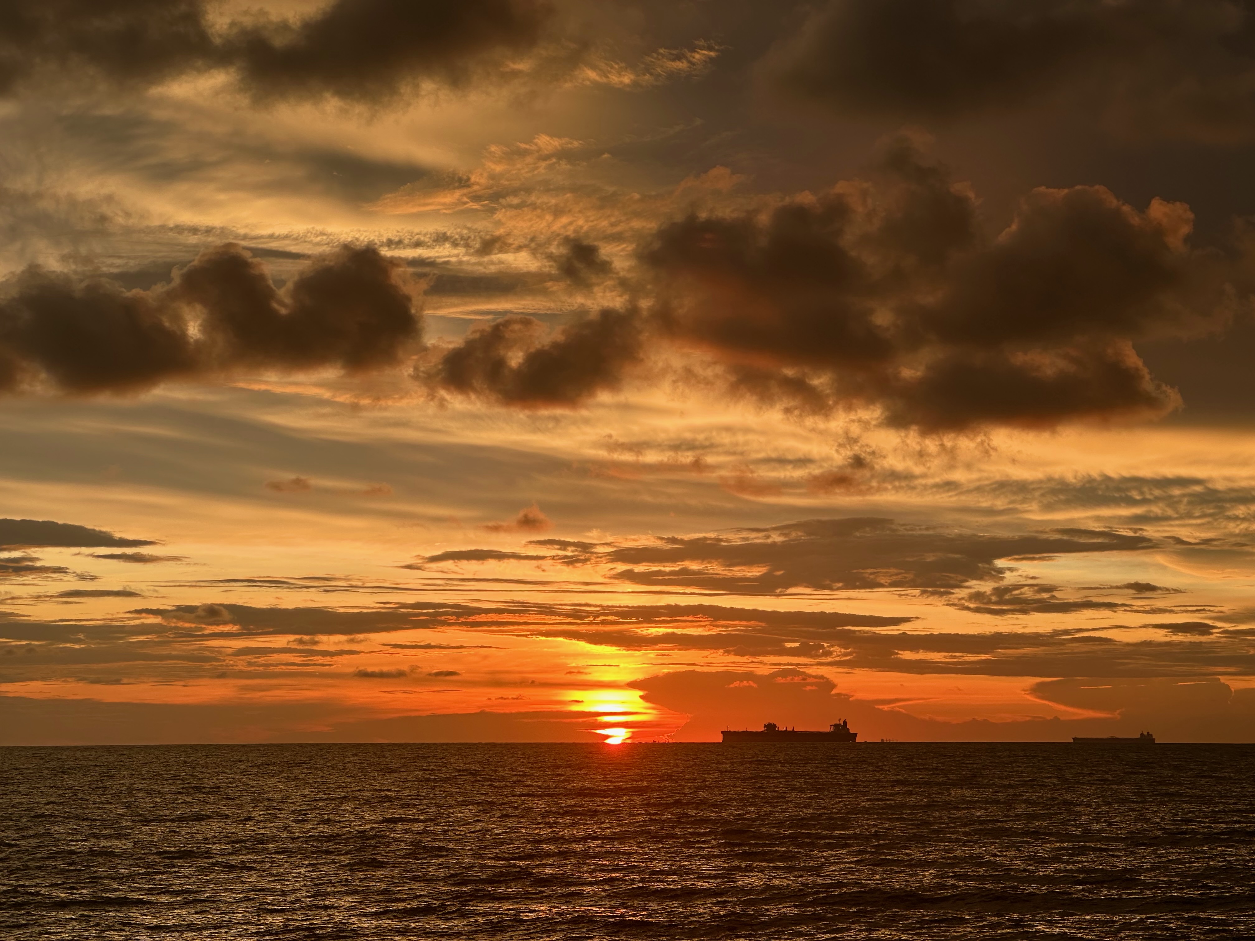
We spent another pleasant evening over coffee, watching the setting sun.
The threat of more rain in the morning convinced us to load our bikes into Leena’s car and have her drive us back to KL instead of cycling to Sungai Gadut KTM station to catch a train as originally planned.
We set off at 5:15 am to beat the commuter rush into Kuala Lumpur that starts from Seremban at about 6:15 am. Unlike my train plan on Day One, this plan worked. At 8:00 am we had driven 127 km, unloaded my bike and gear and ordered breakfast at Crema near where I live. An excellent ending to our adventure.
Postscript
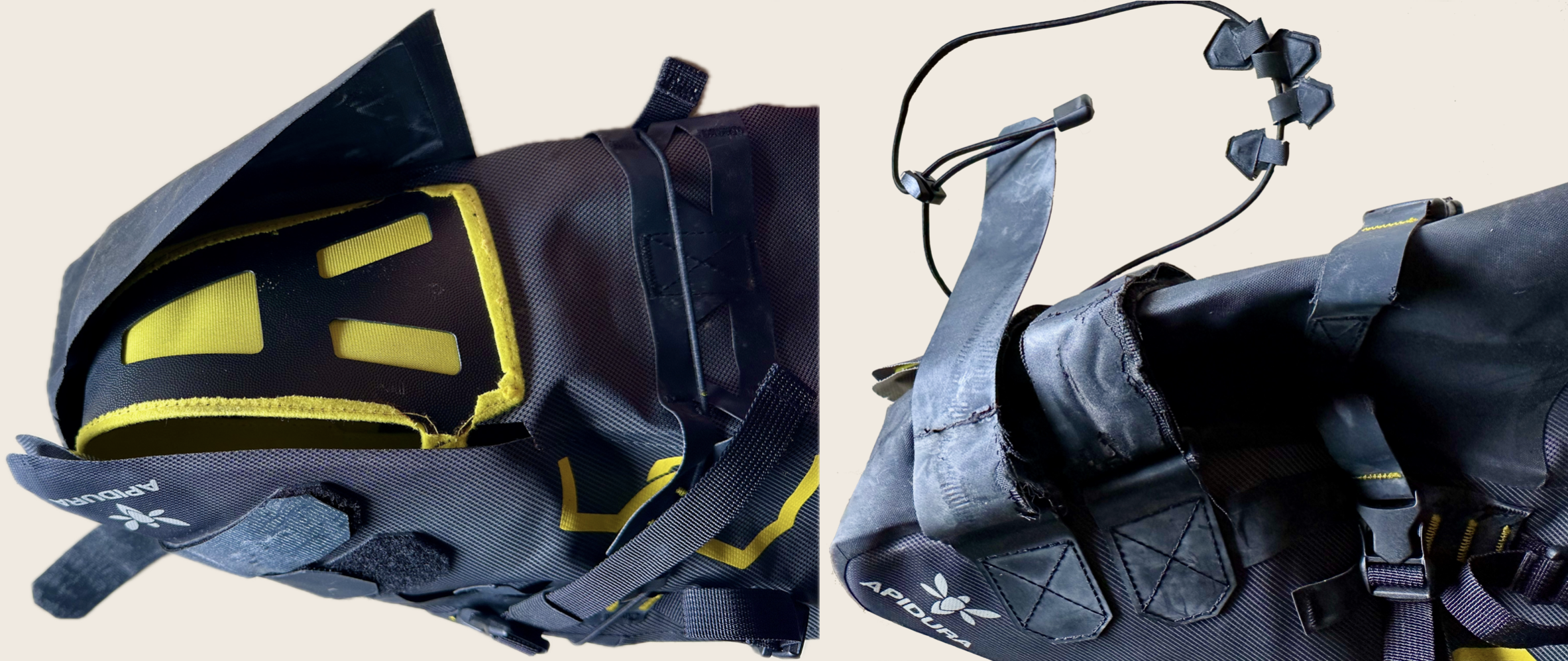
My Route Werks Handlebar Bag QUOC x Restrap Sandals performed as expected. My Apidura Saddle Pack did not. During the ride on Day One, the seams at the tail end of the Pack gave way and a strap delaminated. Nothing fell out, but I put my clothes in a plastic bag before stuffing them into the pack on Day Two. By the end of Day Two, a seam further up the pack had failed and the tabs holding the bungee cord to the top of the pack had come unglued. The rubberised coating on the straps was also peeling.
The saddle pack had been in a cupboard since I used it five years ago. The adhesives and rubbers must have chemically deteriorated. Like most synthetics do in our tropical climate. I reported this to customer support at Apidura because I thought it would be useful for their Product team to know. To Apidura’s credit, I got a “thank you” for letting them know, and a discount code for a replacement saddle pack that is on its way to me now.
I’ll soon be ready for another bike-packing trip. Hopefully, the weather will be cooler.
We had a relaxed start. The hotel breakfast buffet started at 7:30 am. We had seconds. That was not the best idea. By the time we clipped in the sun was bright and the temperature was 28ºC (82ºF).
In 10 km we were on the ferry across the Sungai Pelek. Then it was 80 km to Pantai Pengkalan Balak.
Map courtesy of Ride With GPS
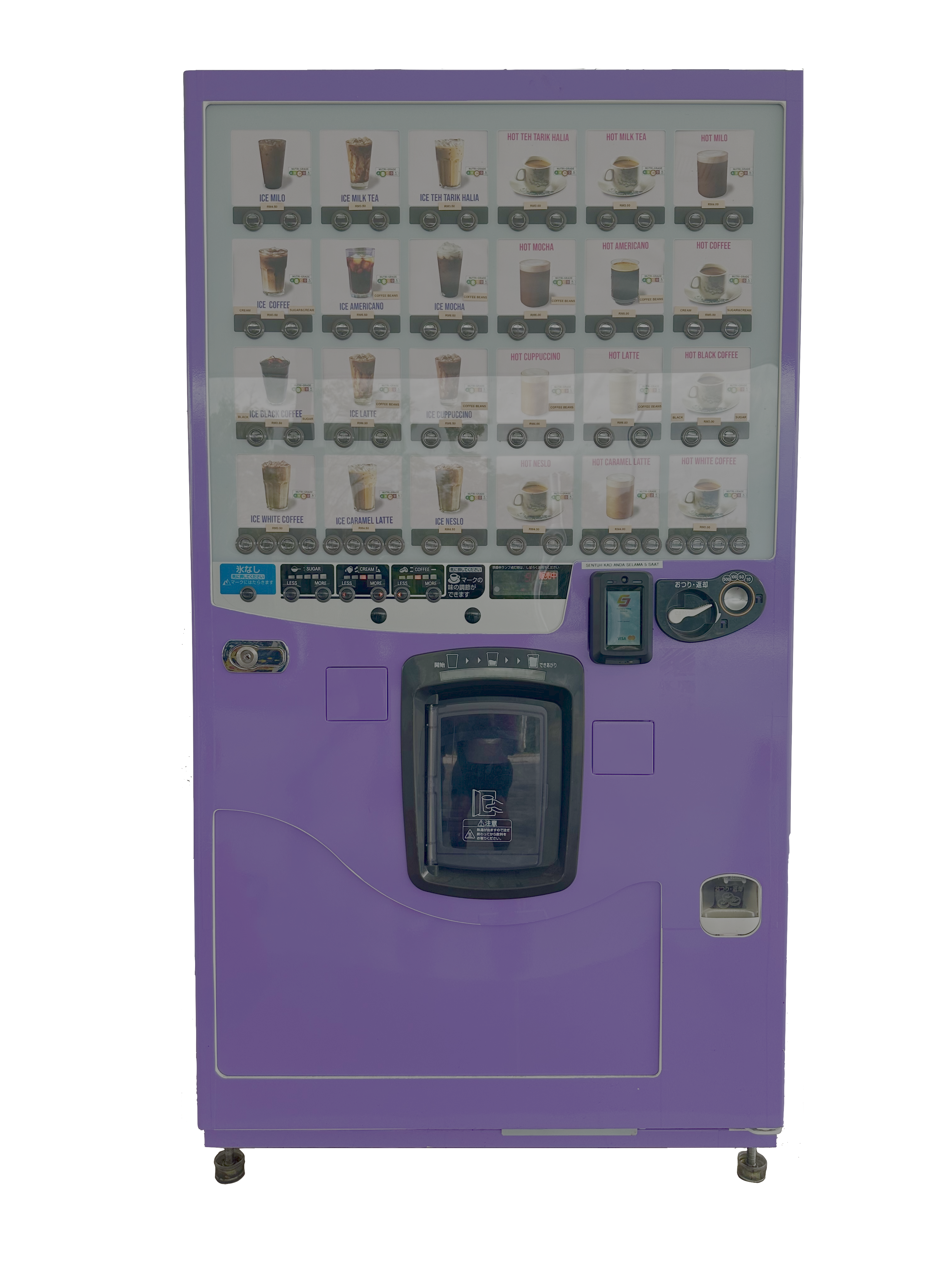
We made the stops we always make on rides down the coast. After taking the ferry across the Sungai Sepang we stopped at the Shell station north of Lukut for drinks and the restroom. Where we saw this new addition. A reconditioned Japanese vending machine.
I didn’t use the vending machine. I bought my usual chocolate milk from the station convenience shop. We also bought water. I had underhydrated the day before and did not want to make the same mistake.
The McDonald’s at Port Dickson Waterfront for an early lunch is another regular stop. It drizzled while we were inside but the drizzle stopped when we got on our bikes.
Any hopes we had of an overcast and cool afternoon were not realised. The temperatures south of Port Dickson were as hot as we experienced on the way to Bagan Lalang.
Graphic courtesy of visualcrossing.com
A second day of ‘Feels Max’ of 39ºC was not much fun. We had ridden about 25 km from the Port Dickson Waterfront. We were just 1.5 km from the Five Petroleum station in Pasir Panjang but it was so hot we had to stop here to cool down for fifteen minutes.
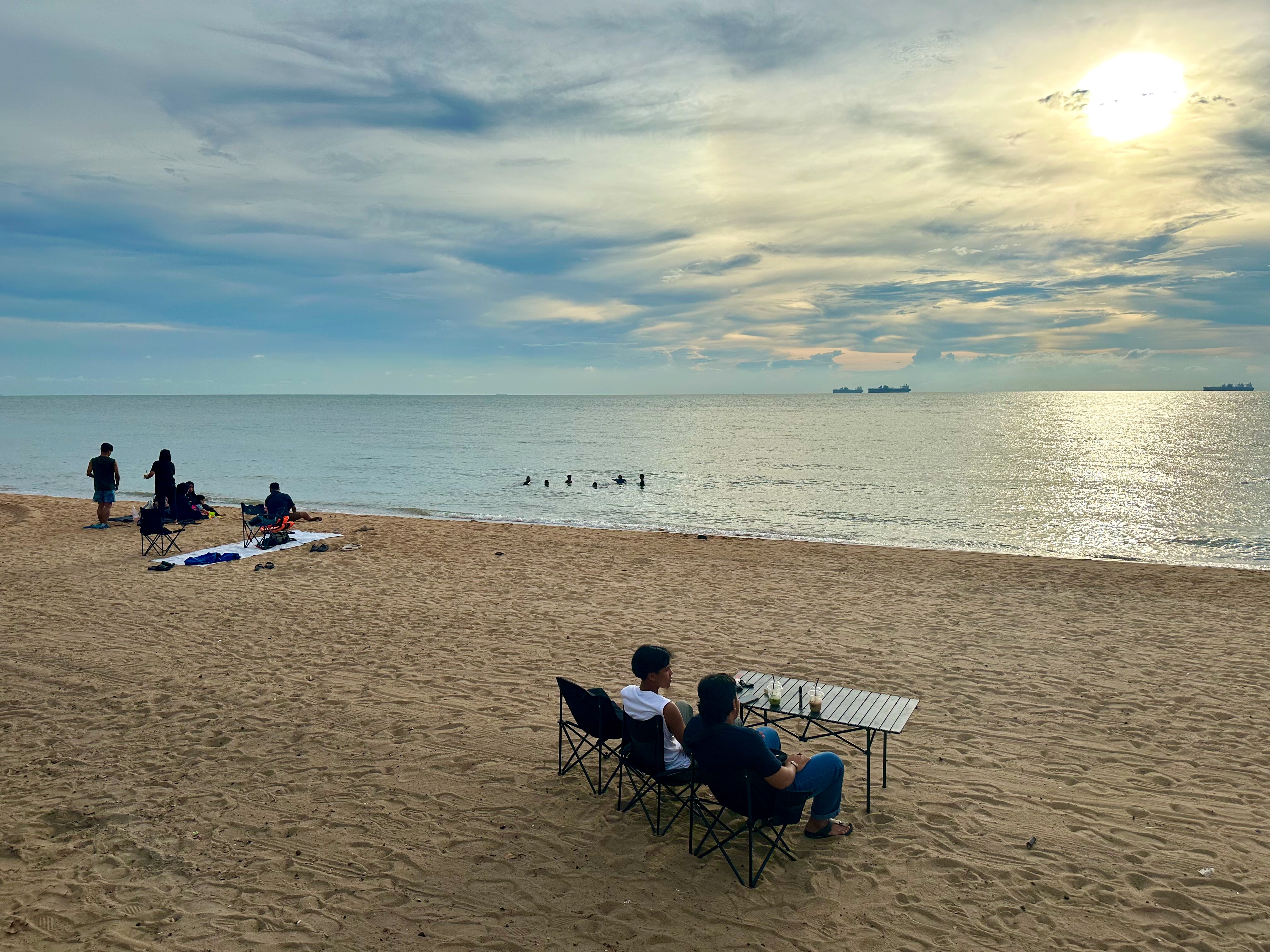
At 2:30 pm we crossed the Sungai Linggi, the border between Negeri Sembilan and Melaka. We had about 18 km to our hotel.
Half of that 18 km was along the beach. The view took our minds off the heat.
Photograph courtesy of Google Street View
We stayed at the Kampong Pinang Sebatang Chalets across the road from the beach.
Checking in proved to be a challenge. Reservations at Kampong Pinang Sebatang Chalets are filed by booking number rather than name. My mobile phone had run out of power. I couldn’t access the online booking number. My booking was found eventually and we hauled our bicycles up a flight of stairs to our first-floor rooms.
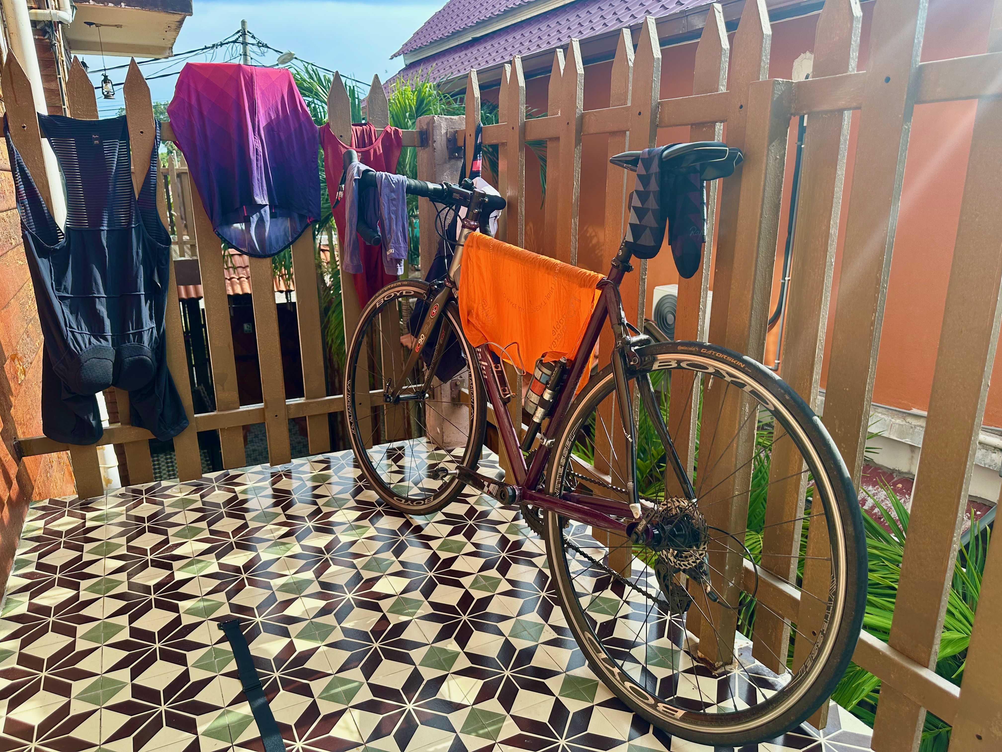
The balcony and blazing sun came in useful for drying my freshly-washed kit.
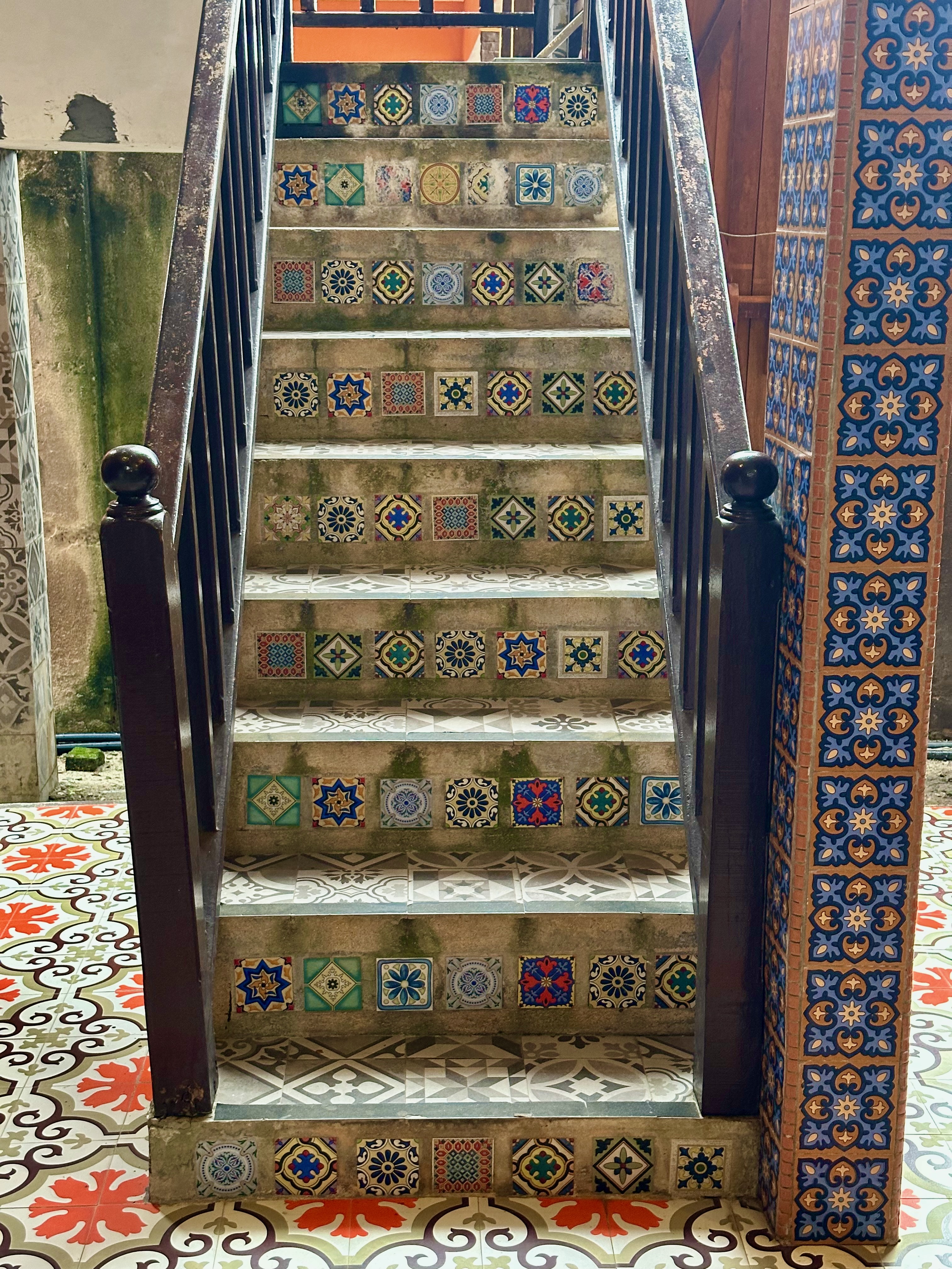
There are tiles everywhere. Tiled floors and steps are a distinguishing feature of homes in Malacca.
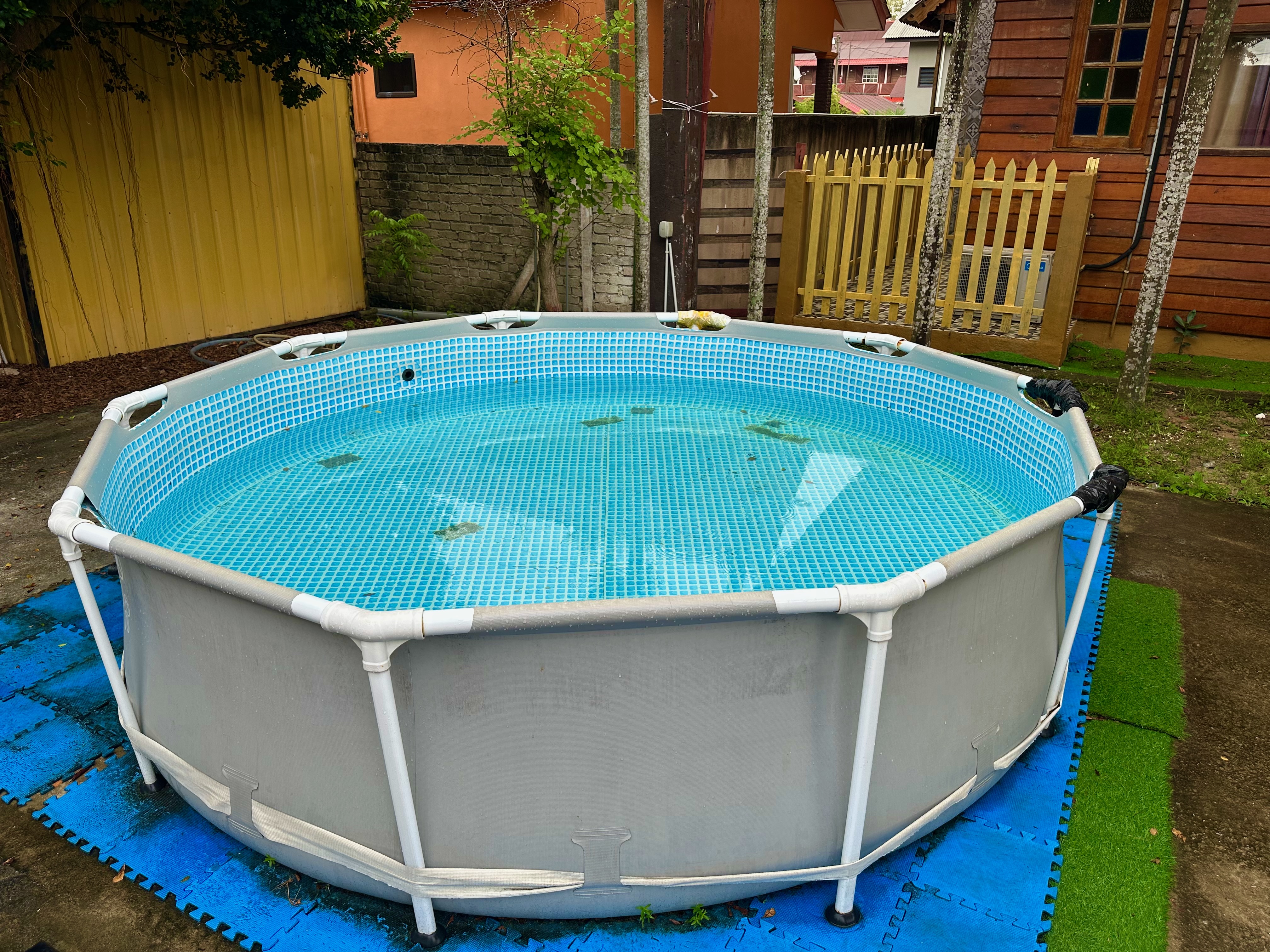
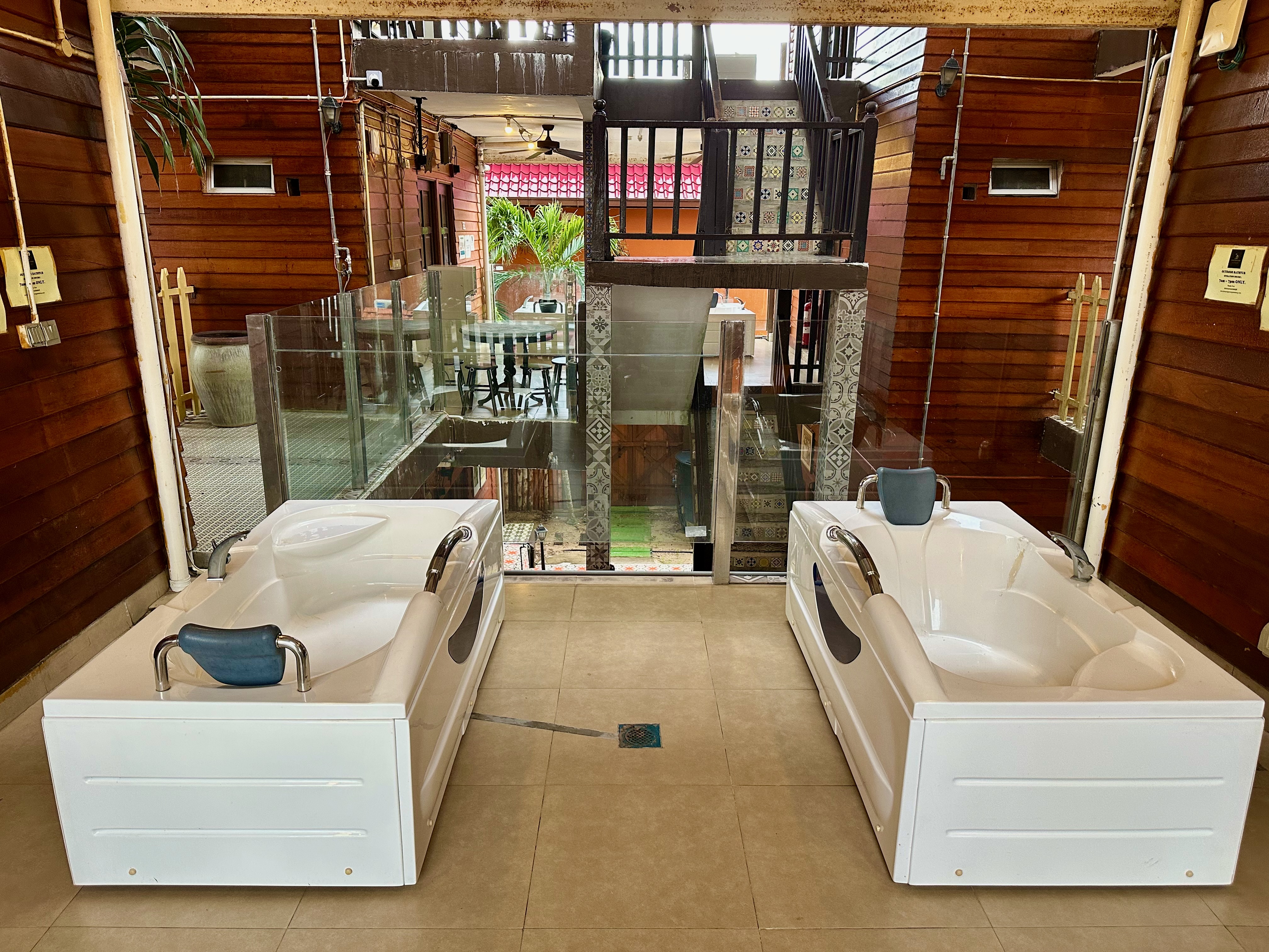
Brian and I were looking forward to a dip like we had at Hotel Seri Malaysia the day before. The kid’s mini pool at Kampong Pinang Sebatang Chalets was too small and not very clean.
The alternative was the Jacuzzis outside our rooms.
Sitting in the Jacuzzis outside our rooms just seemed weird to us. We passed on a soak.
We walked to a nearby restaurant for an early dinner instead. Leena joined us, having driven down to meet us at the hotel. The seafood fried rice and the rice with turmeric fried beef hit the spot. After dinner, we crossed the road for a coffee.
Danial, the 20-year-old owner and operator of Nyxel Coffee, impressed us. Entrepreneurial, resourceful and mature beyond his years. His coffee is good, too.
An example of his enterprising nature: he noticed people kept borrowing his camp chair to sit on the beach. So he bought a bunch of camp chairs and some tables to rent out for RM10 each.
Customers sit in his camp chairs for free. We spent a few hours chatting to Daniel over coffee and iced chocolate. He stays open until past midnight. I needed my bed well before then.
The last time I bike-packed was in December 2019. Six of us, including Brian, rode to Port Dickson and back the next day.
Map courtesy of Ride With GPS
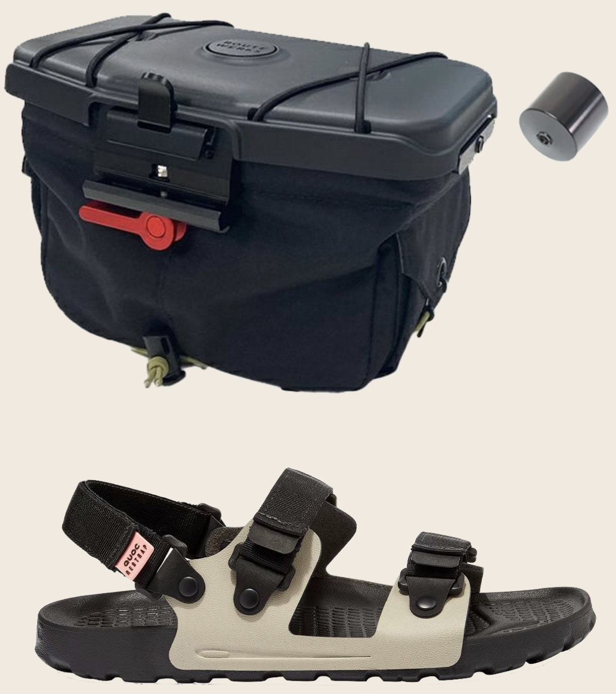
This time Brian and I went on a four-day trip. For the first time, I used two pieces of kit I had bought specifically for bike-packing.
Photographs courtesy of image delivery.net and QOUC.cc
I bought the Route Werks Handlebar Bag in November 2020 and the QUOC x Restrap Sandals in May 2023. Most handlebar bags occupy the space on the handlebar where a Garmin Out-Front mount fits. The Handlebar Bag comes with an add-on stub (shown top right in the photograph above) that fits on the side of the bag. I can attach the Out-Front mount to the stub. That lets me use my UT800 headlight unimpeded. My Garmin Edge clicks into the mount on the lid of the bag.
The differentiator of the QUOC x Restrap sandals is that the centre straps can be reconfigured to hold the sandals on either side of a saddle pack.
You can see an Out-Front mount attached to a stub on the right side of the handlebar bag, my Garmin Edge on the lid, and the QUOC sandals strapped to my saddle pack.
The photograph above was taken on a KTM Komuter train. I caught the 6:54 am train at Putra station. The plan was to meet Brian at 7:20 am at Petaling station— five stations and twenty-six minutes away.
“The best-laid plans of mice and men often go awry” is a line from the 1785 Scots-language poem To a Mouse by Robert Burns. That is what happened to my plan. My train made two unscheduled stops between stations and a long stop at Sentral station. It took almost an hour to get to Petaling station.
It started to rain en route. Brian wisely decided to serve breakfast at his apartment, adjacent to Petaling station, while we waited for the rain to stop.
Photograph courtesy of Brian
We supplemented the bread, butter and jam with some excellent nasi lemak from a small stall outside his apartment building.
The rain had lightened to a drizzle by 9:00 am. Clad in rain gear, we headed out to cycle to Bagan Lalang.
Map courtesy of Ride With GPS
Thirty minutes later the drizzle had stopped and our rain gear had to come off. We were overheating. That was a harbinger of things to come.
By 10:30 am we had ridden through Kota Kemuning and were at the traffic light at the entrance to Rimbayu. The light turned green and I pedalled away. Seconds later a car bumper brushed against my right ankle. I looked over at a driver, focussed on the mobile phone he was holding up in front of him. He hadn’t realised that he had run into me. “Stop looking at your 💩🧨💥 phone while you are driving” is one of the more polite things I shouted at him.
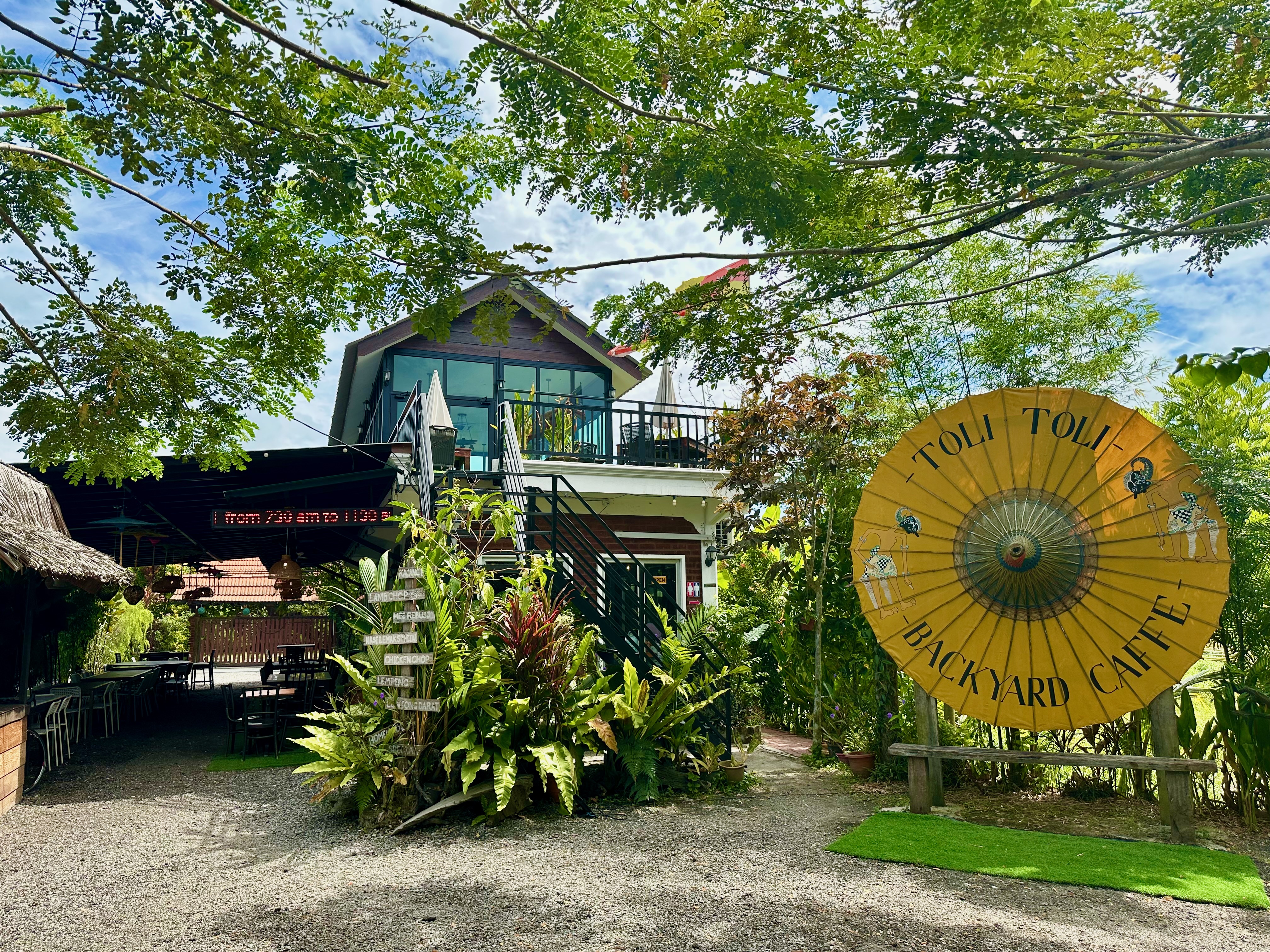
It was a good time to take a break. 7 km down the road we came upon the Toli-Toli Backyard Café. Like the other new buildings we passed after crossing the South Klang Valley Expressway, the café was not there the last time I cycled from Rimbayu to Jenjarom in January 2023.
We enjoyed Toli-Toli’s teh tarik, kaya toast and air-conditioning. It was 11:45 am when we left Toli-Toli. It was already getting hot.
It got hotter as the afternoon wore on. Our route was along quieter rural roads so we didn’t have to deal with traffic. The downside was that we didn’t have much shade to deal with either. These were the temperatures for Tanjong Sepat and Bagan Lalang. That ‘Feels Max’ of 39ºC is 102ºF. It felt every degree that hot.
Graphic courtesy of visualcrossing.com
I was cooked when we got to the Seri Malaysia Hotel in Bagan Lalang. It was all I could do to down two large iced lychees and nap for an hour before I did anything else. Take a shower. And go for a swim. When I made the room reservation the hotel swimming pool was a selling point.
Photograph courtesy of Hotel Seri Malaysia
Refreshed, we took a walk to the beach.
Dinner was at a ‘pick your own seafood’ restaurant. You fill a basket with your choice of freshly caught fish, prawns and squid and tell the staff how you want it cooked.
This group hadn’t cycled together in a long time. I was excited to join them on a ride to Kundang.
Photograph courtesy of KBS
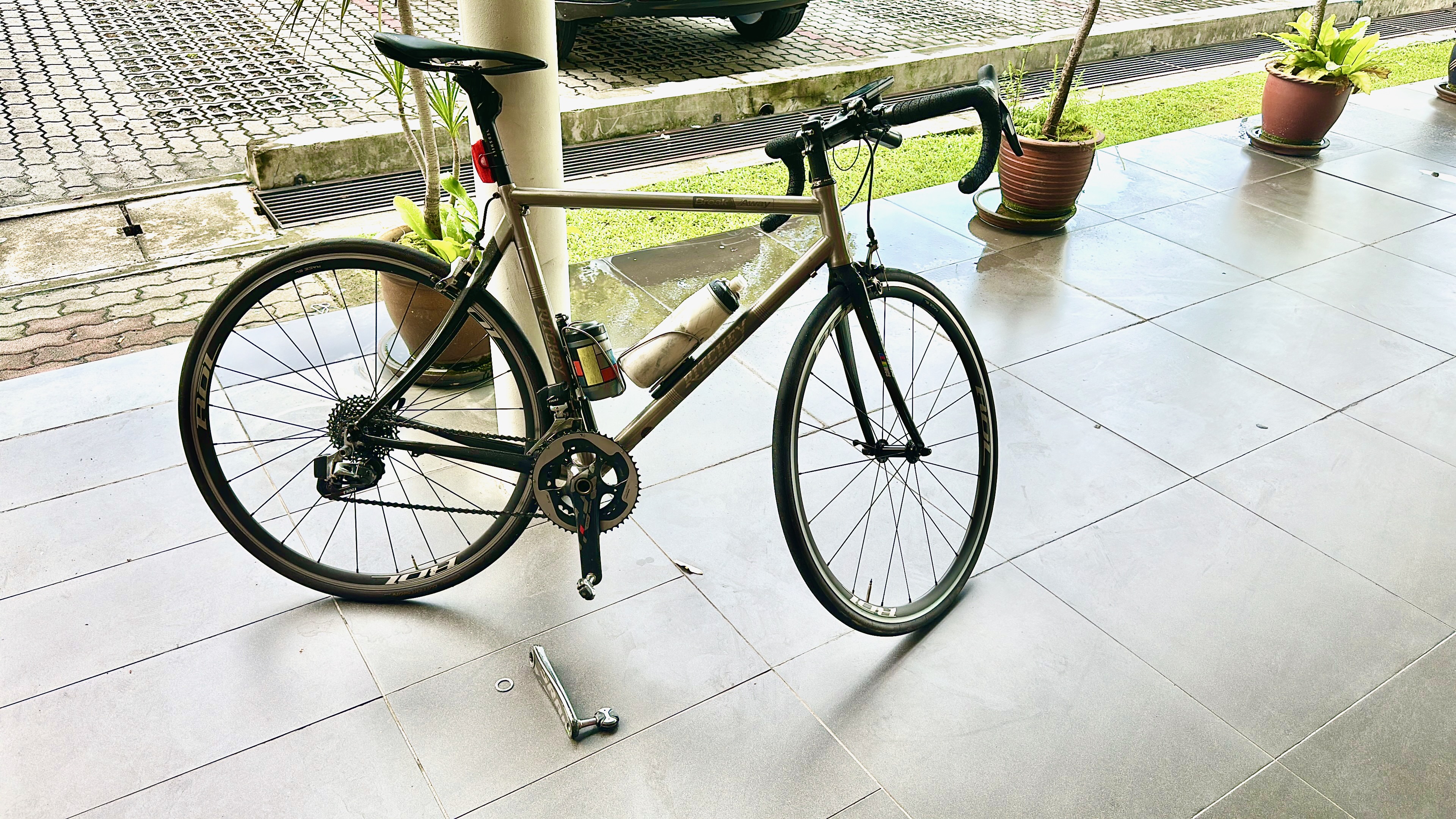
A few kilometres into the ride my left foot started wobbling. It felt like either the Speedplay cleat was loose on my shoe or a float adjustment screw had unwound.
At 6 km my left crank arm, attached to my shoe by the pedal, came off the axle. I spent a minute trying to reattach the crank arm, to no avail. Not having the tool I needed, a 10mm hex key, didn’t help.
Later I realised that having the right-sized hex key would not have helped. The self-extracting bolt on my SRAM crankset had snapped.
Photograph courtesy of singletrackworld.com
I had a single-leg workout to get back to the car park. Left crank arm in hand. With the additional need to apply an inward force to stop the chainring from moving outward and disengaging from the chain.
Photograph courtesy of ML
Fortunately, the 6 km back to the start was mostly downhill. ML was with me and provided a very helpful push on the inclines. I did have to walk up the hill at the 9 km point.
Map courtesy of Ride With GPS
It was lucky we were only 6 km from the start when the crank arm came off.
Over to my LBS to get a replacement self-extracting crank bolt.