RSS Feed

Tag Archives: Bandar Rimbayu

Ride Your Age

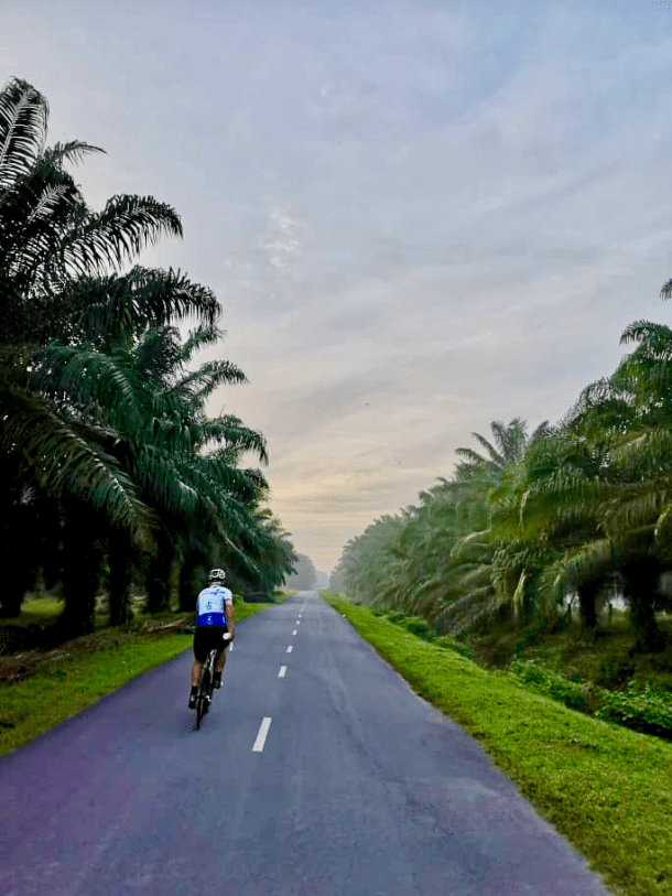
I picked up a birthday “tradition” while living in The Netherlands.  Ride Your Age.  In most cases, this means a ride length equal to or longer than your chronological age.  My Duch cycling friends added a maximum speed equal to or faster than your chronological age to the mix.

It sounded like a good idea ten years ago.  Less so now.  There will come a time when the ever-increasing miles required turns this tradition into a fool’s errand.  Nevertheless, I set out on a solo ride this morning to ride my age in miles.  This was my first chance for a ride since my birthday last week.

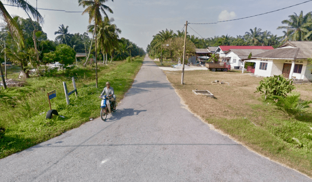
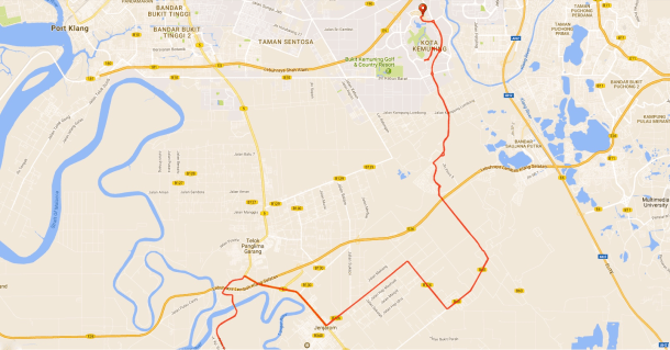
The route which started in Bukit Jalil was a mix of motorcycle lanes, main roads and quieter back streets.

Ride your Age Route

Map courtesy of Ride With GPS

To make sure I covered the necessary miles for my age I took a little detour from Bandar Rimbayu to Bandar Saujana Putra.  All those lakes are disused tin mining pools.  In the 1880s Malaya as it was then was the largest tin producer in the world.  As late as 1979 Malaysia was still producing 30% of the world’s tin.

Much of the mining was done by floating dredges.  The chain of buckets on the front scooped up the tin-bearing soil, which then passed through an oscillating drum and a system of jigs and screens to extract the tin, before spewing out the waste material at the rear end through a number of chutes.

Tin Dredge

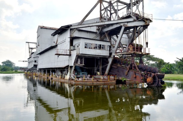
The heydey of the tin dredge has passed.  Tin prices collapsed in 1985 and the tin mining industry in Malaysia went into terminal decline.  The ponds which were left behind have become prime real estate spots.  My guess is that in five years a photograph taken from this spot will show waterfront homes lining this pool.

IMG_0919

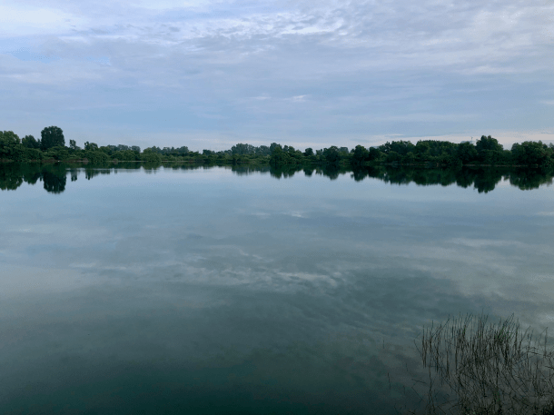
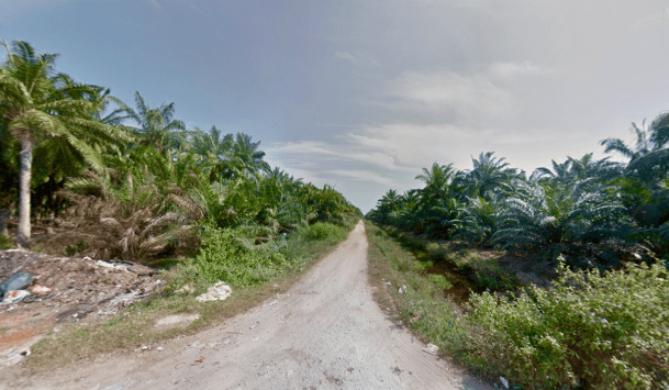
The morning stayed overcast so I had a very pleasant ride.  I rode back to Bandar Rimbayu and then followed the usual route to Jenjarom.  From Jenjarom I rode along Jalan Klang – Banting for 15km / 9mi to the junction with the KESAS Highway.  I got back onto the motorcycle lane all the way back to Bukit Jalil.

As a bonus, I hit my age in kilometres per hour too.  There is a one kilometre stretch in Subang Jaya (see the top centre of the route above) which has an average gradient of -1.6%.  The slope certainly helps.  This is also the location of a major highway exit.  You come off the motorcycle lane and ride for that kilometre amongst five lanes of traffic.  The resulting adrenaline boost helps with top speed too!

IMG_0921

Another year.  Another Ride Your Age in the bag.

Tanjung Sepat for Congee

The last time the R@SKLs rode to Tanjung Sepat, we had drinks at the Hai Yew Hin coffeeshop.  While we were there the proprietor gave us sample bowls of their congee (rice porridge).  That porridge was so good that stuck in the minds of some.  Jake, Mark, Martin, Simon and I rode to Tanjung Sepat last weekend just for the porridge.

Starting at 5.30am has caught on with some of the R@SKLs.  Better the pain of getting out of bed at 4.15am than the pain of getting sunburnt after 1.00pm.

We had planned on parking at IJM Land’s The Arc show gallery in Bandar Rimbayu.  I first parked there in June.  It was just Lay and I in my car.  As we were setting up our bikes a security guard came up and told us that parking at The Arc was not allowed before 7.00am.  The security guard then walked away.  I locked my car and we rode off.

The second time I parked there was in early August.  I was with Mark.  Again in my car.  I parked further away from the show gallery building than I had in June.  Security was nowhere to be seen.

I was back there the next day.  This time there was eleven of us spread over ten vehicles.  We parked away from the show gallery.  The security guards were visible but they didn’t approach us.

Last Sunday I was the first to arrive at the road leading to The Arc.  To discover that access to the car park was blocked by these.Tanjung Sepat Barriers

IJM Land really do not want us parking at The Arc before 7.00am.

So I went hunting for parking where the Ecoworld development is.  I found a place which would fit four vehicles at the spot circled below.  Hopefully, we don’t get blocked from that area as well.

Tanjung Sepat Parking

The five of us set off at about 5.45am.  Once out of the Bandar Rimbayu area headlights were essential.

Tanjung Sepat Martin Low

Photograph courtesy of Martin Low

It is just under 70km / 43.5mi to Tanjung Sepat via the back roads.

Tanjung Sepat Road Mark Lim

Photograph courtesy of Mark Lim

At 8.30am we were riding through the fishing village of Tanjung Sepat.

Tanjung Sepat Fishing Boats

A few minutes later we were in the Hai Yew Hin coffeeshop.

Tanjung Sepat Coffeeshop 1 Jake Sow

Photograph courtesy of Jake Sow

This is what the guys came for.  Salted egg, century egg and chicken congee, garnished with yew char kway (Chinese crullers).

Tanjung Sepat Porridge 1 Simon Soo Hu

Photograph courtesy of Simon Soo Hu

We also had some pau (steamed dumplings) delivered from the shop across the street.  Apparently, the original vendor of the famous Tanjung Sepat pau is Hai Yew Hin.  As demand grew, a separate pau only shop, with a slightly different name, was opened across the street.

Tanjung Sepat Pau Shop Simon Soo Hu

Photograph courtesy of Simon Soo Hu

After breakfast, we checked out one of the stalls selling another product that Tanjung Sepat is famous for.  Locally grown and roasted coffee.

Tanjung Sepat Coffee Jake Sow

Photograph courtesy of Jake Sow

Photographs at the Instagrammable locations were a must.

It will be Independence Day in less than two weeks.  Malaysian flags are starting to fly everywhere, including at the end of this pier.

Tanjung Sepat Pier Group Mark Lim

Photograph courtesy of Mark Lim

Our route to and from Tanjung Sepat is a bit longer than it could be.  One reason is that we want to avoid riding on Route 5, which is a busy trunk road.  Another reason is we have to take a detour along Jalan Kenangan Baru, Jalan Saga and Jalan Nangka, instead of riding on Jalan Kenangan Lama.

Tanjung Sepat Jalan Kenangn Lama 3

Map courtesy of Ride with GPS

This is what Jalan Kenangan Lama looks like from Jalan Kenangan Baru.  Nothing wrong with the road from here.

Tanjung Sepat Jalan Kenangan Lama 1

Photograph courtesy of Google Maps

And this is what Jalan Kenangan Lama looks like from Jalan Nangka.

Tanjung Sepat Jalan Kenangn Lama 2

Photograph courtesy of Google Maps

Jalan Kenangan Lama turns into an unpaved track somewhere between Jalan Kenangan Baru and Jalan Nangka.  So better to avoid Jalan Kenangan Lama completely than run the risk of having to ride over a stony, rough and muddy trail.

Throw in a cendol stop and we were back at our cars before 1.00pm.  It won’t be long before we will be riding to Tanjung Sepat with other R@SKLs to wreak more damage on the local congee and pau.

Tanjung Sepat Empties

Tanjung Sepat x 2

Tanjung Sepat View 1

Rides from Kota Kemuning to Morib and back have formed the basis for a number of my posts.

September 2016
March 2017
June 2017
July 2017
March 2018

Rides to Morib and back are about 100km / 62mi long.  Long enough that we don’t venture further down the coast unless the destination is Port Dickson or Melaka.

Tanjung Sepat is a fishing town about 18km / 11mi down the coast from Morib.  Tanjung means cape, and Sepat is a type of fish.  This is one of the towns that we ride through on those longer rides.

March 2014
August 2016
December 2017

Lately, Tanjung Sepat has become a destination in its own right.  I first rode inner roads to Tanjung Sepat with Lay in June.  We returned via the coastal road through Morib.  In July Mark led a group of R@SKLs on a Morib ride extension to Tanjung Sepat.  Last Saturday Mark and I rode to Tanjung Sepat entirely on inner roads, bypassing Morib completely.

The photographs Mark posted led to some R@SKLs asking if Mark and I would lead a duplicate ride the next day.  Which we did.  Hence Tanjung Sepat x 2 for Mark and I.

The long-standing start point for rides to the coast has been Restoran BR Maju in Kota Kemuning.  Since that ride with Lay, I have started from the Bandar Rimbayu Show Gallery instead.  That cuts out 8km / 5mi of road made dusty and sandy, or muddy, depending upon the weather, by legions of earth-moving lorries.

The other R@SKLs have bought into the new starting point too.

Tanjung Sepat Route

These are the photographs that prompted other R@SKLs to want to do this ride also.  Lovely quiet country roads.

Tanjung Sepat Road 2 Mark

Photograph courtesy of Mark Lim

Tanjung Sepat Road 1 Mark

Photograph courtesy of Mark Lim

So eleven of us fired up our lights and rolled out of the Bandar Rimbayu Show Gallery carpark at 6am on Sunday.

The run to the bridge over the Langat River is the same one we always use.  The only mechanical issue o the day came at the apex of the bridge, where Annie dropped her chain.

Tanjung Sepat Dropped Chain Annie Lim

Photograph courtesy of Annie Lim

The new route I plotted kicks in about 1.5km / 1mi from the river, where we turned right off Jalan Pusara onto the much quieter Jalan Kampung Sawah.

Different day, same conditions.

Tanjung Sepat Road 2 Mark Lim

Photograph courtesy of Mark Lim

Happy faces!

Tanjung Sepat TH Wee Giap

Photograph courtesy of Chew Wee Giap

Tanjung Sepat Mark and Martin Mark Lim

Photograph courtesy of Mark Lim

Tanjung Sepat Kiam Woon Wee Giap

Photograph courtesy of Chew Wee Giap

Tanjung Sepat via these inner rural roads is 65km / 40mi from Bandar Rimbayu.  Everyone was hungry when we got there.  The first stop was for breakfast.

Tanjung Sepat Breakast Alfred Chan

Photograph courtesy of Alfred Chan

By some accounts, Tanjung Sepat’s fishing fortunes are in decline as the sea in that part of the Straits of Melaka gets increasingly polluted.  It retains its reputation for good seafood restaurants, of which there are many.  It is also developing other attractions.

A wooden jetty known as Lover’s Bridge collapsed some years ago and has been replaced by a concrete pier.  It is not a particularly romantic structure, but it is worth going out to the end for a photograph.

Tanjung Sepat Pier Group Mark Lim

Photograph courtesy of Mark Lim

You also get a ride track 350 metres / 1,150 feet out into the Straits of Melaka.

Tanjung Sepat Pier

Map courtesy of Ride With GPS

Some enterprising locals have also built a series of Instagrammable structures out of old wine barrels.  Quite a tourist pull on weekends.  This dragon, for instance.

Tanjung Sepat Dragon Mark

Photograph courtesy of Mark Lim

And this bridge between two towers of wine barrels.

Tanjung Sepat Bike Bridge Mark Lim

Photograph courtesy of Mark Lim

There is something for all ages!

Tanjung Sepat Giraffes Mark Lim

Photograph courtesy of Mark Lim

A longer-standing attraction is the Hai Yew Heng pau (stuffed buns) shop.  Famous for over forty years for its traditional home-made Hainanese steamed buns.  The buns sell like hot cakes (pardon the mixed metaphor).  I’ve been through Tanjung Sepat three or four times, and this was the first time the shop was open.  There is no seating in the pau shop, so we sat in the coffee shop across the road

Tanjung Sepat Pau Annie Lim

Photograph courtesy of Annie Lim

We rode back to Bandar Rimbayu was under mostly overcast skies.

Tanjung Sepat Sky Mark Lim

Photograph courtesy of Mark Lim

We made our customary cendol stop after we re-crossed the Langat River.  It made a difference having 8km / 5mi less to ride to get from the cendol stall to the carpark.  I think the Bandar Rimbayu starts are here to stay.

The R@SKLs get fried

Temperature

I suspect what will be remembered most about today’s ride to Pulau Carey is how hot it was while we were riding back to Kota Kemuning.  It got up to 37° C / 99° F.  Combine the temperature with the humidity of almost 70%, and the temperature felt like 45° C /  113° F.  Even a rare tailwind – hooray – between Jenjarom and Bandar Rimbayu did nothing to cool us down.

Route

We shouldn’t have been surprised that it got so hot.  It felt warmer and more humid than usual at 6.15am when the first R@SKLs arrived at Restoran BR Maju.  Warning sign #1.

Carey Island early arrival

Photograph courtesy of Alfred Chan

30 of us were ready to roll at 7.00am.  Under a cloudless sky.  Warning sign #2.

Carey Island start

Photograph courtesy of Lee Heng Keng

Twenty minutes later we were riding through Bandar Rimbayu, with the sun already making its presence felt as it rose above the horizon. Warning sign #3.

Carey Island riding

Photograph courtesy of Mark Lim

We were in Jenjarom at 8.00am.  The temperature was 28° C / 82° F.  About half of the group could only do a short ride and were turning back at Jenjarom.  We all flooded into a coffee shop for breakfast before the group split up.

Carey island breakfast

Photograph courtesy of TH Lim

Carey island breakfast 2

Photograph courtesy of Jiv Sammanthan

40 minutes later 17 of us continued on to Pantai Tanjung Rhu, Pulau Carey.  We were very happy to see that sections of Jalan Klang Banting had recently been resurfaced.  Including the section between the Lebuhraya Lembah Klang Selatan flyover and Jalan Bandar Lama, which had been exceptionally badly rutted and potholed.

As you can see from the route map above, Pulau Carey is barely an island.  The land mass of Pulau Carey is separated from the peninsula by the Langat River and a narrow meandering finger of the Strait of Malacca.

When we got to the sea at 9.20am, the tide was out.

Carey Island panorama

Photograph courtesy of Luanne Sieh

There was no shade, which was inconvenient as Jiv had a puncture just as we got to the end of the road.  There was quite a bad cut in his tire, so the fix was a bit involved and took some time.  CK to the rescue!

Carey Island flat

Photograph courtesy of Jiv Sammanthan

We interrupted the repair for a group photograph.  It was too hot to linger, so as soon as Jiv’s tire was fixed we started the return leg to Kota Kemuning.

Carey Island group

Photograph courtesy of Lee Heng Keng

By 10.30am we had covered the 16km / 10mi between the beach and our regular cendol stall.  Wet, ice cold and sweet.  Just what the doctor ordered when it was 32° C / 90° F and felt closer to 37° C / 99° F.

Carey Island cendol

Photograph courtesy of Mark Lim

The temperature kept climbing as we rode the 28km / 17mi from the cendol stop to Restoran BR Maju in Kota Kemuning.  We needed a short rest in the shade at Kampung Sri Cheeding after 15km / 9mi.

Lots of sunblock and sunscreen were applied today.  Nevertheless, I suspect some of us got burnt over the last 35minutes of the ride today.  It was a scorcher!  Probably hot enough to do this.

Carey Island fried egg

Photograph courtesy of alert-conservation.org


A bit like trying to herd cats

Morib Banner jkstakent com

Graphic courtesy of jkstalent.com

The Bangsar Cycling Group organised a Sunday ride from Kota Kemuning to Morib.  I suggested that they use the route that the R@SKLs ride to get to Morib.  It avoids the heavily-trafficked and poorly surfaced Jalan Klang Banting, except for  4.5km / 2.8mi stretch from Jenjarom to Jalan Bandar Lama.

None of the BCGers knew that route.  That is how I ended up leading the BCG ride.

Coincidentally, the R@SKLs were also riding from Kota Kemuning to Morib on Sunday.  They were starting from their usual meeting point, Restoran BR Maju.  The BCG were starting from their usual meeting point, McDonald’s.  So I arranged for both groups to meet at Bandar Rimbayu, so that we could all do the ride together.

Both groups got to Bandar Rimbayu, as planned, at 7.30am.  There were forty two riders in all, including the cameraman for this shot.

Morib 01 J Sopiee

Photograph courtesy of Johan Sopiee

From the left:

Morib 07f J Sopiee

Photograph courtesy of Johan Sopiee

Morib 07e J Sopiee

Photograph courtesy of Johan Sopiee

Morib 07d J Sopiee

Photograph courtesy of Johan Sopiee

Morib 07c J Sopiee

Photograph courtesy of Johan Sopiee

Morib 07b J Sopiee

Photograph courtesy of Johan Sopiee

Morib 07a J Sopiee

Photograph courtesy of Johan Sopiee

I set off at the head of this large group of riders, leading them through Bandar Rimbayu and onto the bridge over the SKVE.

Morib SKVE Bridge Up Shahfiq Khairy

Photograph courtesy of Shafiq Khairy

As we rolled off the bridge I was still at the head of the group, riding at approximately the advertised moving speed of 29kph / 18mph.

Morib SKVE Bridge Down Shahfiq Khairy

Photograph courtesy of Shafiq Khairy

Just as I felt a sense of control over the group, my illusion was shattered.  Riders shot off ahead of me, clearly more interested in testing their legs than sticking to 29kph.  Oh well!

Morib 12 Winston Wong

Photograph courtesy of Winston Wong

To no one’s surprise, the faster riders missed the right turn at Kampung Seri Cheeding.  Mobile phones to the rescue.  A few back-and-forth calls, and Google map consultations, and everyone was reunited 15km / 9mi later at the junction of Jalan Bukit Jugra and Jalan Jeti.   Google maps didn’t warn of this road hazard though.

Morib Cows Wee Hwee Wang

Photograph courtesy of Wee Hwee Wang

As usually happens, there was some talk of climbing Bukit Jugra.  I thought that first getting some food and drink at Morib was the way to go.  And that was what we did.

It was about 10.30am, and getting hot, by the time we left Morib for the homeward leg.

Morib 03 Shafiq Khairy

Photograph courtesy of Shafiq Khairy

The R@SKLs left a bit before the BCGers, and they headed straight back to Kota Kemuning.  Some of the BCGers were determined to climb Bukit Jugra.  Which is why we ended up here.

Morib Jugra Climb Shahfiq Khairy

Photograph courtesy of Shafiq Khairy

Some, probably wisely, elected to wait at the bottom of the hill.  Those who braved the up to 17° gradients were rewarded with views of the Langat River from the lookout point.

Morib Jugra Viewing Shafiq Khairy

Photograph courtesy of Shafiq Khairy

And the added treat of watching a paraglider launch himself off the slope.

Morib Paragliding backpackerzmag com

Photograph courtesy of backpackerzmag.com

We probably spent a bit too long up on the hill.  I had expected that we would be back at Kota Kemuning at about noon.  It was 11.30am by the time we all got going again from the base of Bukit Jugra.  There was 45km / 28mi, and a cendol stall, between us and Kota Kemuning.

Any thoughts of skipping the cendol stall were dispelled by the 34°C / 93°F temperature.  The heat, and the distance, were starting to affect some riders, so a stop for a cold drink and a rest was well worth it.

And then the punctures started.  First at the cendol stall, when a tube spontaneously popped.  Then 5km / 3mi later.  A further 5km and it was my turn.  I rode over a rock. Eight of us clustered in the shade under a tree in someone’s front garden to review the damage to my rear rim.

Morib Flat Shafiq Khairy

Photograph courtesy of Shafiq Khairy

Not good.  Fortunately the rim was still rideable.

We weren’t done yet.  We had only just got moving again when we had puncture number four.  All in the space of 13km / 8mi.

What with one thing or the other, it is no surprise that out of the total ride time of seven hours, we were stopped for three hours.  Which explains why we didn’t get back to the McDonald’s in Kota Kemuning until 2.00pm, when the temperature was pushing 37°C / 99°F.

A salted caramel sundae never tasted so good!

Morib Salted Caramel

We all got split up between Morib and Kota Kemuning.  I haven’t heard any reports of missing cyclists, so I can only assume that everyone got back safely.  Albeit some with minor scrapes, cramps and sore muscles.

I need to practice being a ride leader.  If nothing else, it makes a good excuse!

Morib Banner north florida bicycle club

Graphic courtesy of North Florida Bicycle Club

R@SKLs Do Morib

Posted on
Morib Sign tripadvisor co uk

Photograph courtesy of tripadvisor.co.uk

The R@SKLs still had the 1,200 plus meters / 3,900 plus feet of climbing to Fraser’s Hill, from the weekend before, in their legs.  So for this weekend’s ride they opted for the flat run from Kota Kemuning to the beach at Morib.

Sixteen of us gathered at BR Maju Restaurant in Kota Kemuning.  We weren’t the only ones in lycra at BR Maju.  It is a popular spot for cyclists to have breakfast, or just a drink, before heading out on their rides.

Morib Restoran BR Maju

Photograph courtesy of Peter Shea

My previous rides to Morib have been westward on the motorcycle path alongside the KESAS Highway, and then south on Jalan Klang Banting.  The ride along the motorcycle path is nice enough, especially on Sundays when there are few motorcycles on the path with you.

The riding on Jalan Klang Banting, however, is truly unpleasant.  That road has been damaged by the constant heavy vehicle traffic.  Cyclists face more than 10km / 6mi of potholes, ruts, lumps and bumps.

Morib Old Route

This time Meng and CK led us along a much more pleasant route southward from Kota Kemuning to Bandar Rimbayu and the bridge over the South Klang Valley Expressway (SKVE).

From the SKVE crossing to Jenjarom, the riding is along 14km / 9mi of well-surfaced, lightly trafficked kampung roads.  The occasional speed bump is much more preferable to the minefield that is Jalan Klang Banting.

Morib New Route

We did have to ride northwest along Jalan Klang Banting to get from Jenjarom to Jalan Bandar Lama.  Whilst the road surface along that 4.5km / 3mi section was not great, we had avoided the worst ruts and potholes to the north.

The right turn onto Jalan Klang Banting confused some of us.  A left turn onto Jalan Klang Banting, aka Federal Route 5, would take us south and then west through Banting town and onward to Morib.  Surely turning right would add distance to our ride?

Turning right instead of left did add 6km / 4mi to our ride.  The reward for riding extra kilometers was that once we were on Jalan Bandar Lama, we rode over well-surfaced and quiet roads to Morib.  Although the road surface south along Federal Route 5 from Jenjarom to Banting and then Morib does improve, there is always a lot of traffic to deal with.  Thumbs up for the coastal route.

The group had been divided about where to eat and drink in Morib.  Delicious Bread Coffee Shop was on the minds of some.  As the name suggests, their kaya toast is delicious.  But the coffee shop had run out of nasi lemak by the time we got there, so we opted for the food stalls along the beach instead.

Morib Delicious Bread

I had not noticed, but our group had shrunk by one.  Leonard’s bicycle had started making worrying noises as we left Kota Kemuning, so he headed back to his car.  And drove to Morib.  I’m not sure which he wanted to see more, us or the nasi lemak!

Morib Waiting for Food Simon

Photograph courtesy of Simon Soohu

This is what everyone had been waiting for.

Morib Food Mark

Photograph courtesy of Mark Lim

We found a helpful tourist to take a group picture of us at the beach.

Morib Group 2 Ong Peng Hong

Photograph courtesy of Ong Peng Hong

I suspect that most tourists are disappointed when they see Morib beach.  It is not one of Malaysia’s better beaches.

Morib Beach 1 Simon Soohu

Photograph courtesy of Simon Soohu

We retraced our route back to Kota Kemuning.  We rode along the coast for 7km / 4mi, and then along the Sungai Langat for 3.5km / 2mi.  Just as the road veers away from the river, there is the option to turn left to Bukit Jugra, and a climb of 180 meters / 590 feet over 1.6km / 1mi.

We turned right.

Morib Route

As is often the case, it had warmed up considerably by 11am.  Luckily we were spared the full brunt of the sun.  There were rain clouds over the sea, and it was overcast on the coast.  It had rained the night before.  The rising temperature had made it more and more humid, so everyone was dripping with sweat.  We didn’t help ourselves by pushing a 30kph / 18.5mph pace.

Once we had crossed the climb of the day – the bridge over the Sungai Langat – we were ready for a drink and a rest.

Morib Sungai Langat Bridge Google Maps

Photograph courtesy of Google Maps

1.5km / 1mi from the river is Ross Cendol & ABC Santan Sawit.  The stall is not much to look at from the back.

Morib Cendol Johan

But it has tables and chairs shaded from the sun by umbrellas.

Morib Cendol 2 Simon Soohu

Photograph courtesy of Simon Soohu

Morib Cendol Simon Soohu

Photograph courtesy of Simon Soohu

And of course, ice-cold and sweet cendol.

Morib Cendol 3 Simon Soohu

Photograph courtesy of Simon Soohu

It was about 30km / 18.5mi from Ross Cendol back to BR Maju Restaurant.  By the time we left the cendol stall, those rain clouds over the sea had moved inland ahead of us.  The wind picked up, especially as we neared the bridge over the SKVE.  Fortunately, we didn’t get rained on.  We got a bit splashed and splattered anyway.  The roads between Bandar Rimbayu and BR Maju Restaurant were very wet.

Apart from Leonard’s mechanical, that was the only blemish on the ride.  Nice roads, good weather, and excellent company.  What more can a group of cyclists ask for?