RSS Feed

Tag Archives: Bukit Tinggi

Actual Route May Vary

Janda Baik Elevation

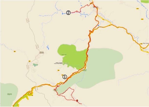
Sunday’s ride was posted as HOA to Sempah to Janda Baik.  What this usually means in practice is that we get to the Genting Sempah flyover after 765  metres / 2,500 feet of climbing over 16.5km / 10mi and only then decide whether to continue to Janda Baik, or to turn around and ride back to the Hospital Orang Asli (HOA).

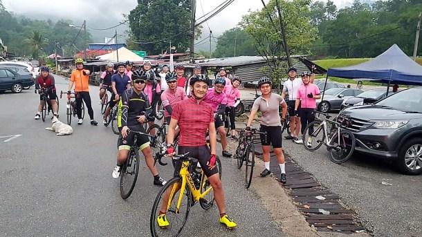
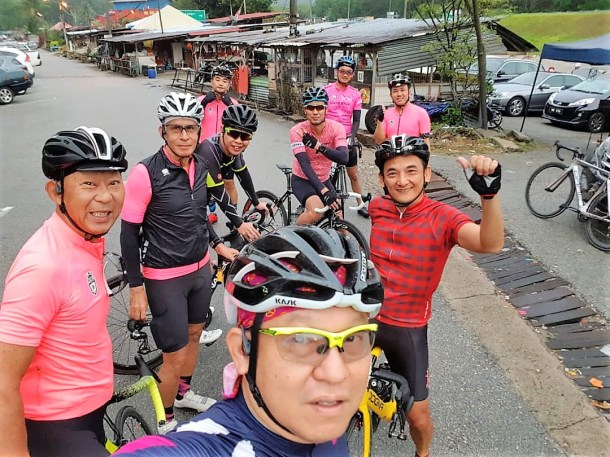
I didn’t count, but I think eighteen of us started from the HOA.  And all who started got to the Genting Sempah flyover.

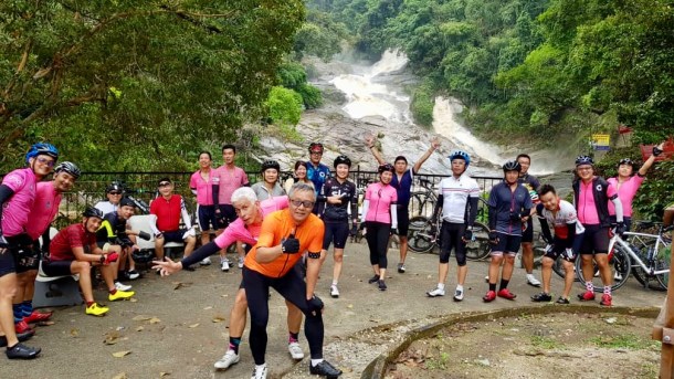
The consensus was to continue down the other side of the hill.  What was not so clear was continue to where?  The plan I heard was to go to Bukit Tinggi for breakfast, and then do a loop through Janda Baik.  We know of lots of places for breakfast in Bukit Tinggi.  Restaurant and coffee shop choices in Janda Baik are more limited.

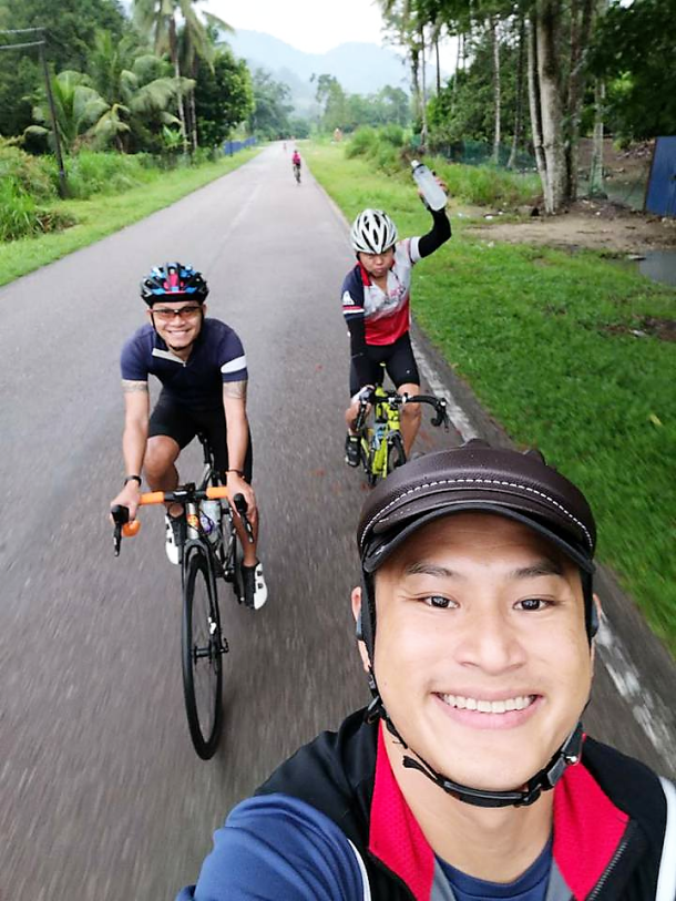
It is a high-speed run from the flyover all the way to the slightly offset four-way junction to either Bukit Tinggi to the left or Janda Baik to the right.  Much more pleasant since much of the road has been repaved.

Janda Baik Route

I anticipated turning left onto the blue section in the map above.  Instead of turning left to Bukit Tinggi, the lead riders turned right.  I had misunderstood or was unaware that the plan had changed.  Now we were doing the Janda Baik loop first (green in the map above) and then going to Bukit Tinggi for breakfast.

That upset things for a few of the group who needed to get back to the HOA by 11.00am or so.  It was 8.40am when we got to the four-way junction.  The Bukit Tinggi loop is 6.5km / 4mi long and includes 180 metres / 590 feet of climbing.  With a thirty minute stop for breakfast, the guys could have been back at the four-way junction with enough time to climb the 280 meters / 920 feet over 6km / 3.7mi to the flyover and then roll down the rest of the way to the HOA by 11.00am.

Getting back to the HOA by 11.00am would not be possible after doing the Janda Baik loop.  The run through Janda Baik is 17km / 10,5 mi long with 375 metres / 1,230 feet of climbing.  So the three who had a time crunch turned around and headed back to the HOA.

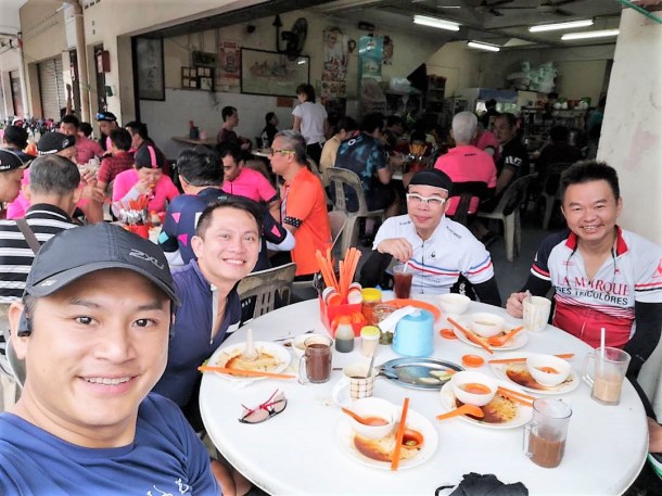
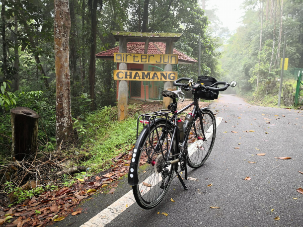
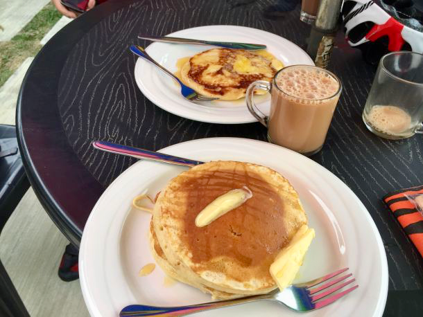
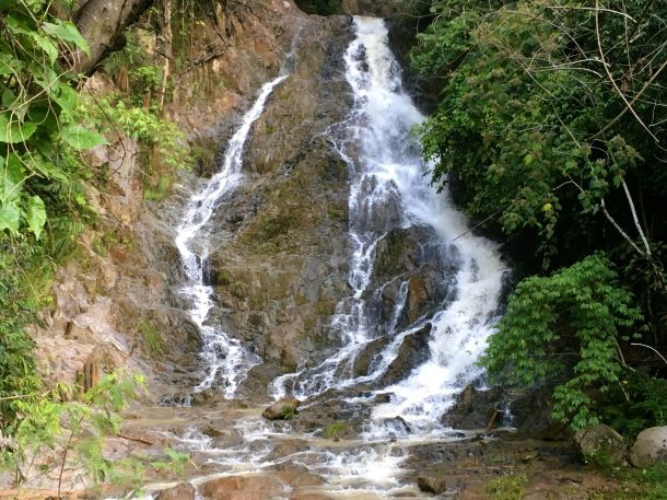
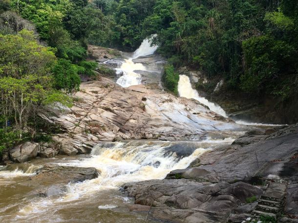
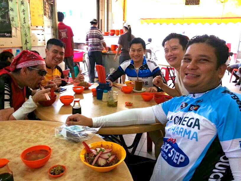
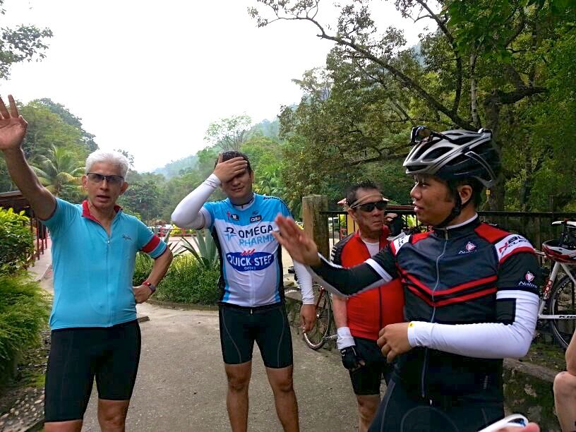
The rest of us pedalled up the steep initial slope under the arch and over the rolling terrain through Kampung Janda Baik.  Near the small Janda Baik police station is a sundry shop.  A short stop there to buy drinks morphed into a long stop at Warung Janda Baik next door for breakfast.

Janda Baik Breakfast 1Janda Baik Breakfast 2

There were a lot of patrons at the restaurant when we got there.  The fifteen of us stretched the restaurant’s capacity to the limit.  We finished off all the food they had immediately available.  We had to wait while they cooked more nasi lemak for us.

An hour later we got on our bikes again.  Having already fed ourselves, Bukit Tinggi was off the agenda.

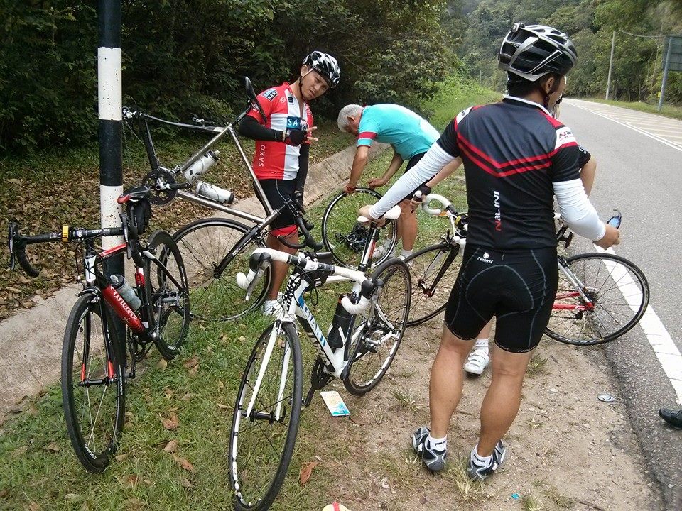
I wish I could say that we all had an uneventful ride back to HOA.  Unfortunately, a patch of sand caught one of our group out.  Road rash and an unrideable bike were the results.

The rest of us were more than 4km / 2.5mi up the road, literally, when we heard about the mishap.  Leonard commandeered this tow truck parked outside the police station at the Genting Sempah R&R to head back down the hill to pick up Henry and his bike.  Nothing but the best for a R@SKL!

Janda Baik Tow Truck CK Lim

Photograph courtesy of CK Lim

TH had ridden past us at the R&R and gone on ahead of the rest of us, oblivious to what had happened behind him.

Janda Baik TH TH

Photograph courtesy of TH Lim

So he was the first to the HOA car park and was able to drive back up to the Genting Sempah R&R to ferry Henry and his bike.

Janda Baik Henry TH

Photograph courtesy of TH Lim

It was not the best end to what had been a very enjoyable ride.  But falling is a hazard of our sport.  We are all glad that Henry suffered only some road rash.  On a more positive note, many have already volunteered to help him shop for a new frame!

Chamang Waterfall with the R@SKLs

Posted on
Chamang Banner odysseyonline com

Photograph courtesy of odysseyonline.com

My body clock usually wakes me up before the alarm clock goes off.  I was awake before the alarm clock buzzed this morning, but this time it was thunder and lightning at 4.30am which stirred me.  Not a good omen for a ride that thirty people had signed up for.

It was still raining in most of Kuala Lumpur at 6.00am.  The last time this happened, I stayed in bed.  Only to later see R@SKLs smiling in group photographs taken on dry roads.

This time I took the chance that it would be dry in Bukit Tinggi.  Kedai Makan dan Minum Zheng Ji (literally translated as Zheng Ji Eat and Drink Shop) in Bukit Tinggi was the designated meeting point for the start of the ride.

Depending on where you live in Kuala Lumpur, Bukit Tinggi is 40km to 50km / 25mi to 31mi away.  The rain put some people off from driving that far.  I started to have my own doubts as I drove through the rain at Genting Sempah, which is 5km / 3mi from Zheng Ji.

I needn’t have worried.  The rain had stopped by the time I parked my car.  Half a dozen buddies were already sitting over hot drinks at Zheng Ji, and more were arriving by the minute.  Twenty-eight riders were ready to roll at 7.20am.  The roads were wet, but the rain had stopped.

Chamang Start 01 Lee Heng Keng

Photograph courtesy of Lee Heng Keng

Chamang Start Lee Heng Keng

Photograph courtesy of Lee Heng Keng

Our destination was the Chamang waterfall, with a stop in Bentong on the way for breakfast.

Chamang Route

It is about 28km / 17.4mi from Bukit Tinggi to Bentong.  Almost all of it downhill.  We were on the old road between Kuala Lumpur and Bentong.  The old road runs alongside the Kuala Lumpur – Karak Highway, which was opened in the 1970s to provide a faster and safer link between Kuala Lumpur and the east coast of Peninsular Malaysia.

There is usually very little traffic on the old road.  Add the overcast skies and you have very pleasant conditions for a ride.  Despite the short flooded section and the occasional rutted patch of tarmac.

Chamang On The Road 03 Marco Lai

Photograph courtesy of Marco Lai

Chamang On The Road 01 Khoo Bin Soo

Photograph courtesy of Khoo Bin Soo

Among us were some cyclists who had never ridden this route before.  We stopped after 11km / 7mi at Bentong Hot Spring to regroup.

Chamang Bentong Hot Spring gobentong com

Photograph courtesy of gobentong.com

All smiles at this point.

Chamang Hot Springs 03 Mark Lim

Photograph courtesy of Mark Lim

Chamang Hot Springs 01 Arthur Ang

Photograph courtesy of Arthur Ang

The next regrouping location was the Shell station on the edge of Bentong town.  Clearly some fiddling was going on here.

Chamang Bentong Shell Station 02 Marco Lai

Photograph courtesy of Marco Lai

Chamang Bentong Shell Station 03 Marco Lai

Photograph courtesy of Marco Lai

Then it was on to breakfast at Kedai Kopi dan Makanan Kow Hing (Kow Hing Coffee and Food Shop).

Chamang Bentong Breakfast Marco Lai

Photograph courtesy of Marco Lai

Napoleon Bonaparte said Une armée marche sur son ventre (An army marches on its stomach).

In the case of the R@SKLs, Le peloton monte sur son ventre (The peloton rides on its stomach).

Stomachs ready for more cycling, it was on to Chamang waterfall.  The ride to the waterfall requires about 200 metres / 655 feet of climbing.  Which is even more of a challenge when you are on a touring bike, as Marco was.

Chamang Entrance Marco Lai

Photograph courtesy of Marco Lai

The work was worth it.  The waterfall was in full flow.  The heavy rain the night before meant that there was a greater volume of water than usual tumbling down the rock face.

Chamang Waterfall 03

Group photo time.

Chamang Waterfall Group Hsing C Pai

Photograph courtesy of Hsing C Pai

Those darned photobombers!

Chamang Waterfall 01 Lee Heng Keng

Photograph courtesy of Lee Heng Keng

The first time I rode to Chamang waterfall was in 2013 with the Flipsiders.  It was very nice to be still riding with some of that group.

Chamang Flipside Marco Lai 02

Photograph courtesy of Marco Lai

Usually, where hills are involved, our rides end with a descent.  This time the last part of our ride was the 550 meter / 1,800 foot climb from Bentong to Bukit Tinggi.

Still smiling!

Chamang On The Road 02 Marco Lai

Photograph courtesy of Marco Lai

We made the obligatory stop in Bentong to take photos in front of the big sign.

Chamang Bentong Sign 01 Lee Heng Keng

Photograph courtesy of Lee Heng Keng

Paul deserves a solo photo for smiling through the longest ride he has done for some time.  Despite getting a puncture.

Chamang Bentong Sign 02 Lee Heng Keng

Photograph courtesy of Lee Heng Keng

Everyone finished the ride safely, albeit sweatily because the sun had come out and the humidity had soared over the last 20km / 12.5mi.  Just what we didn’t need on the uphill road.

Stomachs needed refilling in Bukit Tinggi.

I’m sure the R@SKLs will do this ride again soon.  Those who slept in are demanding it!

Strava Ride # 1,000

I read a WordPress post by Tempo Cyclist the other day, where he described the first ride he uploaded to Strava.  That got me thinking about all the rides I have uploaded to Strava over the years.

Riffing off Tempo Cyclist’s post, I looked at my 1,000th ride on Strava.  It was a ride to Genting Sempah, with good friends Mark and Ridzuwan, on 18th October last year.

Coincidentally, my very first ride in Malaysia, after moving back home from the Netherlands, was also up to Genting Sempah, on 7th October 2012.

The Genting Sempah climb is probably the most cycled route in the Klang Valley.  I have done the Genting Sempah climb at least forty times since that first ride in 2012.  There has always been dozens of other riders on Jalan Gombak with me.

The climb is generally considered to be from the Hospital Orang Asli (HOA) to the flyover at the summit, which is almost on top of the border between the states of Selangor and Pahang.

GS Strava Heatmap (1)

Heatmap courtesy of Strava

A lot of people start their ride from somewhere near the HOA.  It all depends on where they can find a parking space.

GS HOA 2

Photograph courtesy of Danial Lim

The ride to the flyover is very pleasant.  It is usually quite cool and shady.  The average gradient is about 3.5%, but with some kickers along the way to get the heart rate up.  And traffic is usually fairly light, although occasionally there are car clubs or motorcyclists blasting up the hill..

A number of troops of monkeys live in the jungle lining the road.  It is not unusual to see some during the ride.

GS Monkeys Rodrigo Sala at tcktcktck.org

Photograph courtesy of Rodrigo Sala at tcktcktck.org

The bridge with 1.8km / 1.1mi to go to the summit is a convenient spot to stop to get your breath back before tackling the last two steep corners on the way to the flyover.

GS Bridge Danial Marzuki

Photograph courtesy of Danial Marzuki

Near that bridge, you get a good view of the Karak Highway, which replaced Jalan Gombak as the primary route between Kuala Lumpur and Bentong.

GS Karak Highway Mark Lim

Photograph courtesy of Mark Lim

Most riders turn around at the flyover.

If you are hungry, there is a McDonald’s one kilometer down the other side of the hill, at the Genting Sempah R&R on the Karak Highway.  We often start the Genting Sempah ride with the intention of going to the McDonald’s, but change our mind at the flyover.  The prospect of climbing 64 meters / 210 feet over 1km / 0.6mi from the McDonald’s back to the flyover puts us off.

GS McDonald's

If you want to go further afield for food, you can continue down the hill from the R&R for 5km / 3mi to the left turn to Bukit Tinggi, with its collection of kopitiams, or Hokkien coffee shops.

GS Strava Heatmap (1)

Heatmap courtesy of Strava

A popular alternative is Janda Baik.  Instead of turning left to Bukit Tinggi, you turn right and ride under this arch.

GS Janda Baik Arch

My go-to place for breakfast in Janda Baik used to be Andak’s Place.

GS Food Andak's Place

Sadly Andak’s Place has closed down.

An alternative is Kopi n Kraf.

GS Janda Baik Food Stop

Photograph courtesy of Leslie Tong

If you are looking for a longer ride, continue straight down the hill, past the turnings to Bukit Tinggi and Janda Baik, for another 30km / 18.6mi to Bentong.

There are food choices for those who turn around at the flyover and head back down the hill.  The food stall a few hundred meters from the HOA is a popular spot for a pre-ride or post-ride drink and meal.

GS Food Stall 2 Eric Siow

Photograph courtesy of Eric Siow

A few of us have taken to starting our ride to Genting Sempah from where I live.  Which adds about 40km / 25mi to the 32km / 20mi from the HOA to the flyover and back.  More importantly, it allows us to stop at Santa Chapati, near the Tawakal Hospital, for lunch on the way home.

GS Food Santa

Photograph courtesy of Mark Lim

Good riding, and good eats.  No wonder Genting Sempah is a favourite route.

I’ve Got the ‘Flu. Do I Ride my Bike, or Not?

Influenza Virus Centers for Disease Control and Prevention (1)

Graphic courtesy of the Centers for Disease Control and Prevention

This is the H1N1 influenza virus.  One of the three or four ‘flu viruses which are most prevalent during this 2016 / 2017 influenza season.

Perhaps the ‘flu virus that caught me (I don’t think you catch the ‘flu.  The ‘flu catches you) was the B/Brisbane/60/2008-like virus.  Australia is in the midst of its worst ‘flu outbreak on record.

Whichever strain of the virus it was, I started feeling the effects of the infection ten days ago.  It started with a sore throat, which progressed to a fever, upper chest and nasal congestion, aching joints, and an annoying cough.

After a week of Hurix’s Fluaway capsules, and Strepsils lozenges, I felt better.  Not 100%, but well enough to ride to Kundang with birthday boy Mark, Marco, and Khoo.  I was following the old adage to “sweat out a cold”.

I’m was also sure the Kundang pan mee would have curative properties.

Kundang Noodles

Photograph courtesy of Marco Lai

The same had to be true for the chendol from Hasan’s van on Jalan Bukit Mayang Emas.

I didn’t feel any better, but I didn’t feel any worse, the next morning.  The morning of the Man Ride Day.  Lay, Khoo and Mark were coming to my apartment to start the ride with me.  There was no backing out.

Man Ride

Graphic courtesy of The Bike Artisans

There were two distances to choose from.  100km and 200km.  We all chose the 100km route, from The Bike Artisans on Jalan Doraisamy to Genting Sempah and Janda Baik, and then back to The Bike Artisans.  Hardier souls than we rode twice as far, to Raub and back.

The agreement with Lay, Khoo and Mark was that if I started coughing, the pace was too high.  Which turned out to be an effective way of controlling our speed up the climbs to Genting Sempah.  Cough cough cough!

Man Ride Day 1

Photograph courtesy of Qoo Khoo

We started the ride with about one hundred other cyclists.  Perhaps half were ahead of us by the time we got near the Orang Asli Hospital.  Then everyone moved ahead of us, because we stopped for food and drink at our regular spot, Restoran Sidek Ria.

Man Ride Day 2

Photograph courtesy of Qoo Khoo

We spent 25 minutes over roti telur and iced Milo.  Back on my bike, I coughed, spluttered, and blew snot rockets every now and then all the way up to Genting Sempah.

Snot Rocket REI com

Graphic courtesy of REI.com

At the flyover I decided that I felt good enough to continue to Bukit Tinggi.  That cut out the Janda Baik loop, which removed some steep slopes and about 15km /  9mi from our route.

We stopped for more food and drink in Bukit Tinggi.  There are a number of coffee shops to choose from.

My riding buddies kindly kept the pace low as we climbed the 415 meters / 1,360 feet of elevation over the 9km / 5.5mi from Bukit Tinggi back to Genting Sempah.  I had brought some Strepsils to help with my cough, but had nothing to boost my compromised lung capacity.

Once the last slope at Hamburger Hill was dealt with, it was downhill for 25km / 15.5mi to Jalan Taman Ibu Kota.  Then onto flat ground past the Twin Towers and back to The Bike Artisans.

Man Ride Day 4

Photograph courtesy of Qoo Khoo

The Man Ride Day ended with a nasi kandar and satay lunch, a short talk on Mens’ Mental Health by Associate Professor Dr. Amer Siddiq Amer Nordin from University of Malaya, a short talk on reaching out for help by Kenny Lim of Befrienders Malaysia, and an auction of commemorative Black Sheep Chaos kit.

Man Ride Day 3

Chaos Kit (1)

Photograph courtesy of The Bike Artisans

It was a well-organised event, and good fun.  I’m glad I rode the event, albeit for only 90km / 56mi.

My cough and upper chest congestion didn’t get any better over the weekend.  It was slightly worse on Monday morning.

So today, belatedly, I did some research.  Was there any truth to the “sweat out a cold” adage?

The answer is “it depends.”

Doctors differentiate between ‘above the neck’ symptoms such as a runny or stuffy nose, watery eyes or a mild sore throat, and ‘below the neck’ ones, such as a cough, a congested or tight chest, an upset stomach, muscle aches and fever.

A light to moderate – and brief – workout is fine if your symptoms are above the neck.

If your symptoms are below the neck?  Give workouts a miss.  Exercising with major cold symptoms will prolong your illness and can be dangerous.

Which probably explains why I still have a stuffy nose and a cough.

Sick

I have below the neck symptoms.  So no BCG Tuesday Night Fun Ride for me today.

Now where did I put those Strepsils?

Postscript

I saw a doctor.  He put his stethoscope on my chest as I took deep breaths.  Well, as deep as I could manage.

He heard lots of crackling.  Walking pneumonia was his diagnosis.  I left his clinic with an antibiotic, and something for my cough.

And with strict instructions to avoid any exercise until my lungs were clear.

Seven days later, I could ride again.

Independence Day Ride

BCG Bentong Merdeka

Malaysia was born on 31st August 1957.  That day Tunku Abdul Rahman, the first Prime Minister of Malaysia, read the official declaration granting the Federation of Malaya independence from the British Empire.

Most years friends and I have marked Merdeka Day (Independence Day) with a bicycle ride.  This year it was the BCG Merdeka Ride to Bentong.

About fifteen of us met at the Orang Asli Hospital for a 7.15am start.  I got there early, hoping to have a hot drink at the small restaurant near the hospital.  The restaurant was closed.

I had forgotten that it was a five-day weekend.  Thursday was Merdeka Day.  Friday and Saturday were public holidays for Hari Raya Haji (Eid al-Adha)  And Monday had been declared a public holiday to commemorate Malaysia winning 145 gold medals out of the 225 gold medals competed for at the 2017 SEA Games, which had come to an end on 30th August.

Traditionally Malays celebrate both Hari Raya Puasa (Eid al-Fitr) and Hari Raya Haji with family in their home towns and villages.

Which means a mass exodus from Kuala Lumpur the day before those festivals.  The Karak Highway is the main road link between Kuala Lumpur and the cities and towns on the east coast of the peninsula.

We stopped near the summit of the Genting Sempah to look at the traffic on the Karak Highway.

BCG Bentong Bridge Danial Marzuki

Photograph courtesy of Danial Marzuki

This was the view of the eastbound lanes of the Karak Highway from Genting Sempah.

BCG Bentong Jam Mark Lim

Photograph courtesy of Mark Lim

The volume of traffic on the Karak Highway prompted many to take the old road to Bentong.  Jalan Gombak is usually very quiet.  We cyclists typically share the road with the odd lorry, a few learner drivers, and some motorcycles.  On this day there was a steady stream of cars, vans and buses heading up the road with us.

We had a nice surprise at the Genting Sempah flyover.  The couple who, on weekends, set up a makeshift drinks and snacks stall out of the boot of their car, were there.  Hooray!

BCG Bentong Genting Sempah 2 Vince Chan

Photograph courtesy of Vincent Chan

If you are wondering, I couldn’t find a red hibiscus, which is the national flower of Malaysia.

BCG Bentong Genting Sempah 1 Vince Chan

Photograph courtesy of Vincent Chan

We continued to share the road with a stream of vehicles on the 35km / 22mi run from Genting Sempah to Bentong.  There is a section between Bukit Tinggi and Bentong where the road is badly potholed.  That caused traffic to be backed up for a few kilometers.

Once past the potholes, those vehicles that we had overtaken roared past us.  Only for us to overtake them again as they waited in a long queue for the traffic lights at the T-junction of Jalan Gombak and Jalan Lama Bentong – Karak.  It was definitely faster by bike over the last 25km / 15.5mi to Bentong.

We had planned to eat at Lemang To’ki, home of the best lemang in Bentong.  We weren’t surprised to find that Lemang To’ki was closed.  So we settled for the next-best option.  Roti canai, half-boiled eggs, and kaya toast.

And peanut ice cream at Kow Po Coffeeshop.

BCG Bentong Ice Cream Daniel Ng

Photograph courtesy of Daniel Ng

That was the easy part over and done with.  It was all uphill from Bentong back to Genting Sempah.  1,000 meters / 3,280 feet of elevation gain.

We were smiling as we rode through Bentong.

BCG Bentong Sign Danial Marzuki

Photograph courtesy of Danial Marzuki

The climbing, and the 34° to 36° C / 93° to 97° F temperatures, wiped those smiles off our faces.  By the time we got back to Genting Sempah we were gagging for cold drinks.

We gave the McDonald’s there a miss, assuming, no doubt correctly, that it would be packed with travelers taking a break from the traffic jams.  The roadside stall we stopped at had run out of canned drinks, but fortunately they still had lots of ice and Sunquick.

Then it was just Hamburger Hill between us and the 16km / 10mi descent to the Orang Asli Hospital.  We had to be careful.  The traffic was still streaming up the hill, with some drivers cutting corners.  The bus drivers were the worst culprits.

We all got down the hill safely.  Tired, but glad to have done the ride in great company.  I wonder where we will be riding to when Malaysia turns 61.

BP_31%_Facebk_2017

One Thing Rain is Good For

Posted on

It has been raining a lot lately.  Quite a few night rides have been cancelled because it was too wet.  A ride planned for this morning didn’t happen because it was raining when my alarm went off.

One upside is any waterfalls we pass are worth stopping at for a longer look.  There are a couple on the route from Janda Baik to Chamang.

Waterfalls

The first, Bentong waterfall, is on the left as you descend from Bukit Tinggi.  It feeds the Sungai Tanglir, which is on the right side of the road.

Bentong Waterfall

Bentong Waterfall

The second, Chamang waterfall, feeds into the Sungai Perting.  It is a bit of a climb to get to the falls, but the effort is worth it.

Chamang Waterfall

Chamang Waterfall

The recent rains have added to the volume of water in these falls.  A good thing for sightseers.  But I do hope it isn’t raining tomorrow morning.

Feeling the Pinch

It was the Islamic New Year on 5th November.  Like its Gregorian calendar equivalent, the advent of the Islamic new year is marked by a holiday.  A holiday to be celebrated with a long bicycle ride.

The original plan was to ride from Bukit Tinggi to Bentong, eat beef ball noodles for breakfast, and ride back.  Bukit Tinggi is about 300 meters / 980 feet above sea level.  Bentong is 95 meters / 312 feet above sea level.  The hard work would come on the way back.  Nine of us, including birthday boy Raj,  pointed our bikes downhill and rolled through the light rain.

The wet weather soon moved on toward Kuala Lumpur, leaving us on damp roads but under overcast skies.  There would be no need for arm coolers and suntan lotion.

Photo courtesy of Mark Lim

Photo courtesy of Mark Lim

We swung into Bentong after about an hour.  Only to find that the famed beef ball noodles shop was closed.  So we embarked on a spin around the town looking for an alternative.

We ended up at the wonton noodles shop where we had stopped during the Durian Fiesta ride.  Which suited the birthday boy.

IMG_2291

Photo courtesy of Mark Lim

Everyone was so refreshed after breakfast that we decided to continue on to the Chamang waterfall.

Chamang Waterfall Route

The waterfall is very easy to get to.  Follow the sign just outside Bentong, and start climbing.  Six kilometers into the climb we got our first glimpse of the Perling River.  Accompanied by the thwack thwack thwack of cloth against rock.  Someone was doing their laundry.

IMG_2283

The waterfall was worth the 110 meter / 360 feet climb.  We all enjoyed spending twenty minutes watching the water cascading down the rock face.

IMG_2346

Raj is a relatively new roadie.  So all credit to him for coming along with us on these longer rides.  And being thrilled at the prospect of the climb to come that Griffin and I are pointing out!

Photo courtesy of Mark Lim

Photo courtesy of Mark Lim

On the way back we made a pitstop in Bentong for drinks and photos.

Photo courtesy of Mark Lim

Photo courtesy of Mark Lim

“Is this where I catch the bus to Kuala Lumpur?”

The ride back to Bukit Tinggi was interrupted by two pinch flats.  I was a bit surprised to be stopped by a pinch flat on this smooth section of road.  Here I am demonstrating my tube-changing skills to a very interested audience.

Photo courtesy of Shahfiq Abdul Manap

Photo courtesy of Shahfiq Abdul Manap

Photo courtesy of Shahfiq Abdul Manap

Photo courtesy of Shahfiq Abdul Manap

“Stop thief!!”

Twenty kilometers later I had another pinch flat.  That one was no surprise.  I was on a bridge with a lorry right beside me.  I had no choice but to ride over a gaping expansion joint.  My prayers to the guardian angel of inner tubes were not answered.

That didn’t detract from a great morning out with my riding buddies.  Great company, good food, cool weather, impressive views, lots of laughter, and when I was in a pinch, Marco had an inner tube to spare.

IMG_2281