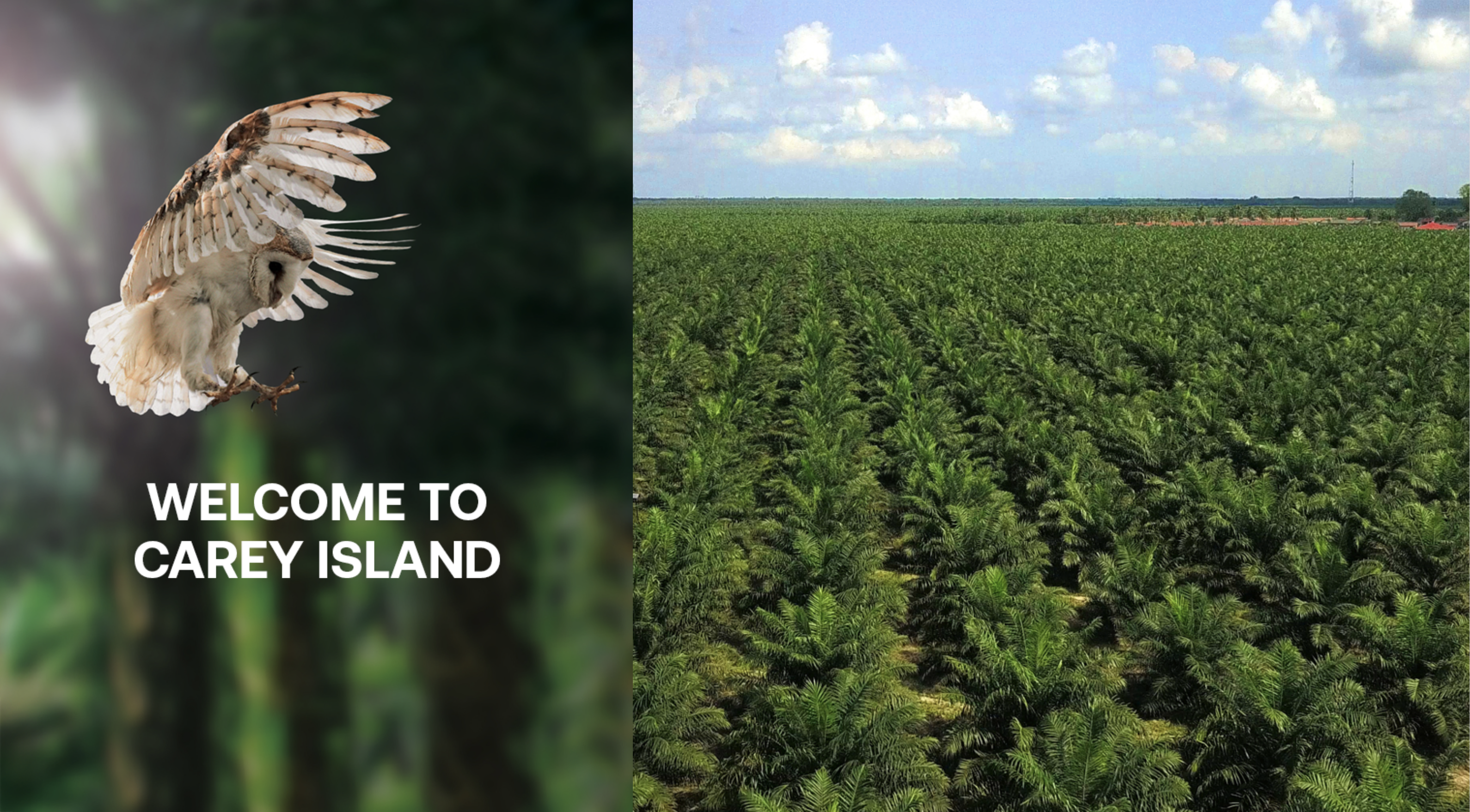
It was a four-day weekend, and my Biker Chick suggested we spend three nights on Carey Island. Carey Island is a 154 km2 landmass separated from the Selangor coast by the Langat River. The island is named after Edward Valentine John Carey, who purchased it in the early 1900s to establish a rubber plantation.
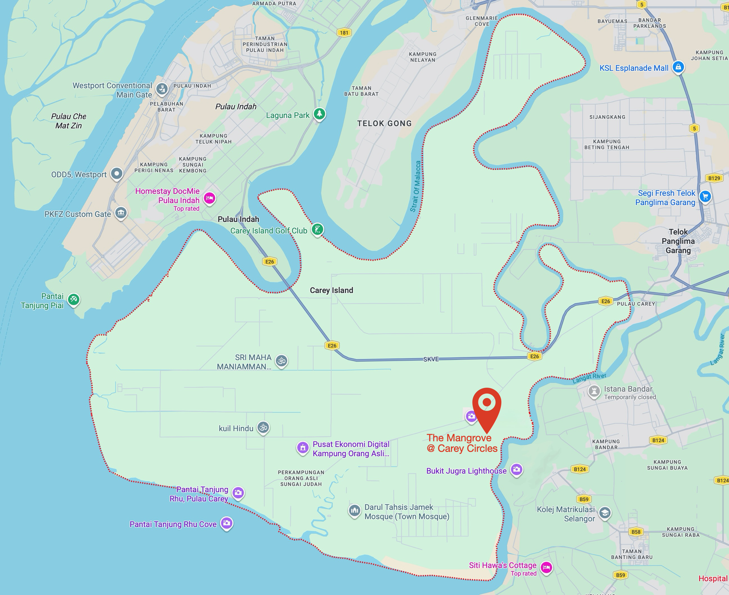
The only accommodation I knew of was the Amverton Cove Golf & Island Resort, but that wasn’t what my Biker Chick had in mind. She suggested we stay at The Mangrove at Carey Circles, a collection of private villas, a clubhouse and a spa that opened in June 2025.
Map courtesy of Google Maps
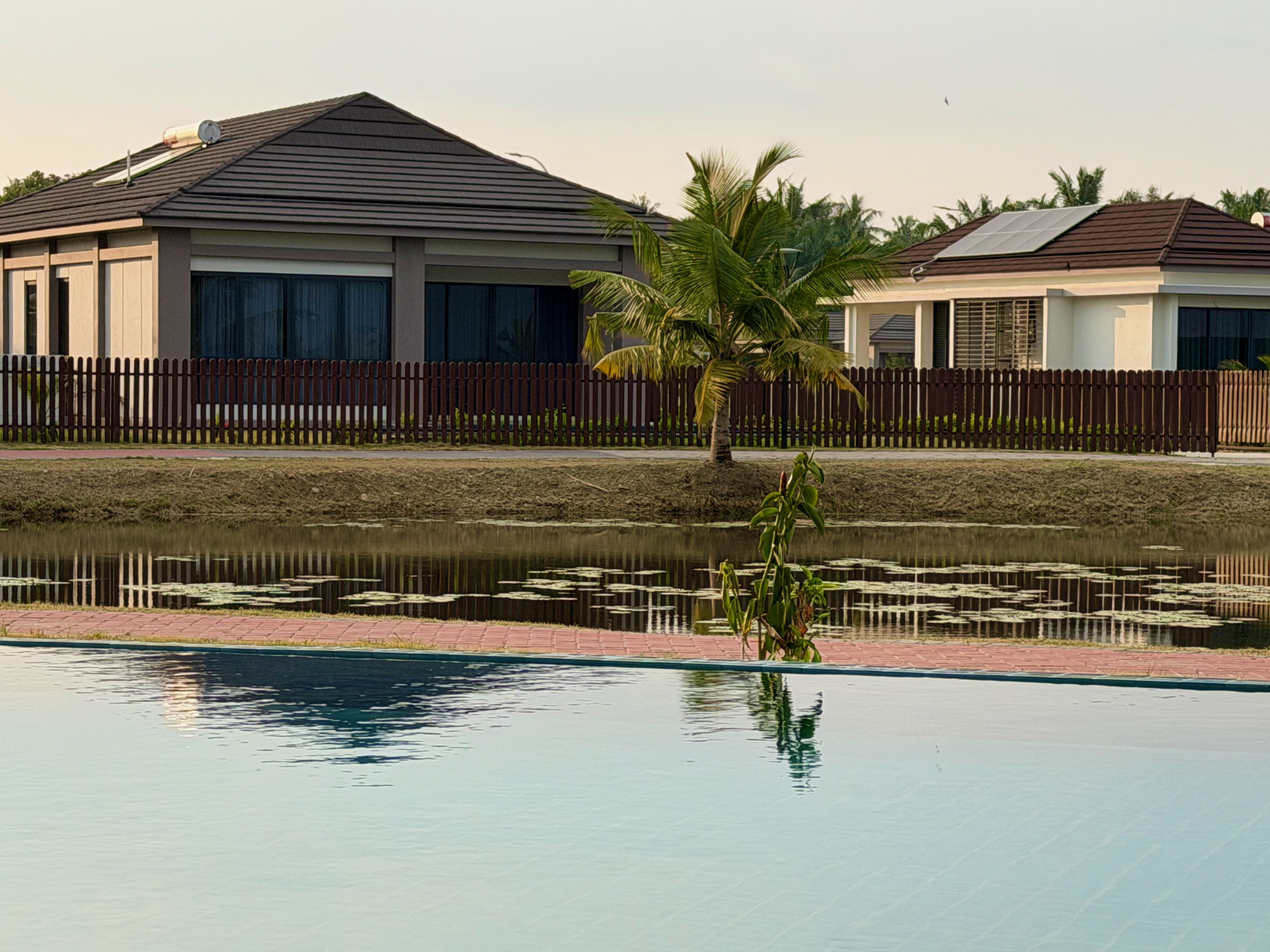
We stayed in a single-room luxury villa. Some of the larger villas among the 56 on the property come with private swimming pools. Since we’re not keen swimmers, we were happy to use the clubhouse’s infinity pool whenever we wanted a dip.
I brought my bicycle along. Carey Island was an occasional destination for the R@SKLs back in the day, and I was keen to revisit the quiet roads running through the oil palm plantations that replaced the rubber trees in the 1960s and 1970s.
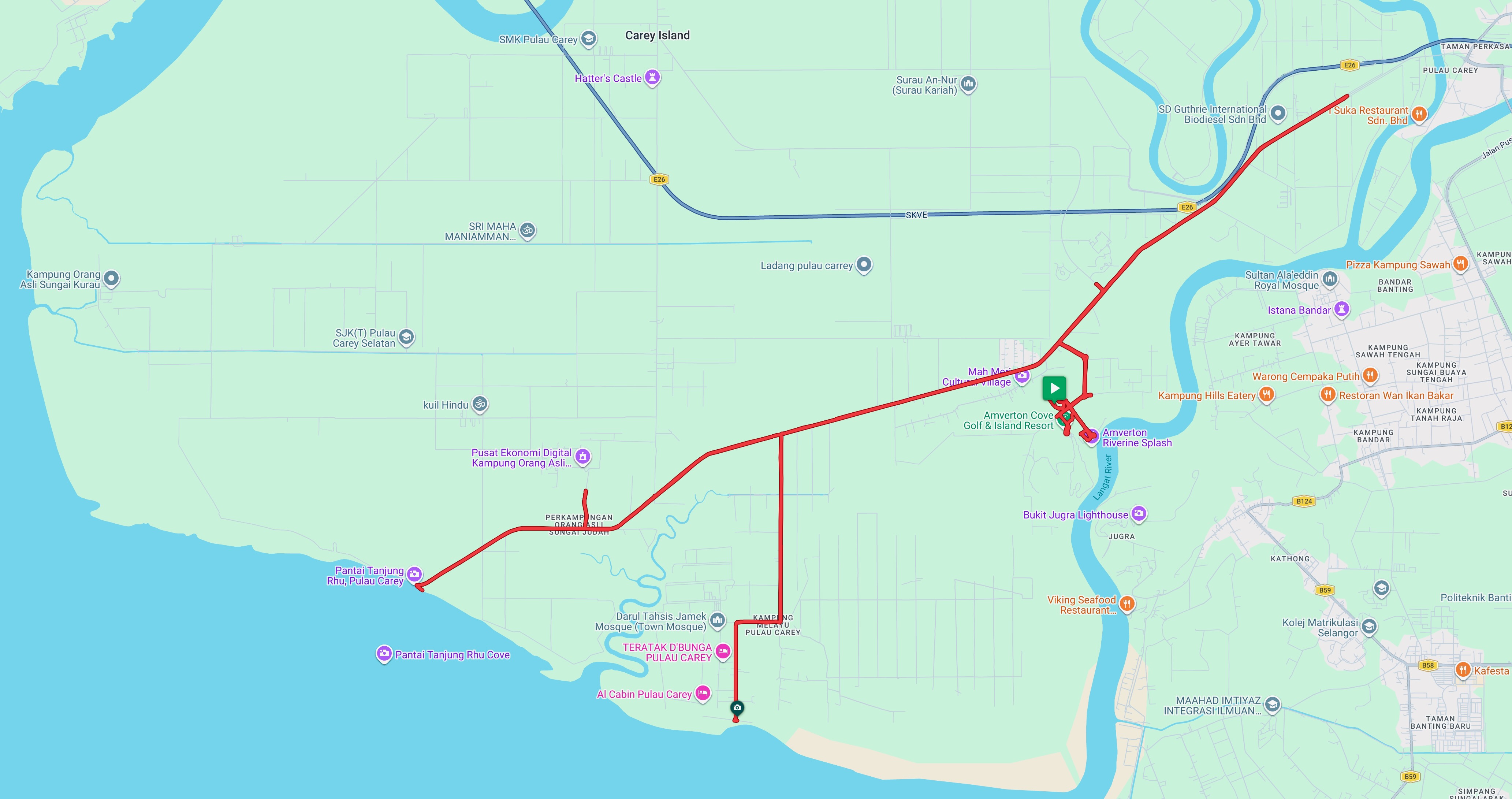
The last time I rode on Carey Island was in June 2019. That ride included breakfast at the Amverton Cove Golf and Island Resort, which has since expanded to include the Riverine Hotel and Suites and the Carey Circles development.
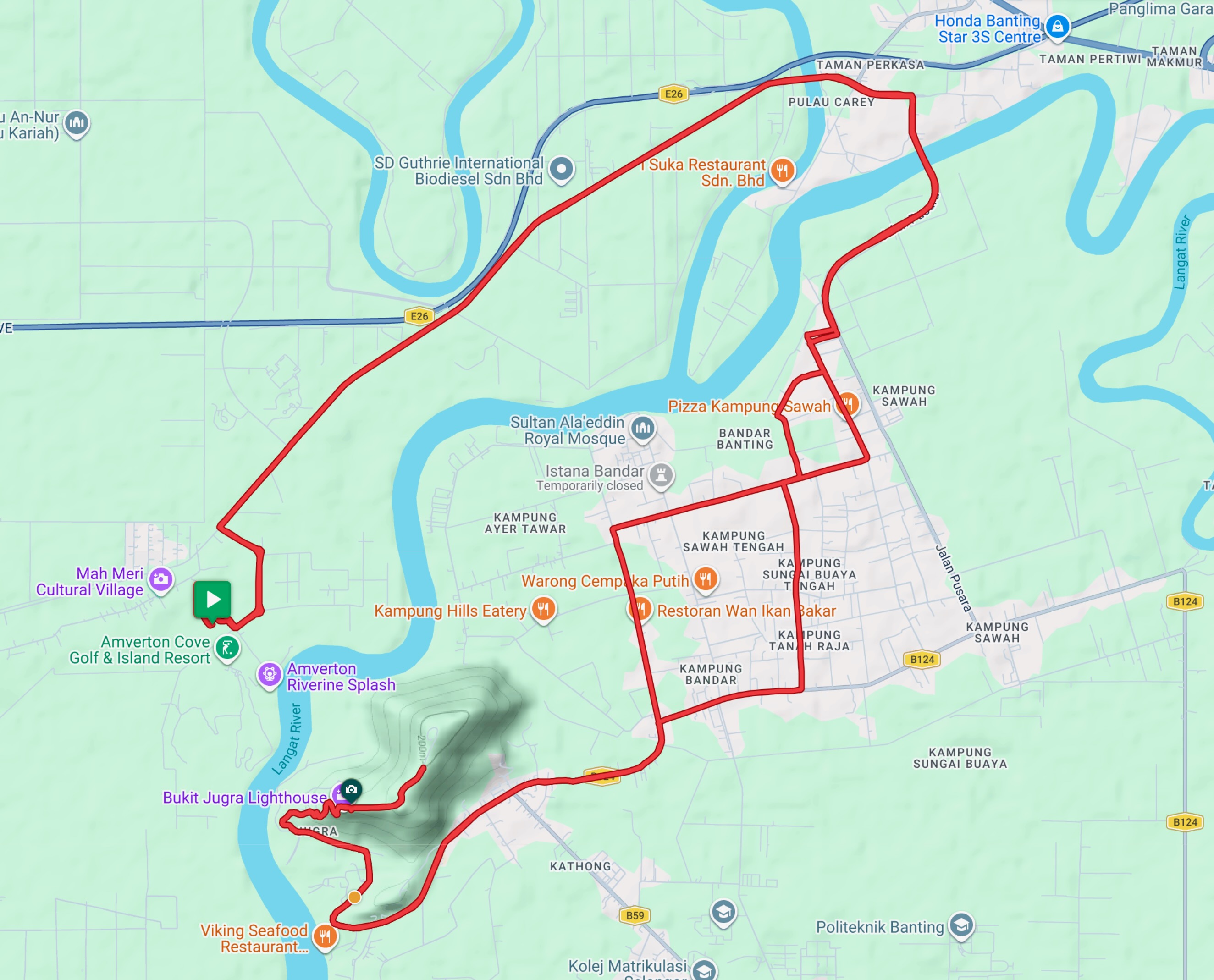
There are now a few more roads within the Amverton Cove and Carey Circles areas, but the ones I cycled in 2019 are still the main routes available today. Jalan Pulau Carey, which crosses the island from east to south-west, and Jalan A9 off Jalan Pulau Carey, along with the roads running through Kampung Melayu, due south.
Map courtesy of Ride With GPS
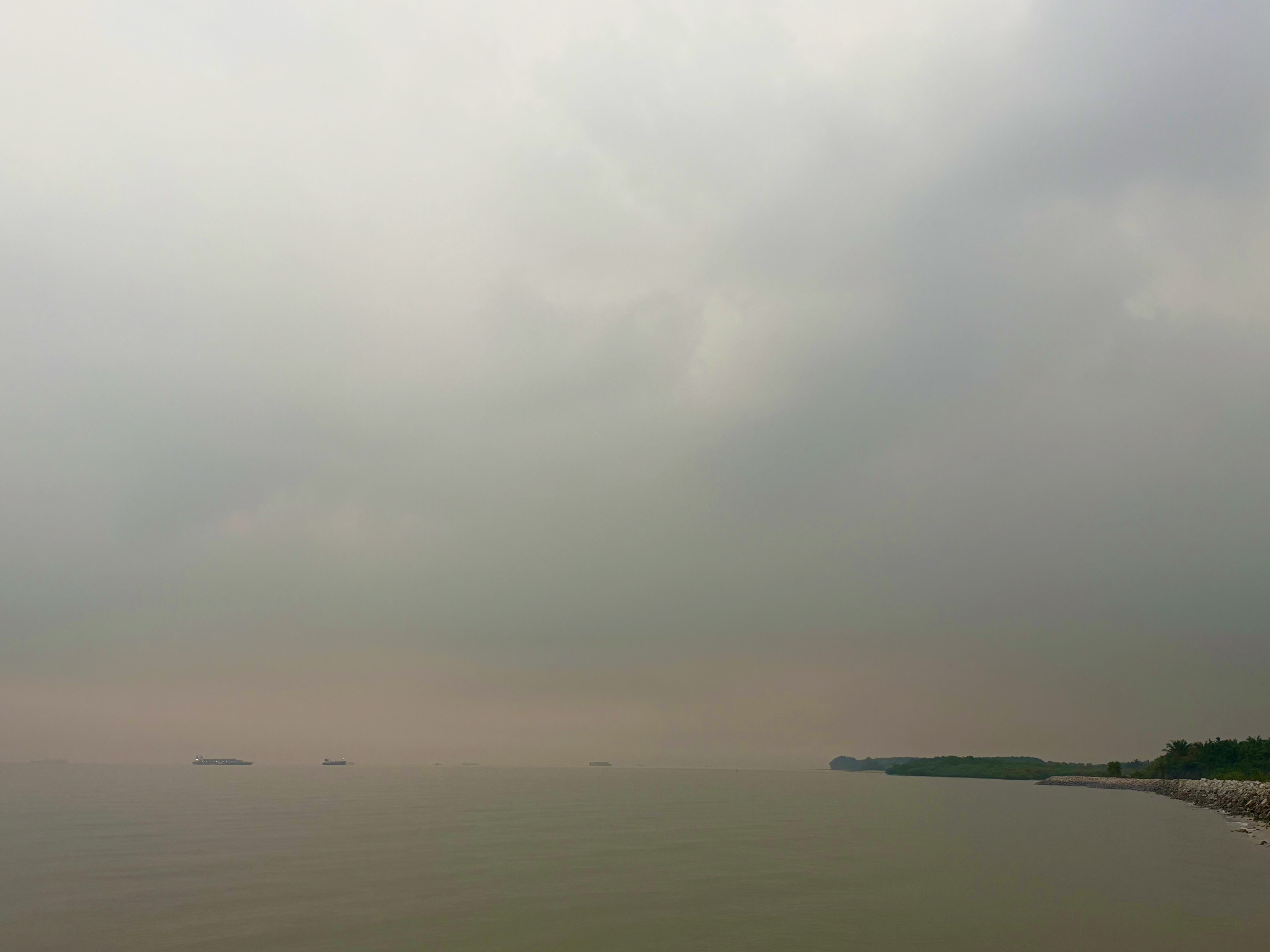
This was the misty early-morning view from the southwestern end of Jalan Pulau Carey at Pantai Tanjung Rhu. In the distance were several vessels waiting to dock at Westport.
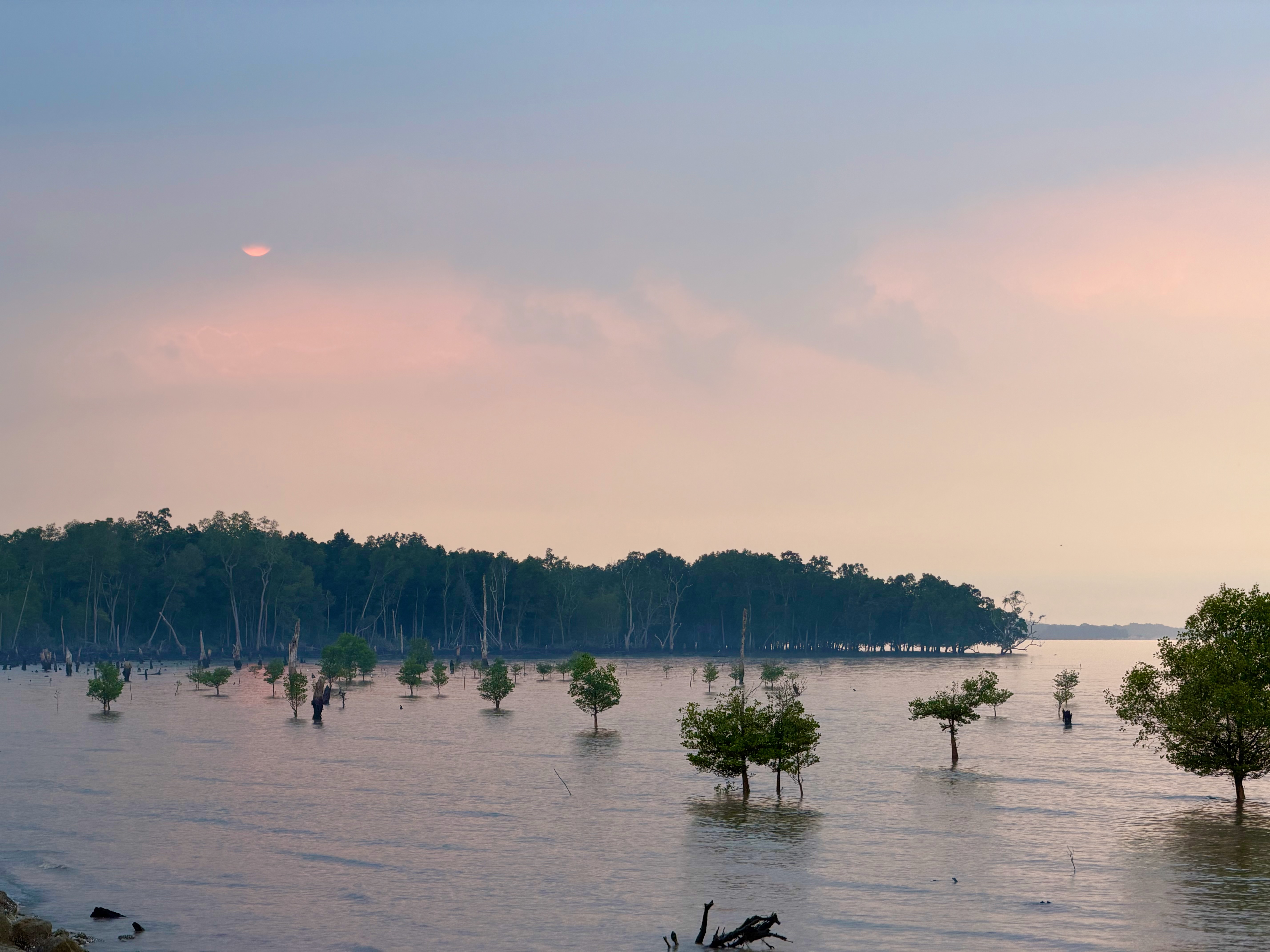
This was the slightly later and less misty view looking south from the end of Jalan Semarak. It’s always more attractive during high tide.
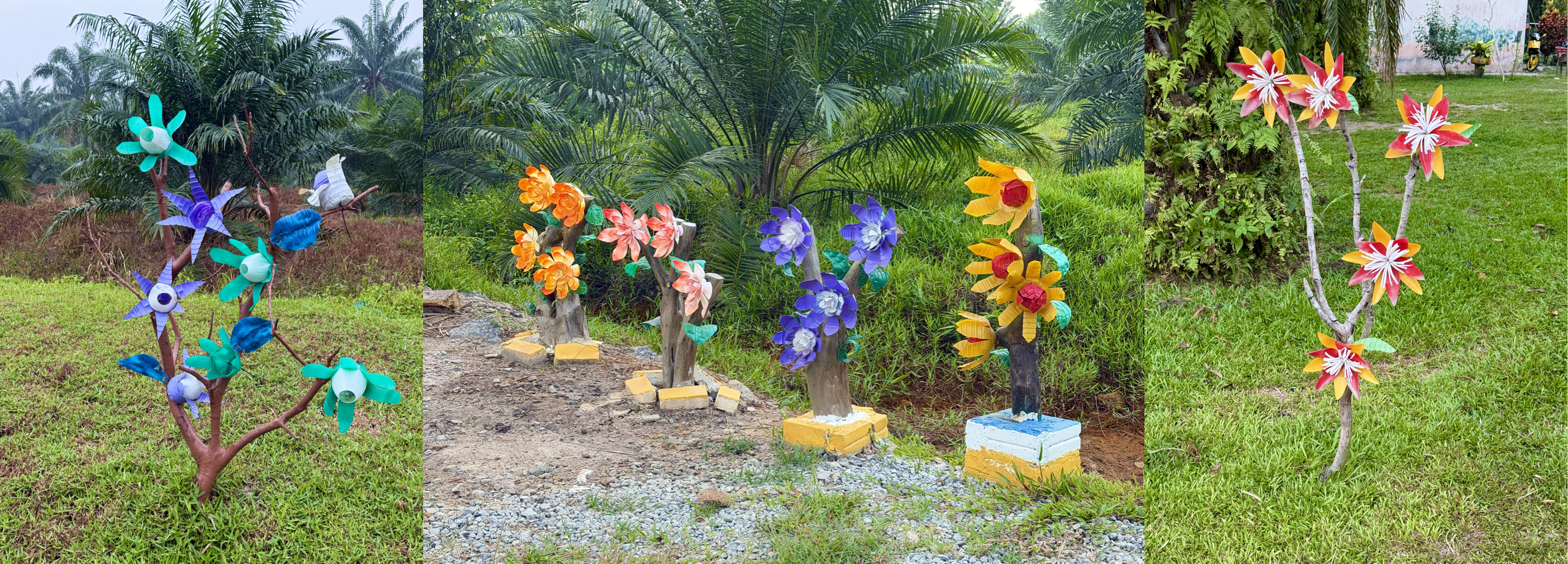
I also set out along one of the few roads on the island that appear in Google Street View. This road leads toward Kampung Sungai Judah, and like some of the other roads branching off Jalan Pulau Carey, its junction was marked by artificial flowers.
I didn’t get very far. A pack of dogs ahead of me seemed a little too interested as I approached, so I decided not to take any chances and turned back. There are a lot more dogs on the island now than I remember from the last time I rode here. Fortunately, the ones scattered along Jalan Pulau Carey paid no attention to me as I cycled past.
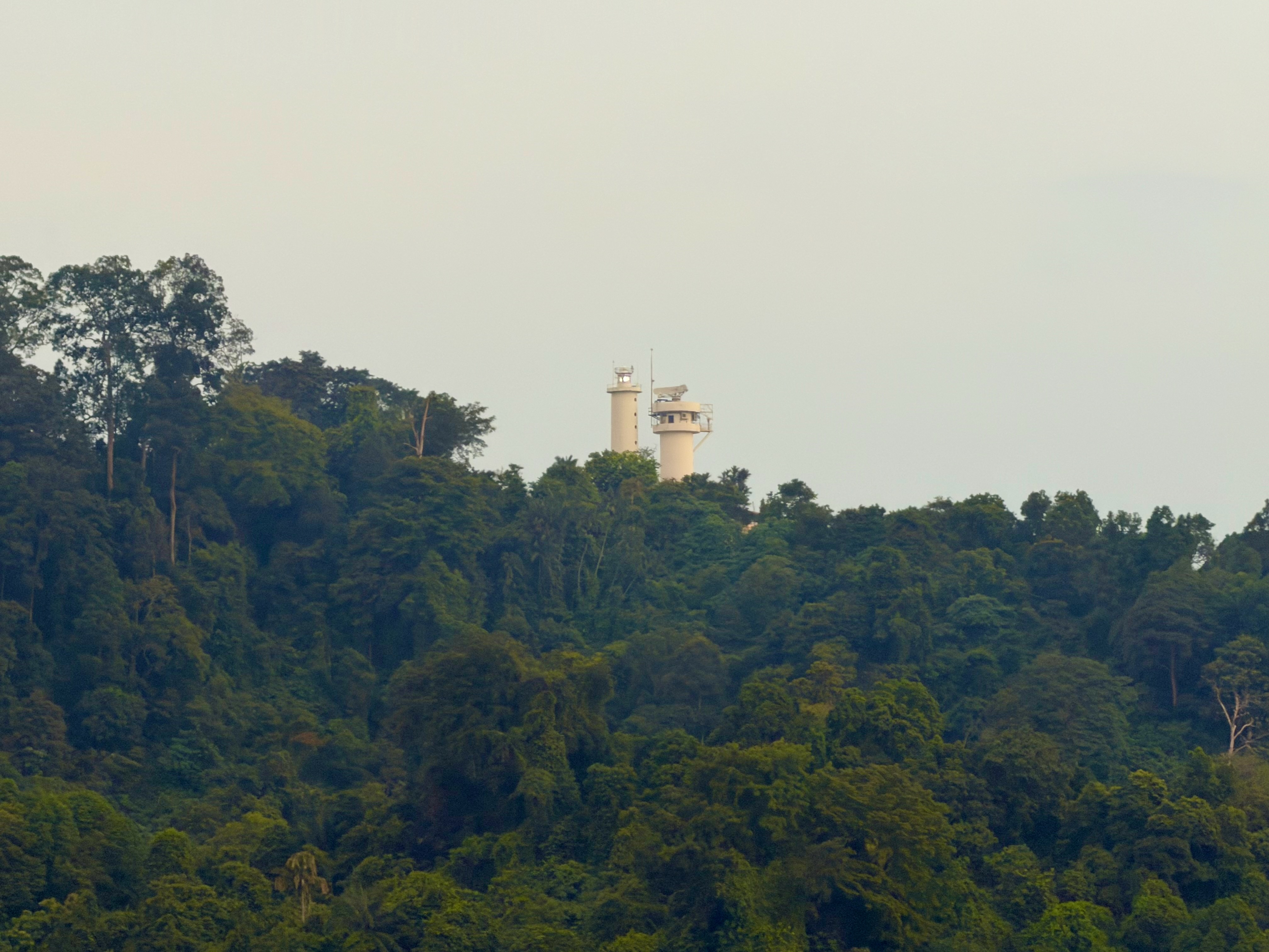
Another option is to ride to the Jugra Lighthouse, which is visible from Carey Circles.
The last time I rode up to the Jugra Lighthouse was in July 2017. I had forgotten how steep that climb is. It’s 1 km from the junction at Jalan Bukit Jugra to the lighthouse, with an average grade of 11% and a maximum of 15.6%. Those switchback corners were very hard work.
After catching my breath at the lighthouse, I joined the crowds walking up the hill and pedalled another 800 metres to the locked gate at the RMAF Bukit Jugra training base.
Map courtesy of Ride with GPS
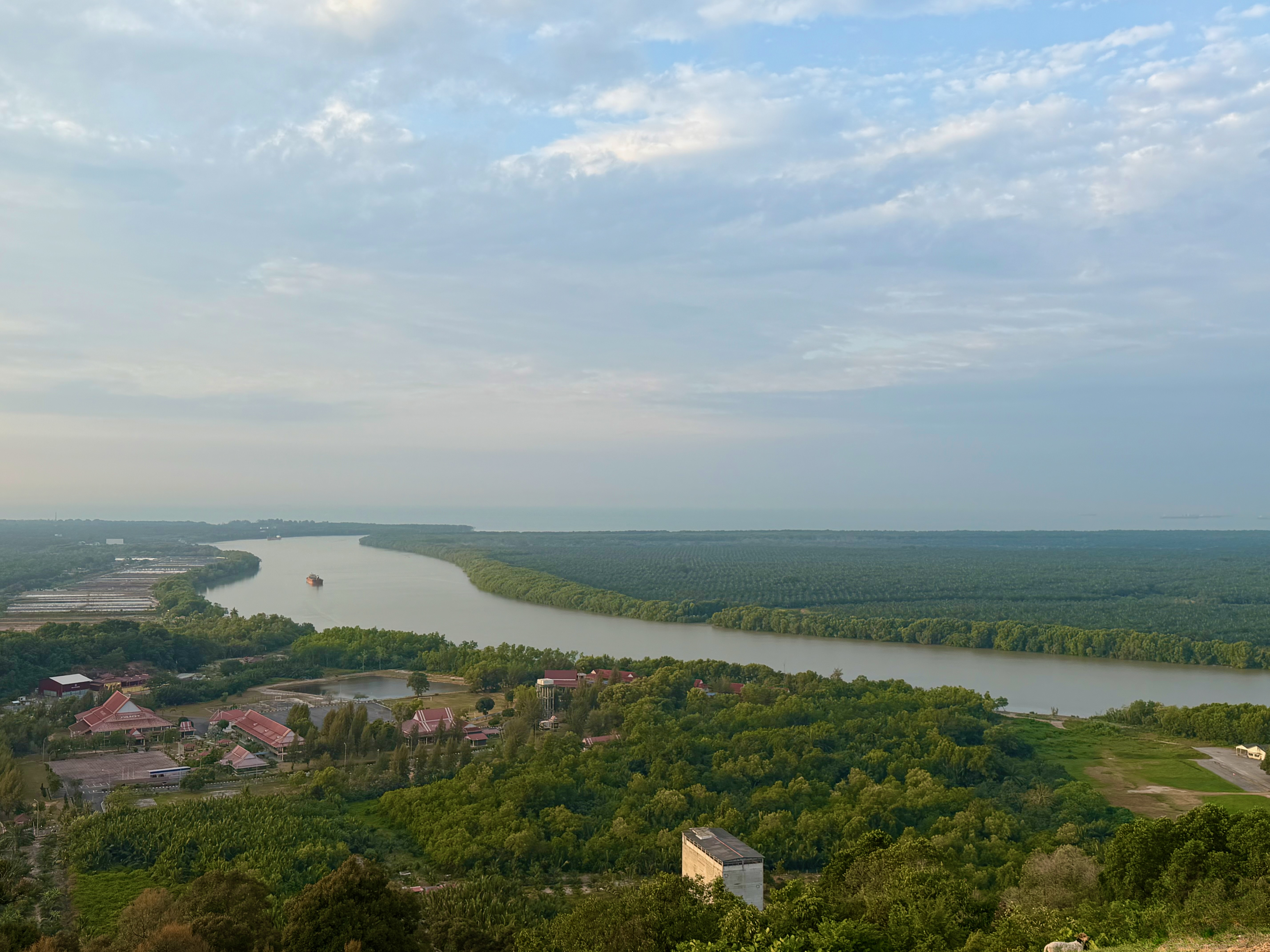
The view of the Langat River from the base of the lighthouse is lovely. There weren’t any paragliders launching themselves off the slope on the Monday morning I was there, but that is a fairly common sight on weekends.
I found out about another cycling option on Carey Island, located within the SD Guthrie estate. There are a number of things to see and visit in the estate, including the Plantation Museum, the Palm Oil Experience Centre, and Hatter’s Castle.
There is a 10 km bicycle lane from the security checkpoint on Jalan Pulau Carey to the Plantation Museum. The bicycle lane is open to the public only on the first Sunday of each month, which is a shame because I was there on a Monday.
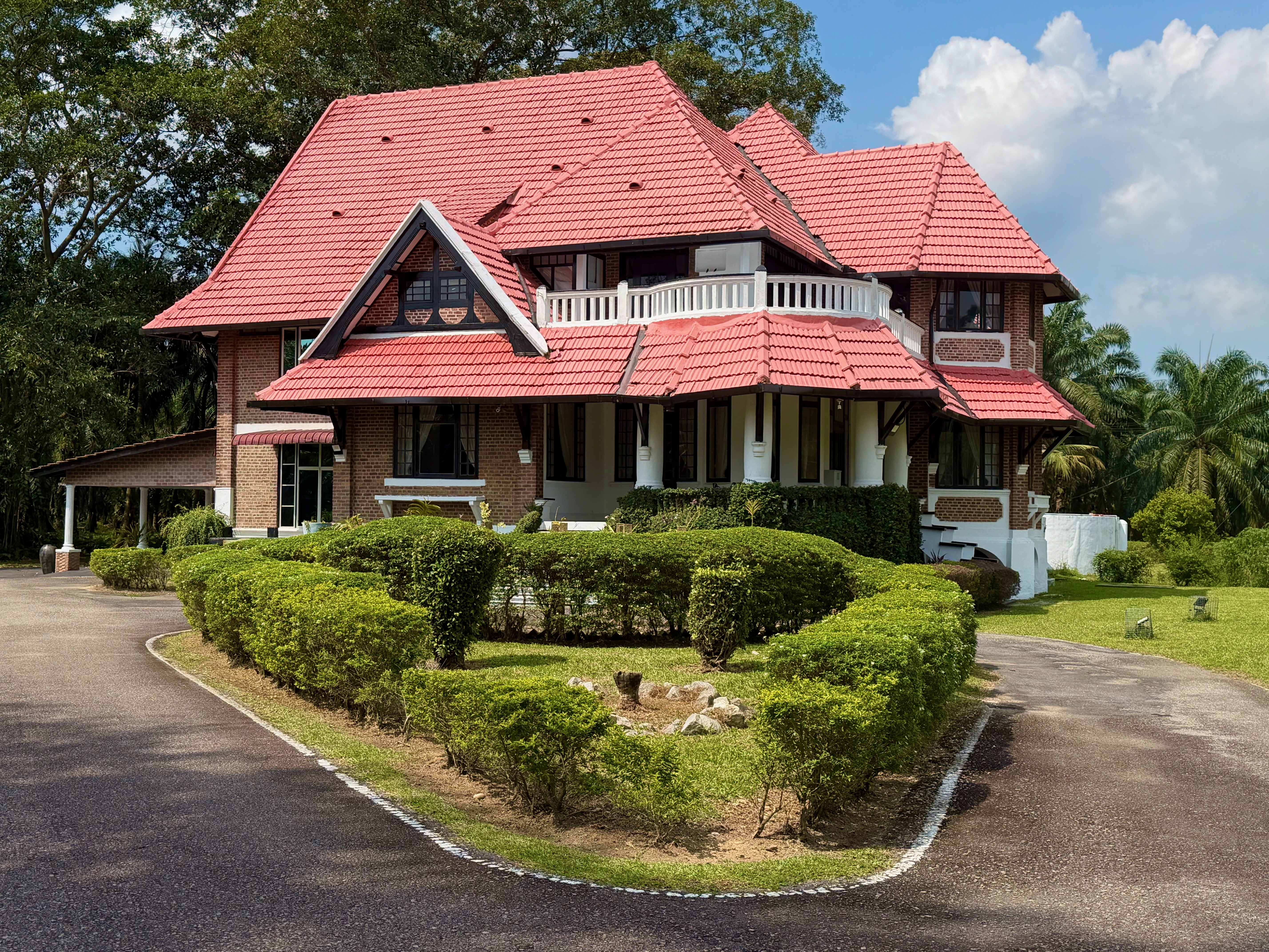
The Plantation Museum was temporarily closed, so we went to see Hatter’s Castle instead. Hatter’s Castle was built in 1922, and its design became the model for all hill station and plantation bungalows erected during the British colonial era in Malaya. The bungalow’s name was inspired by a novel of the same title by Scottish author A.J. Cronin.
I cycled on all three mornings while I was at Pulau Carey. I must say, it was very nice to end my rides with breakfast at The Mangrove instead of having to ride back to Rimbayu.
I look forward to staying at Pulau Carey again, preferably on the first Sunday of the month.
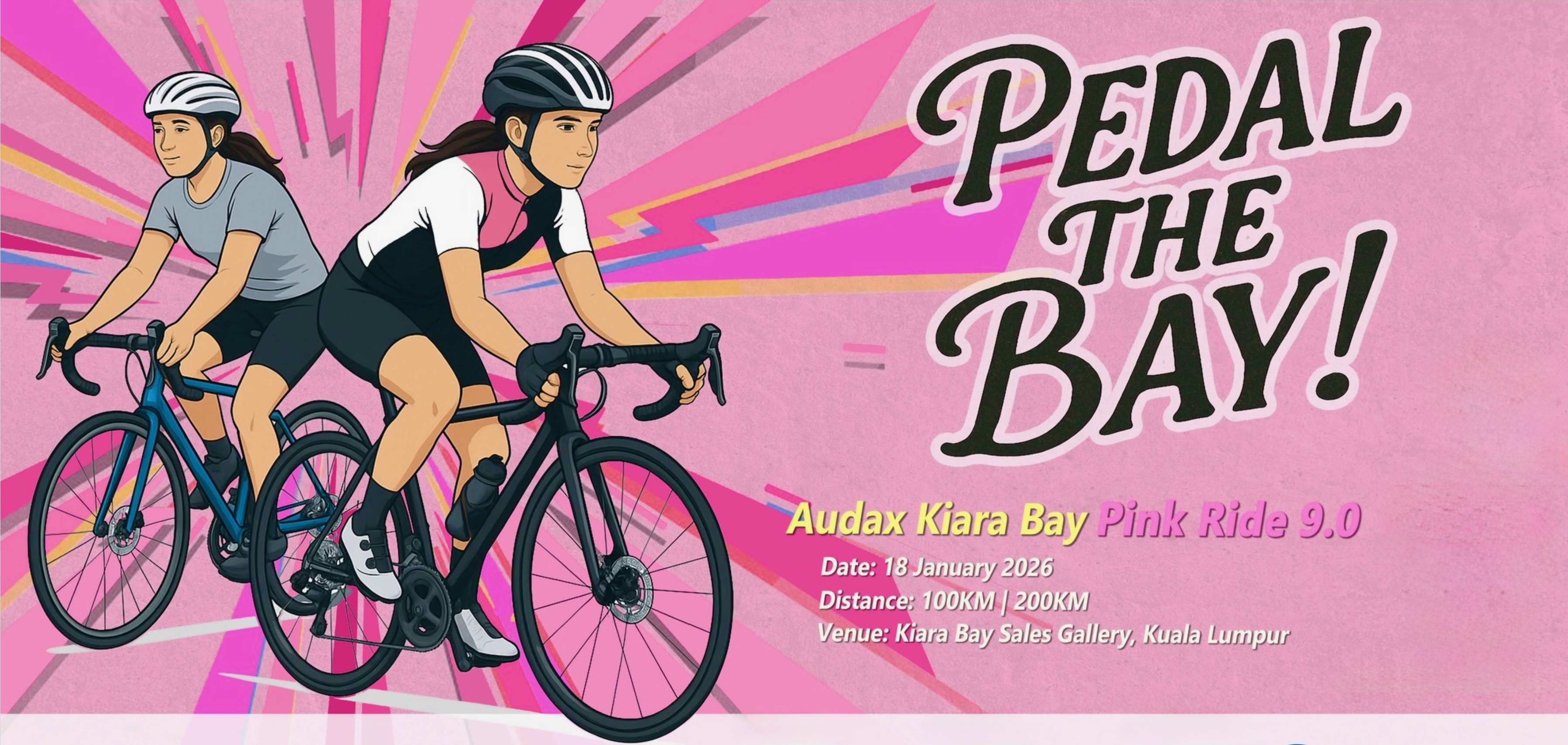
It is January. Which means there was a Pink Ride to participate in. The Pink Ride 9.0 was advertised as the first Audax ride in Kuala Lumpur. To be accurate, this was the first Audax ride to start in Kuala Lumpur. A route of Audax distance will necessarily take you outside Kuala Lumpur.
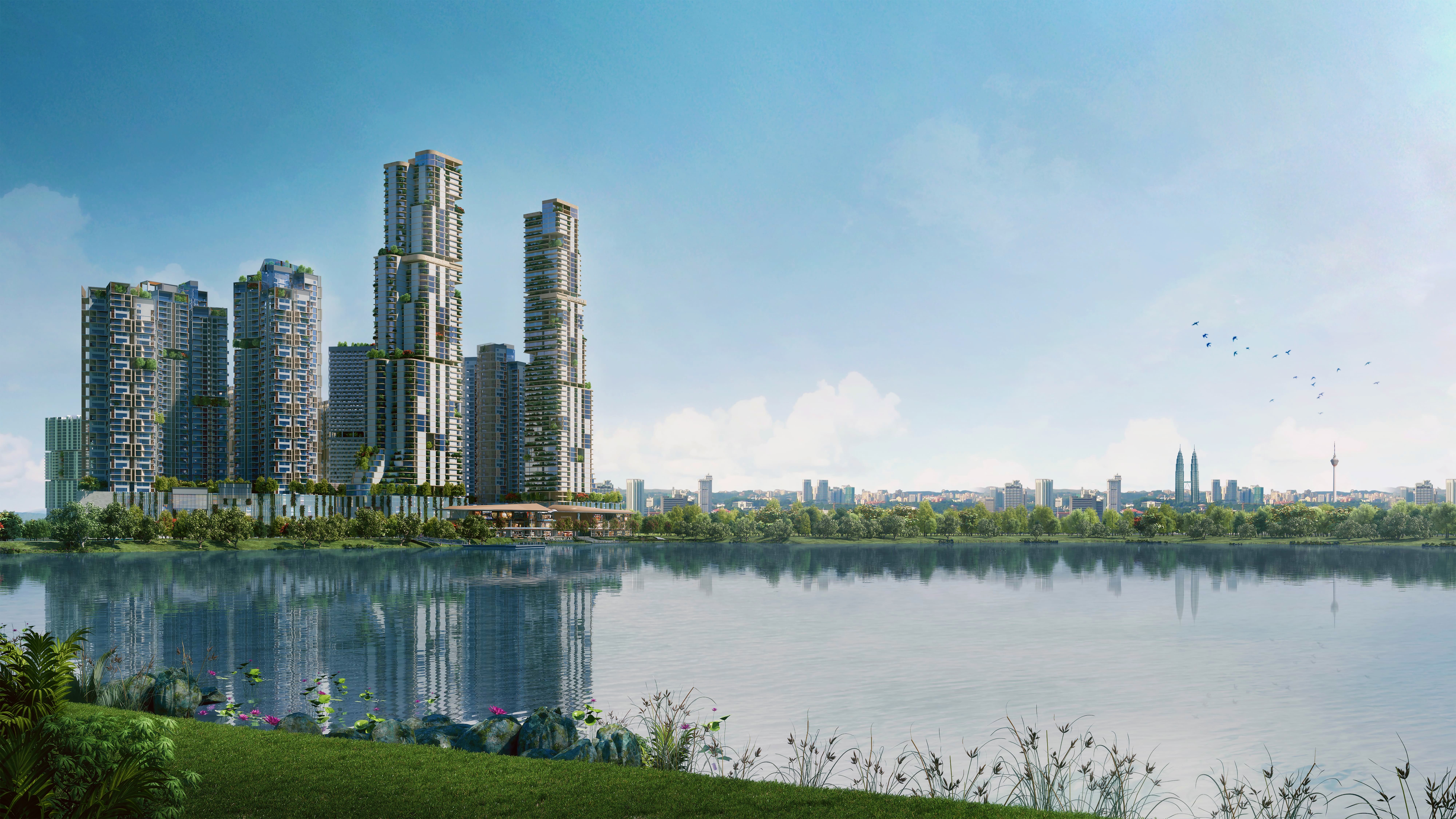
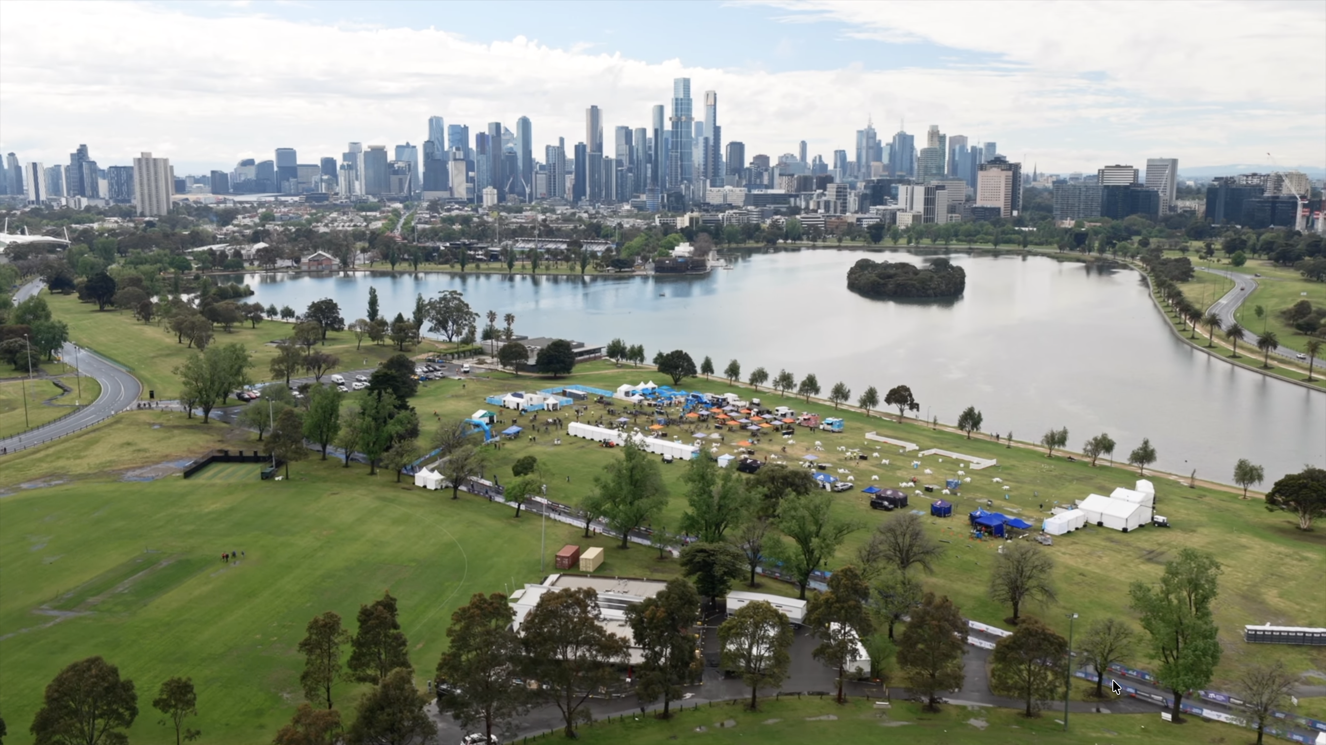
The Kiara Bay Sales Gallery is a 12 km drive from my home. So there was no need to find accommodation near the start. Kiara Bay township is located adjacent to the Kepong Metropolitan Park, which features a 141- acre lake. A scenic place to start an Audax ride from.
Photograph courtesy of uemsunrise.com
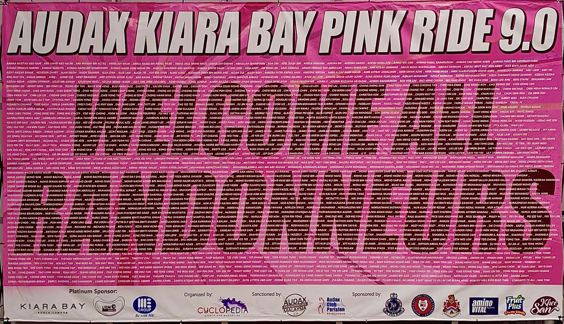
All participants had their names on this banner at the entrance to the Kiara Bay Sales Gallery.
Photograph courtesy of VV
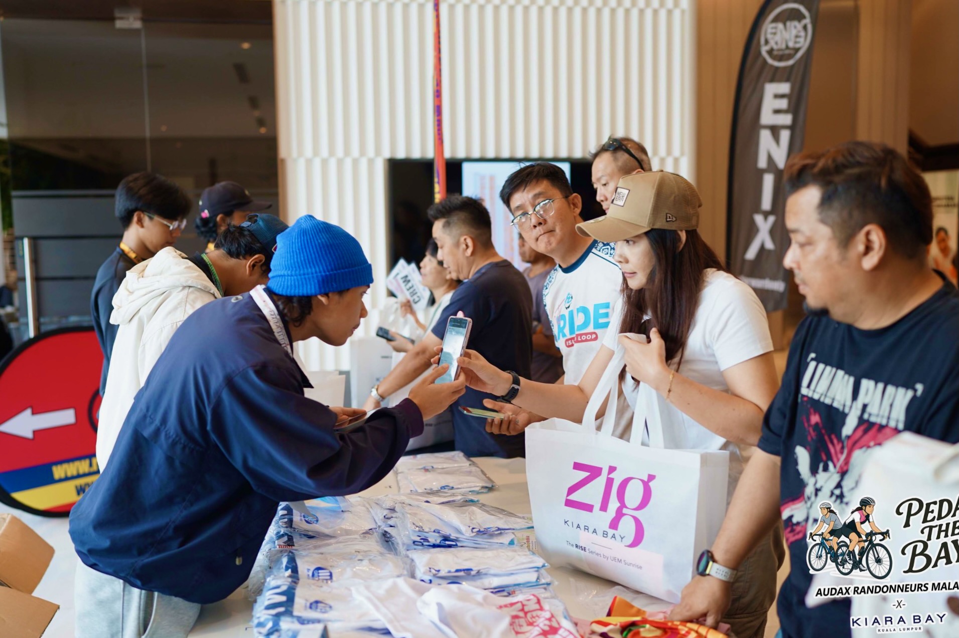
The pre-ride organisation was excellent, as always. Participants could collect their brevet cards at the Sales Gallery on the two days before the ride. I collected my brevet card on Thursday. The process was quick, helped in no small part by the use of QR codes to confirm what each participant was entitled to.
Photograph courtesy of audax malaysia.com
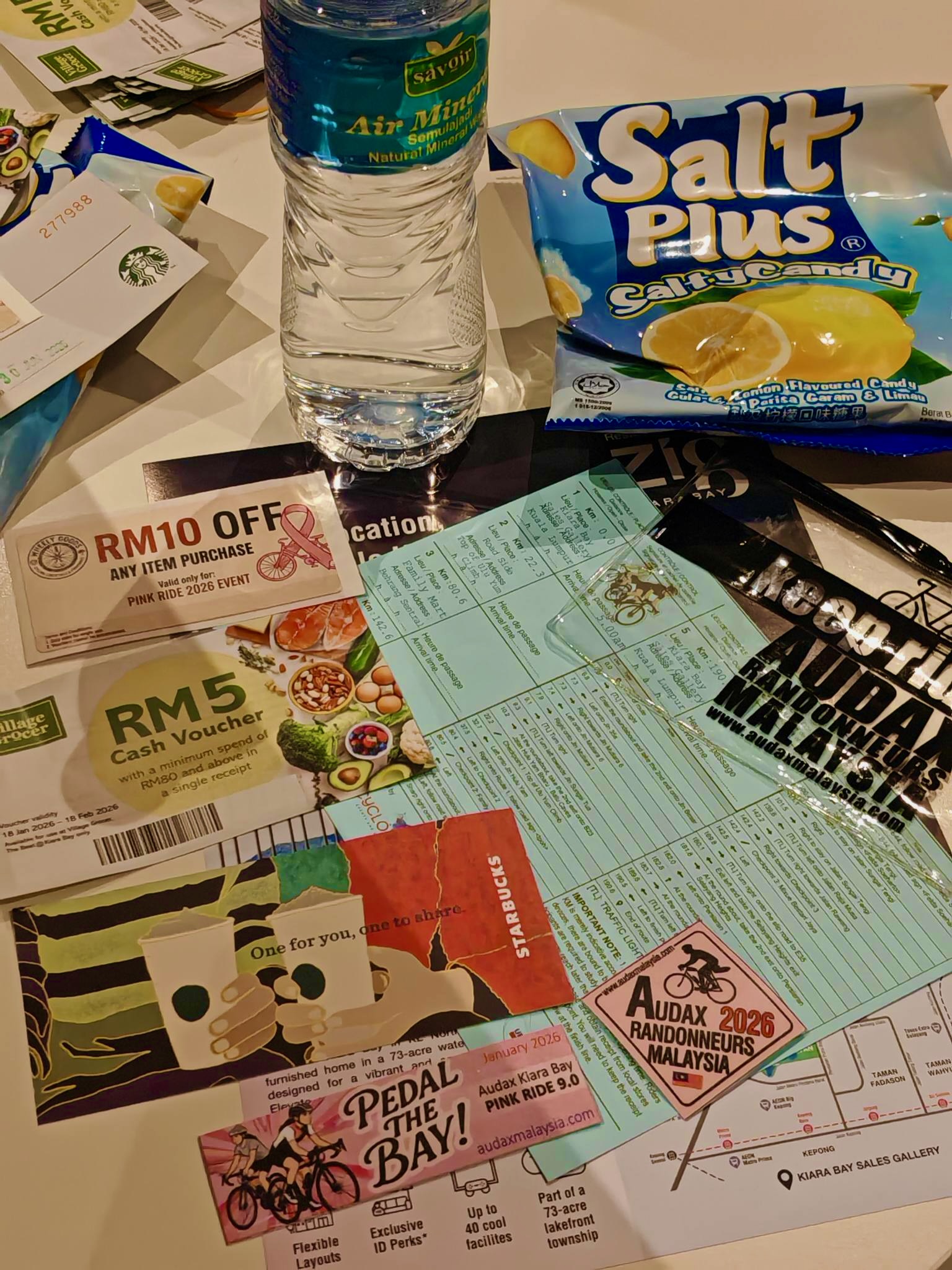
This time, there was quite a lot that came together with the brevet card. My favourite is the waterproof see-through wallet.
Photograph courtesy of audaxmalaysia.com
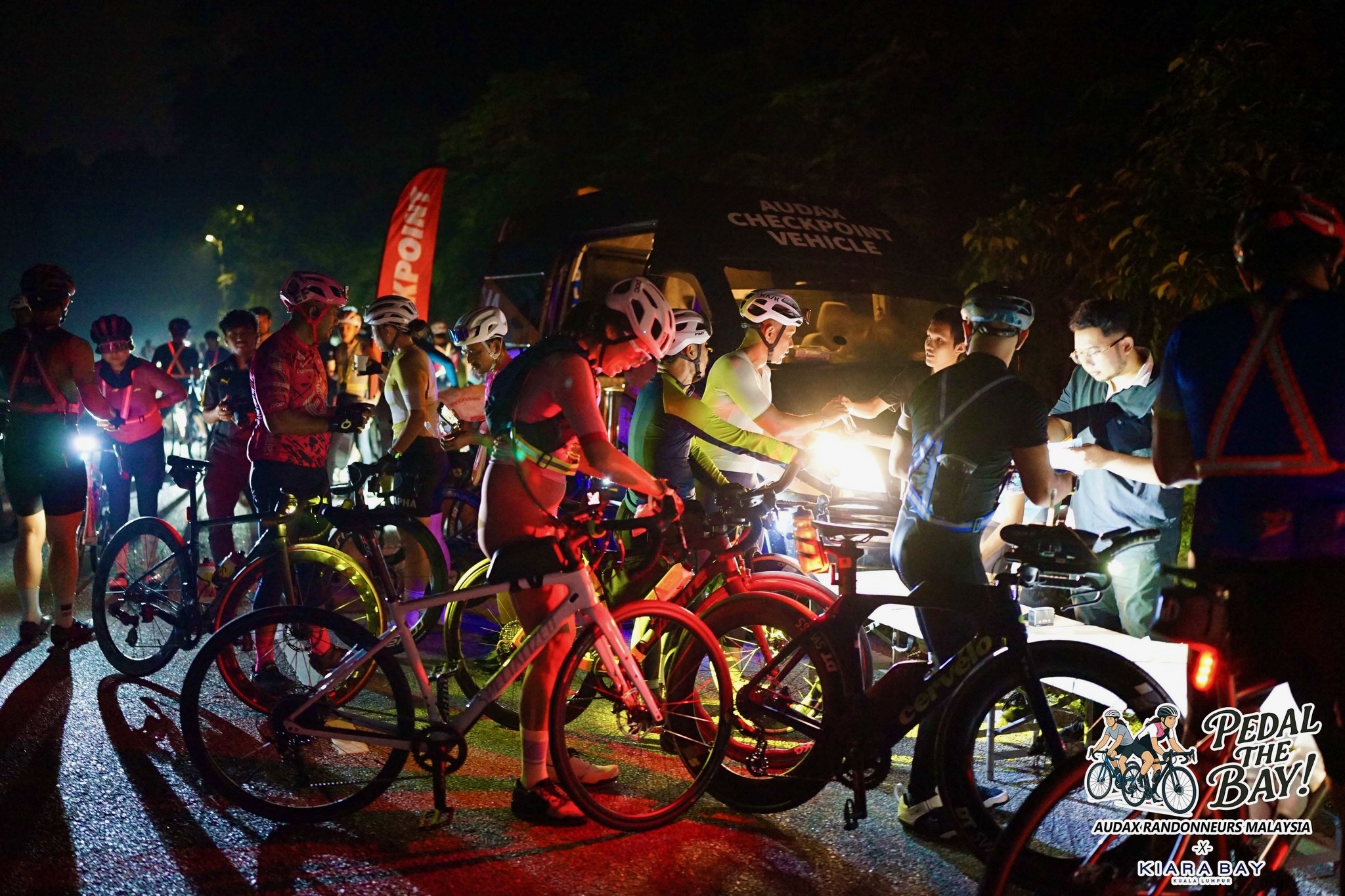
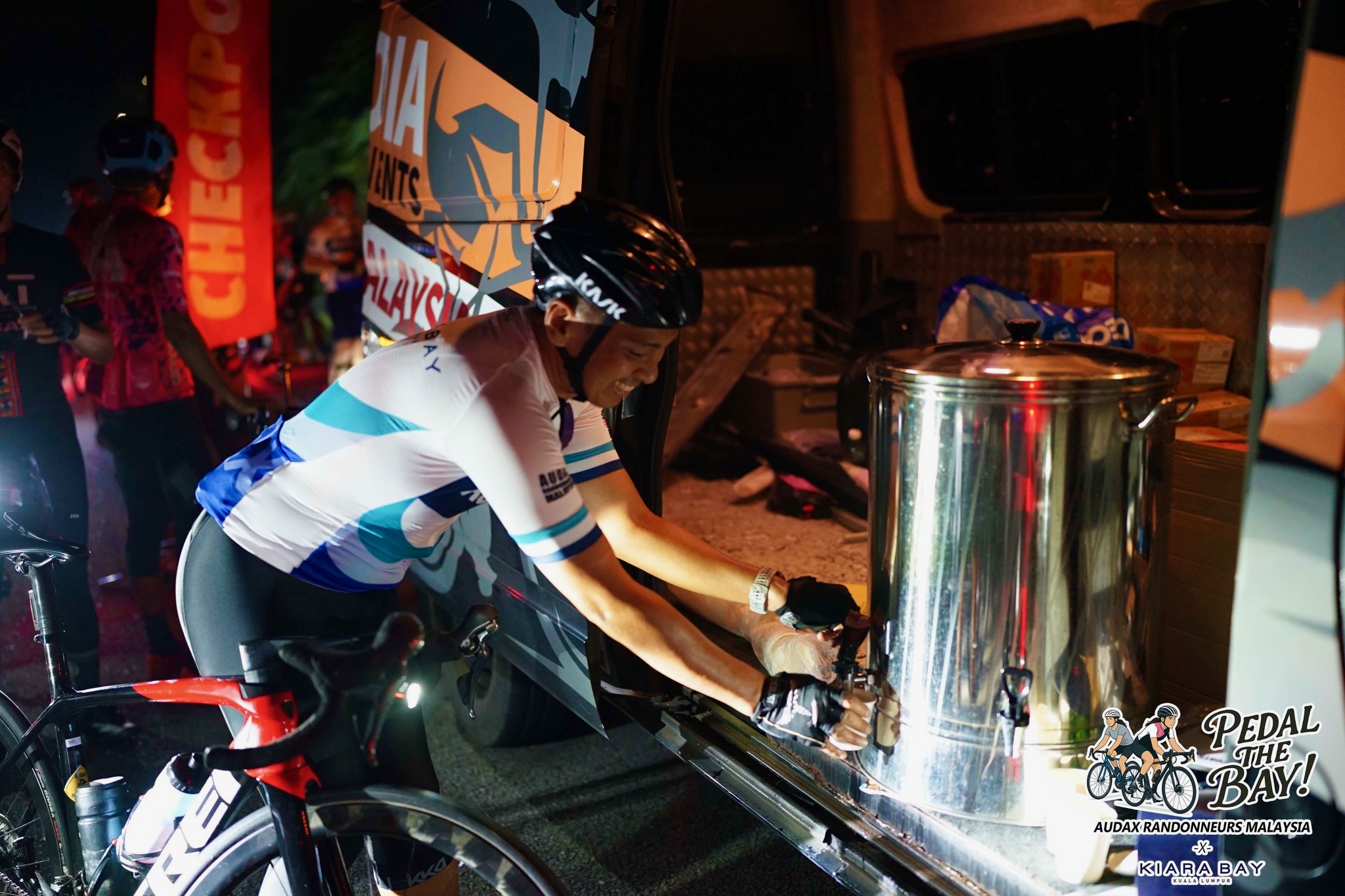
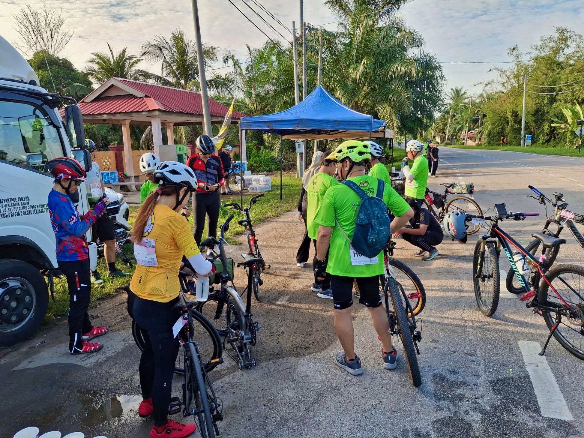
This Pink Ride was promoted as a good introduction to self-supported long-distance rides. A key provision was a Sweeper truck service. A first for an Audax Malaysia ride. An array of sponsors lined up to provide teh tarik, Mixue ice cream, AminoVital energy gels, and water at various points along the route.
The drive to attract new riders was successful. More than 1,000 cyclists were expected to start on Sunday morning. I was pleased to have a reserved parking spot in front of the Kiara Bay Sales Gallery for myself and two of my ride companions, courtesy of a friend in high places at UEM Sunrise.
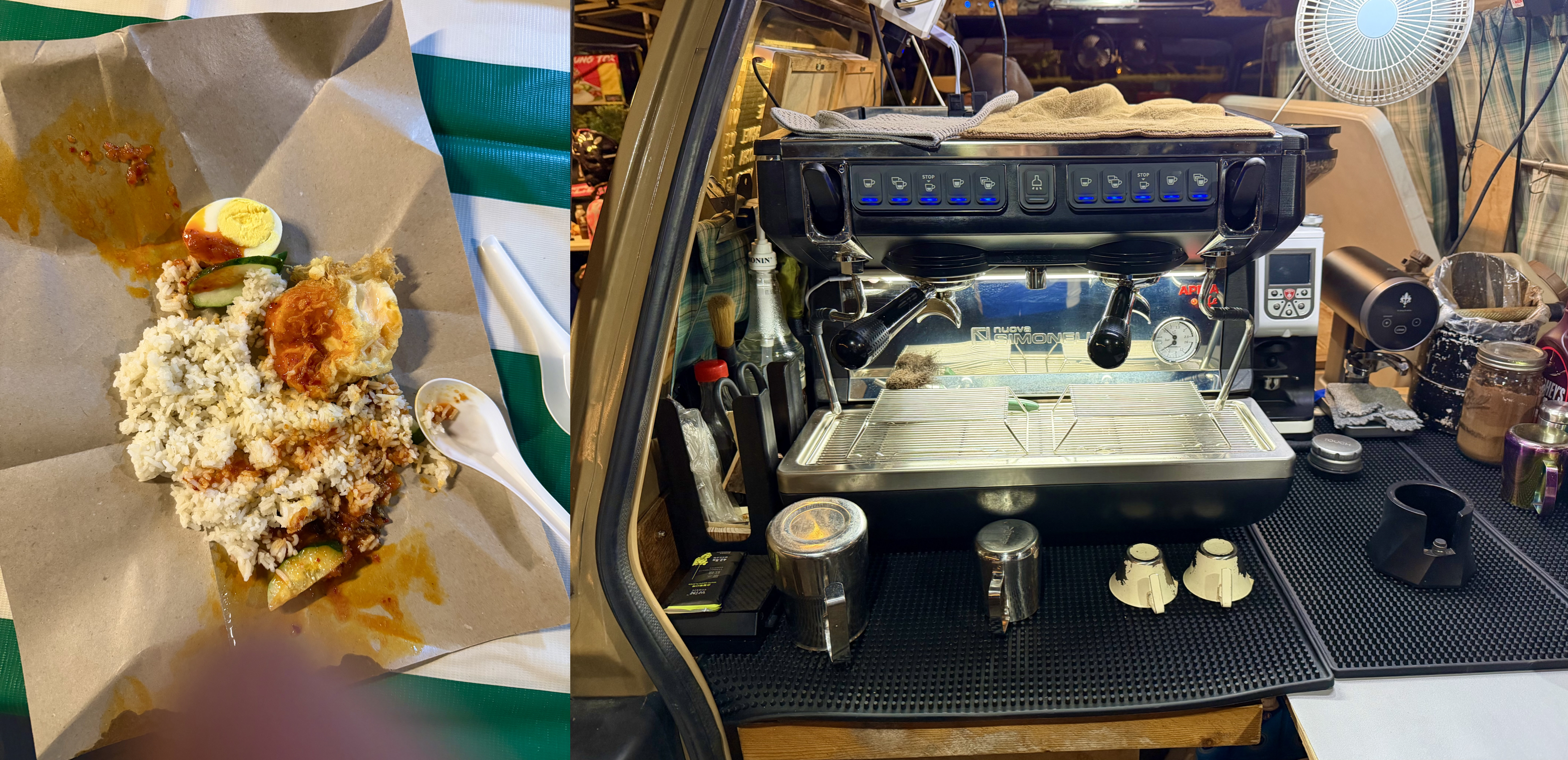
V and I arrived at about 4:15 am. We were pleasantly surprised to see a nasi lemak stall and a coffee van already open for business. Breakfast sorted!
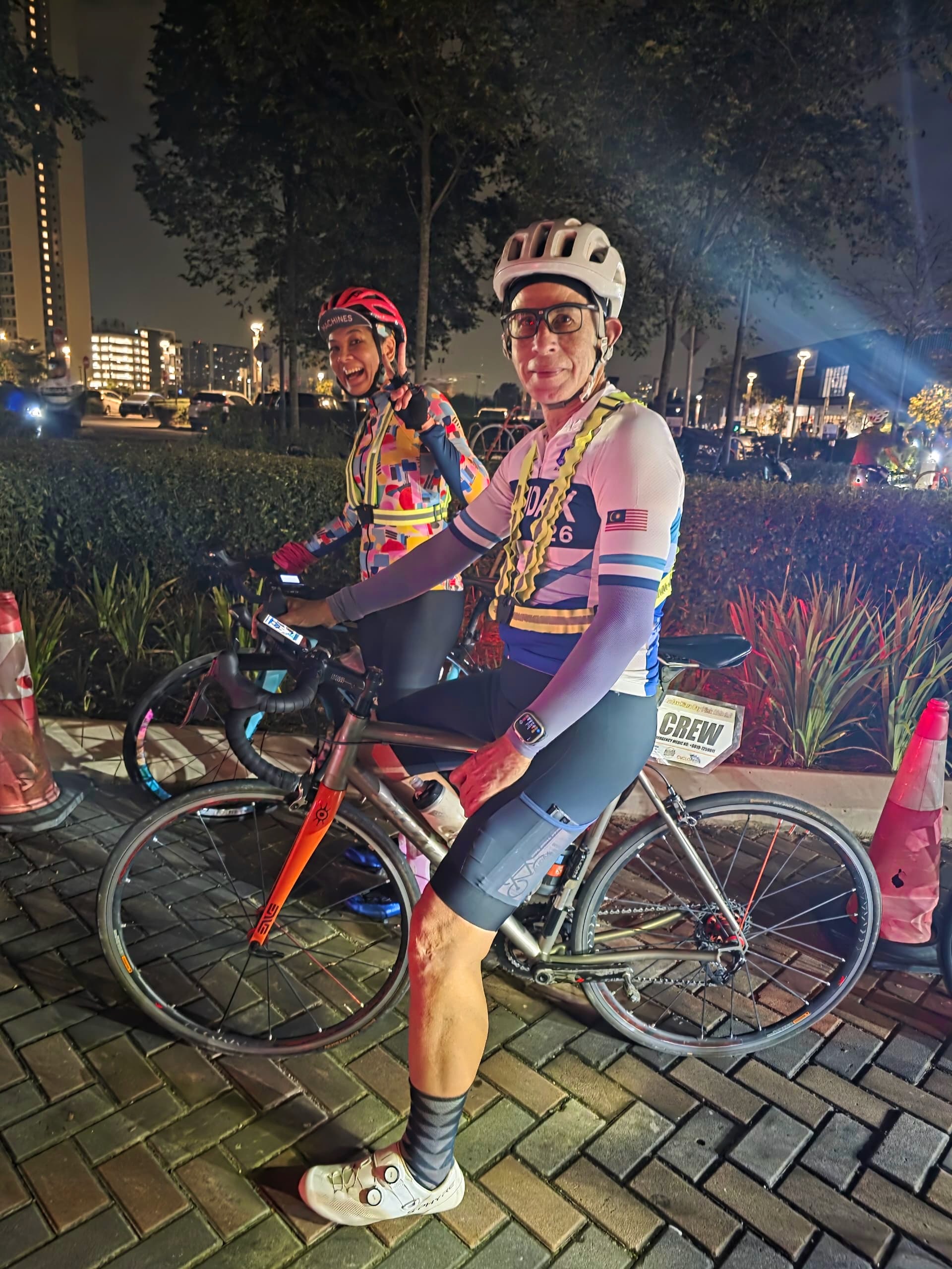
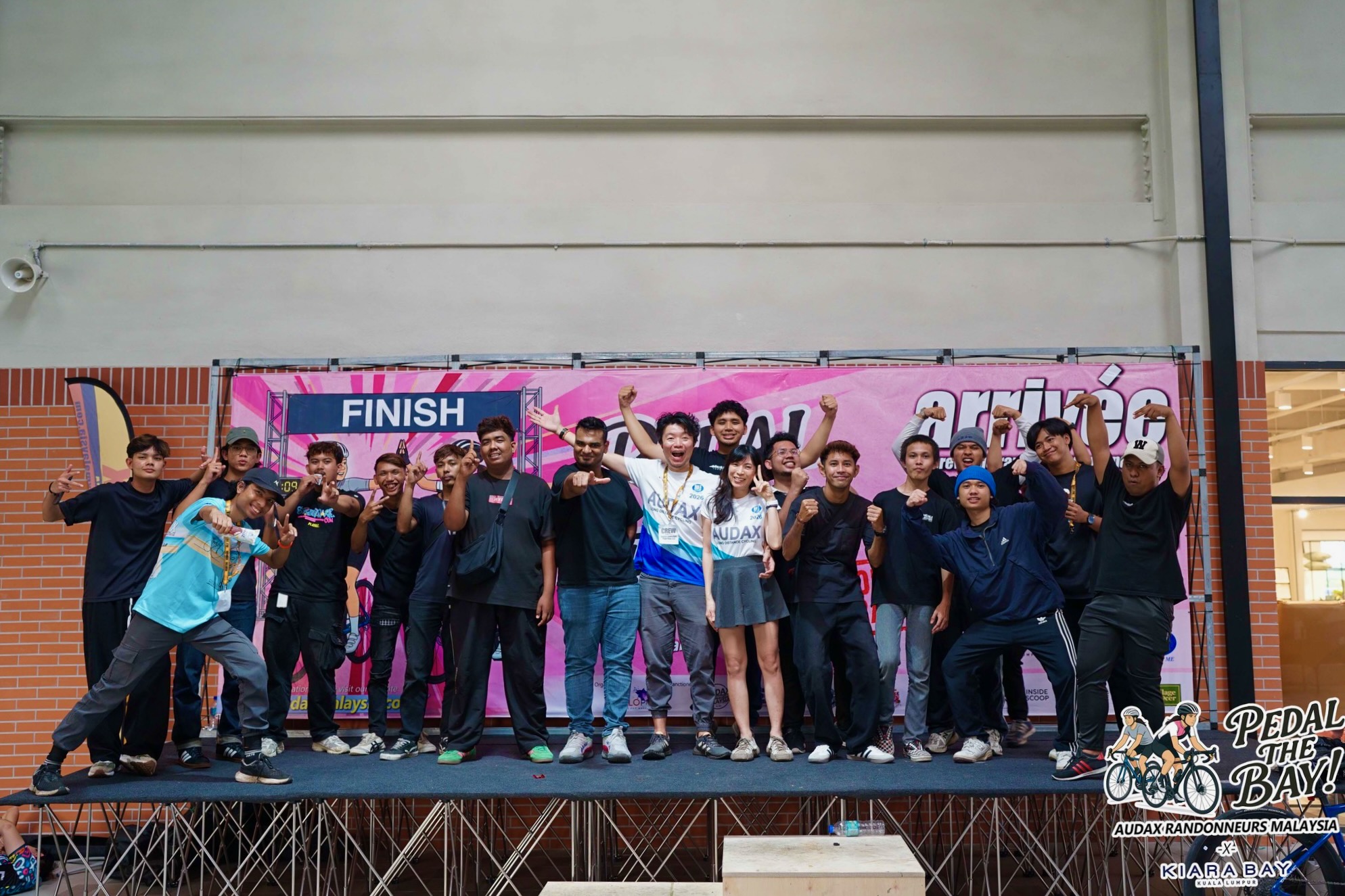
Our group of four were set up for a good day as the 5:00 am start time for our 100 km ride neared.
Photograph courtesy of KSC
Riders who volunteered to guide and support first-time Audax cyclists had a Crew tag. I must admit I forgot I had a Crew tag on my bike, and was a bit surprised at the number of questions I was asked during the ride.
Most of the questions came after Checkpoint 1 from riders who weren’t sure that they were heading in the right direction.
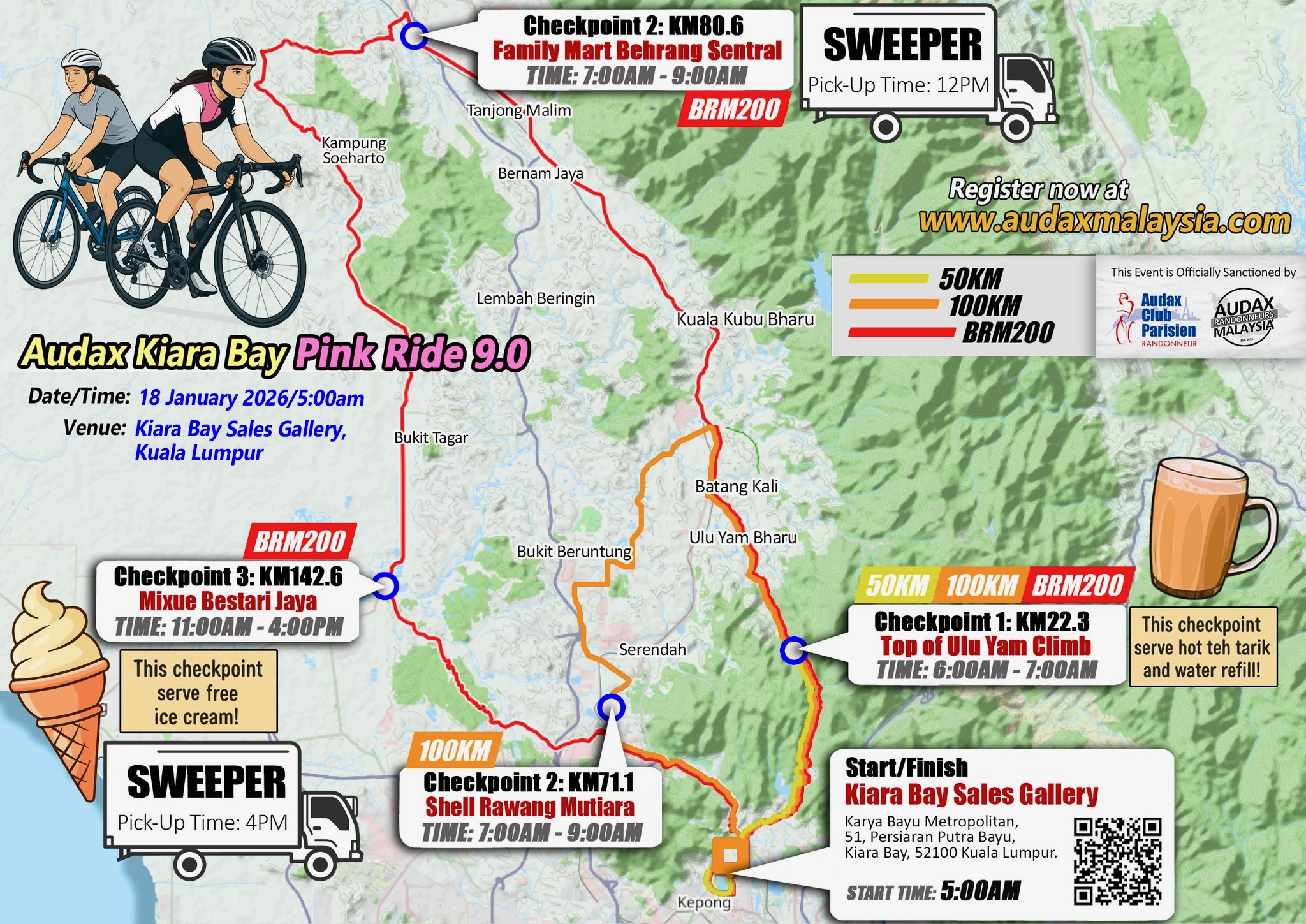
Map courtesy of audaxmalaysia.com
Getting to Checkpoint 1 was a challenge. A short steep hill from KM 10.6 to KM 11.8 at an average grade of 8.6% was followed by a longer slope from KM 15.4 to Checkpoint 1 at KM 22.3 at an average grade of 4.5%. Those two climbs represent 400 metres of elevation.
That came as a shock to some who had to surrender to the grade and walk their way to Checkpoint 1.
Photograph courtesy of audax malaysia.com
The payoff at the top was the free flow of sweet teh tarik.
Photograph courtesy of audax malaysia.com
Checkpoint 1 was where the 50 km participants turned around. This edition of the Pink Ride is the first to offer a 50 km distance for those making an initial foray into the world of Audax rides. Some of the online comments after the ride were that the elevation made this a tough introduction to Audax rides. In reality, the total elevation for this year’s 94 km route isn’t much different from the total elevation for the similarly long routes in 2025 and 2024.
Year
Distance
Total Elevation
2026
94 km
984 m
2025
111 km
989 m
2024
121 km
954 m
There is no doubt, though, that front-loading 41% of the total elevation into the first quarter of this year’s route made it a difficult start.
Fellow R@SKL W was at Checkpoint 1 when we got there. We were a group of five as we made the 17 km descent down the opposite side of the Ulu Yam climb. There was very little traffic, and the road is relatively straight. Those are usually an invitation for a high-speed descent. The road is mostly unlit, though, so I deferred to a sense of self-preservation and stayed on the brakes.
Our next stop was at the Petron petrol station at Rasa. That was 42.7 km into the ride. The konbini (convenience store) at that station is a FamilyMart, a major Japanese convenience store chain. We loaded up on sushi, tamago sandoicchi (egg sandwiches) and pesutori (pastries).
Photograph courtesy of VV
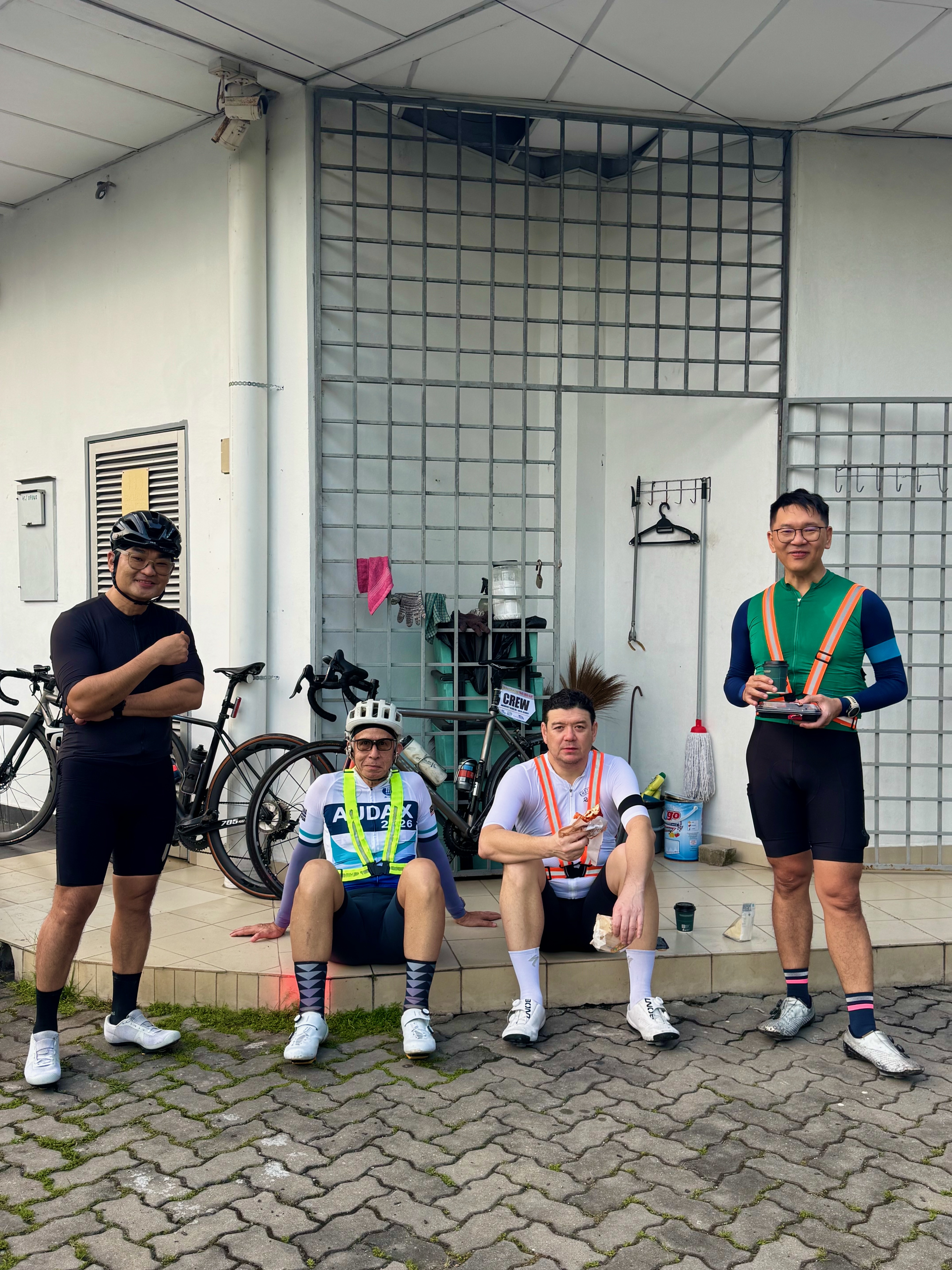
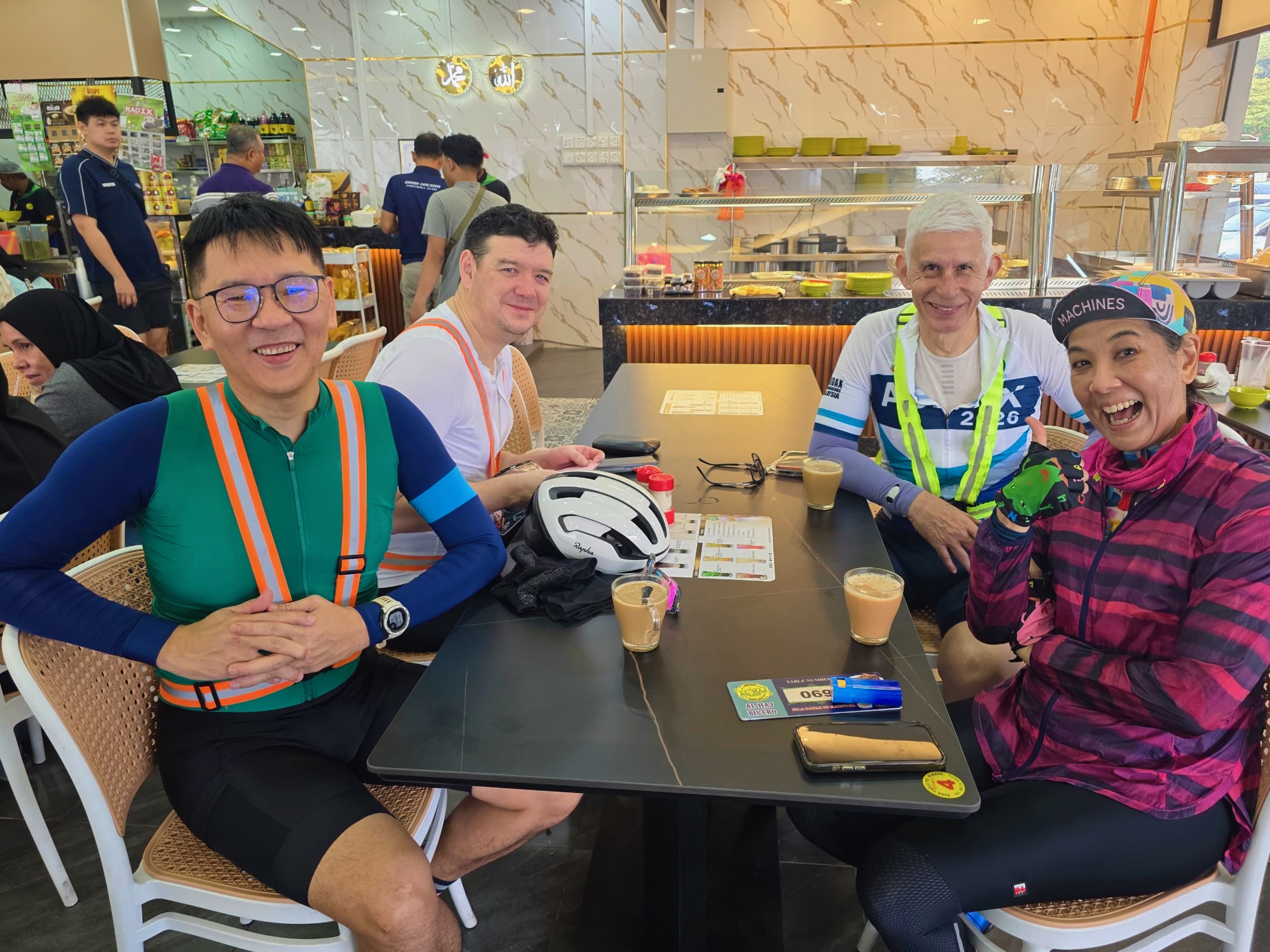
Back on the road again, VV and I fell behind D, KS and W as we rode toward Bandar Bukit Beruntung. Twenty minutes later, we caught up with D and KS, who were waiting for us at the right turn at KM 55. W was well ahead, and we didn’t see him again.
We stopped a couple of kilometres later at Restoran Al Haj Bistro for a coffee or a teh tarik.
Photograph courtesy of KSC
From Al Haj Bistro, it was 15 km to Checkpoint 2 at the Shell Rawang Mutiara petrol station. After getting our brevet cards stamped, KS suggested that we stop in Rawang, 5 km away, for curry mee. We passed through Rawang without spotting the curry mee restaurant, so we kept moving.
It was 30ºC (86ºF) and rising as we cycled the last 17 km to the finish. I was thankful that I had not opted for the 200 km route. Some 200 km riders reported temperatures north of 38ºC (100ºF) during their ride.
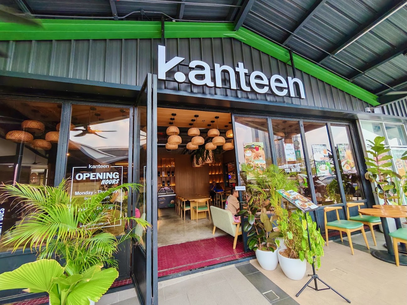
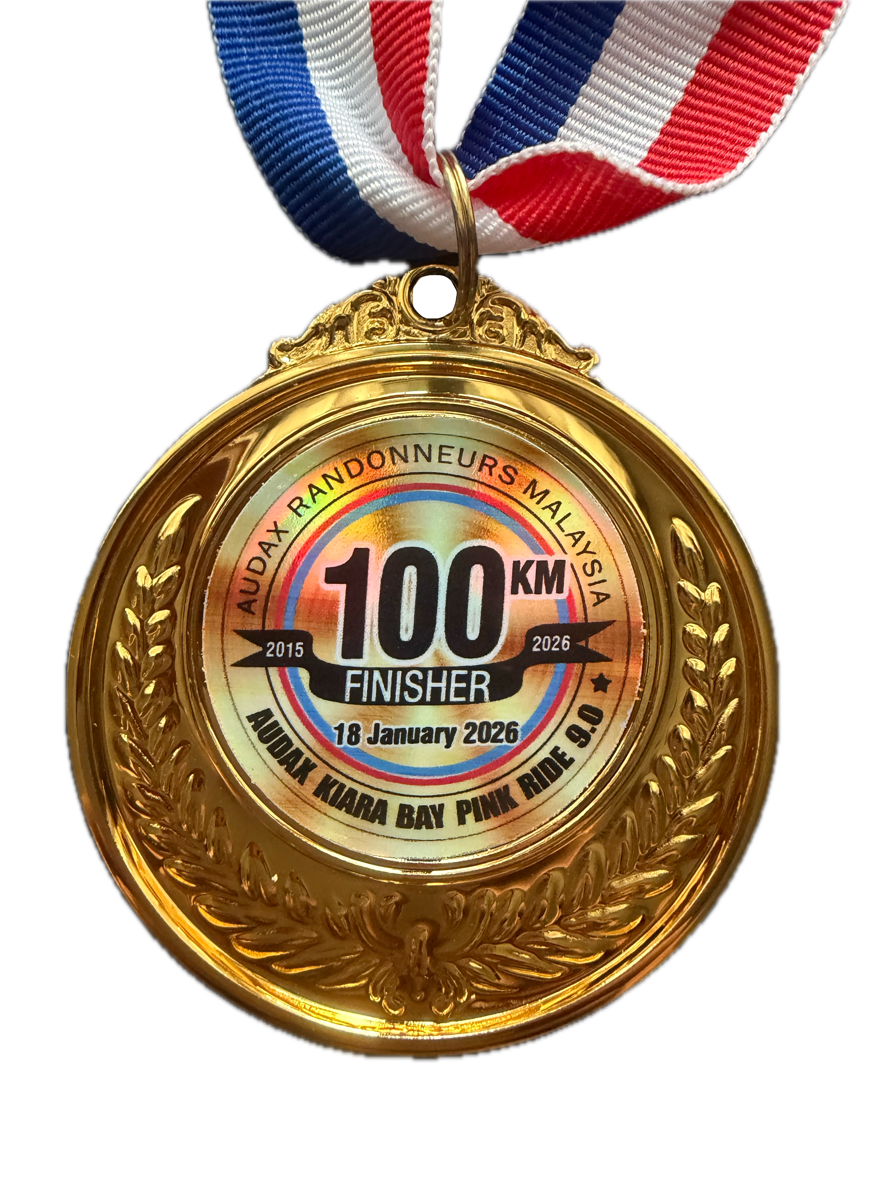
We took refuge in the air-conditioned Sales Gallery after getting our brevet cards stamped and collecting our finisher’s medals. Once we had cooled down, we walked to Kanteen for lunch. A very nice end to the morning.
Photograph courtesy of google.com
Kudos to Sam and his support crew for organizing yet another enjoyable Audax ride. 👏🏼👏🏼 👏🏼👏🏼👏🏼👏🏼They cannot control the weather, but everything within their control was very well managed and run.
That is another Pink Ride done. As tends to be the case these days after rides like this, the initial sense is one of achievement, together with doubt that we will do it again next year. We’ll see what the mood is like come December.
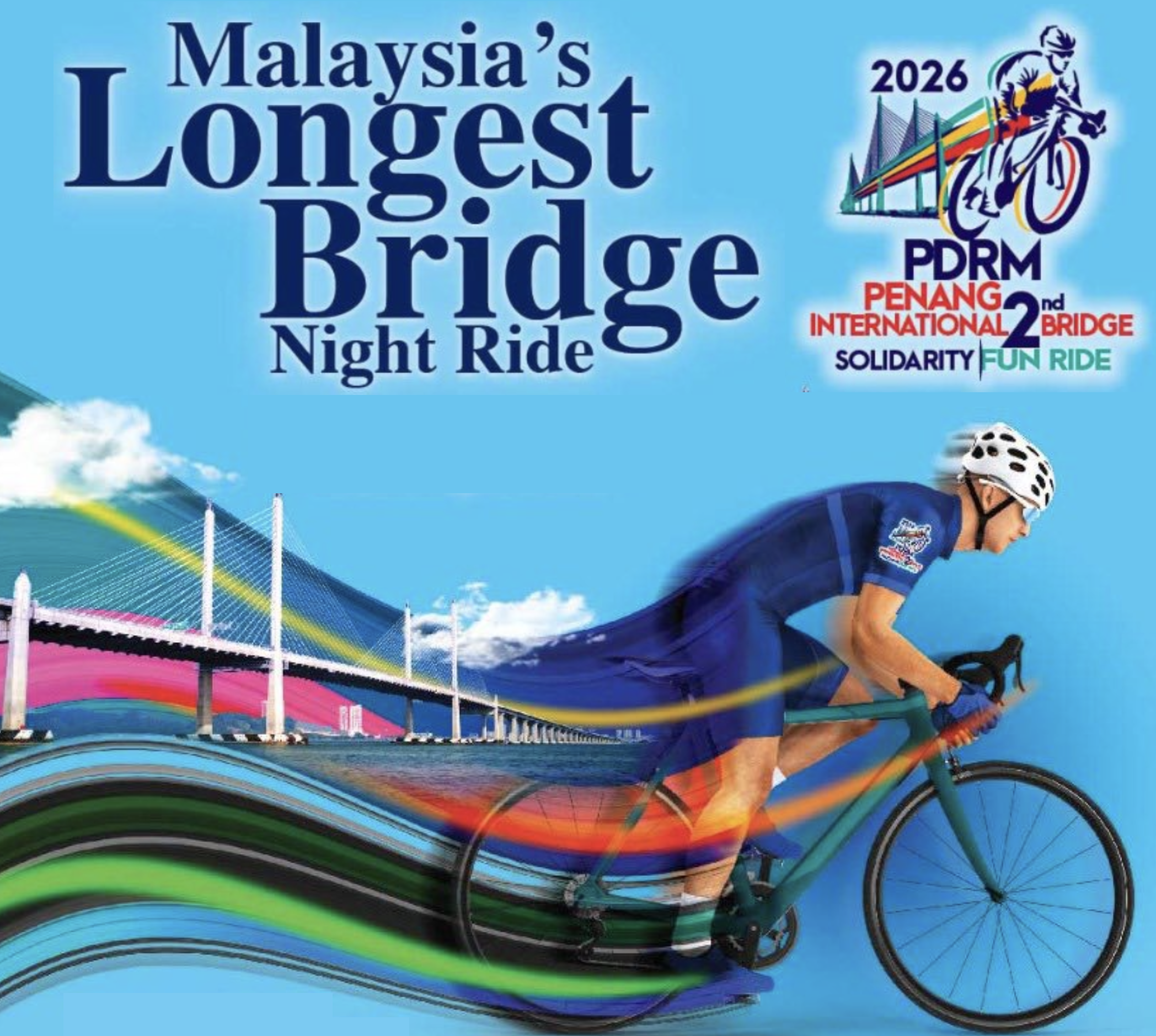
The Penang Second Bridge, formally named the Sultan Abdul Halim Muadzam Shah Bridge, was opened on March 1st, 2014. It is 24 km long, with 16.9 km of the structure crossing over water. This bridge was built to ease traffic congestion on the Penang Bridge, which opened in 1985.
Graphic courtesy of GoSportz
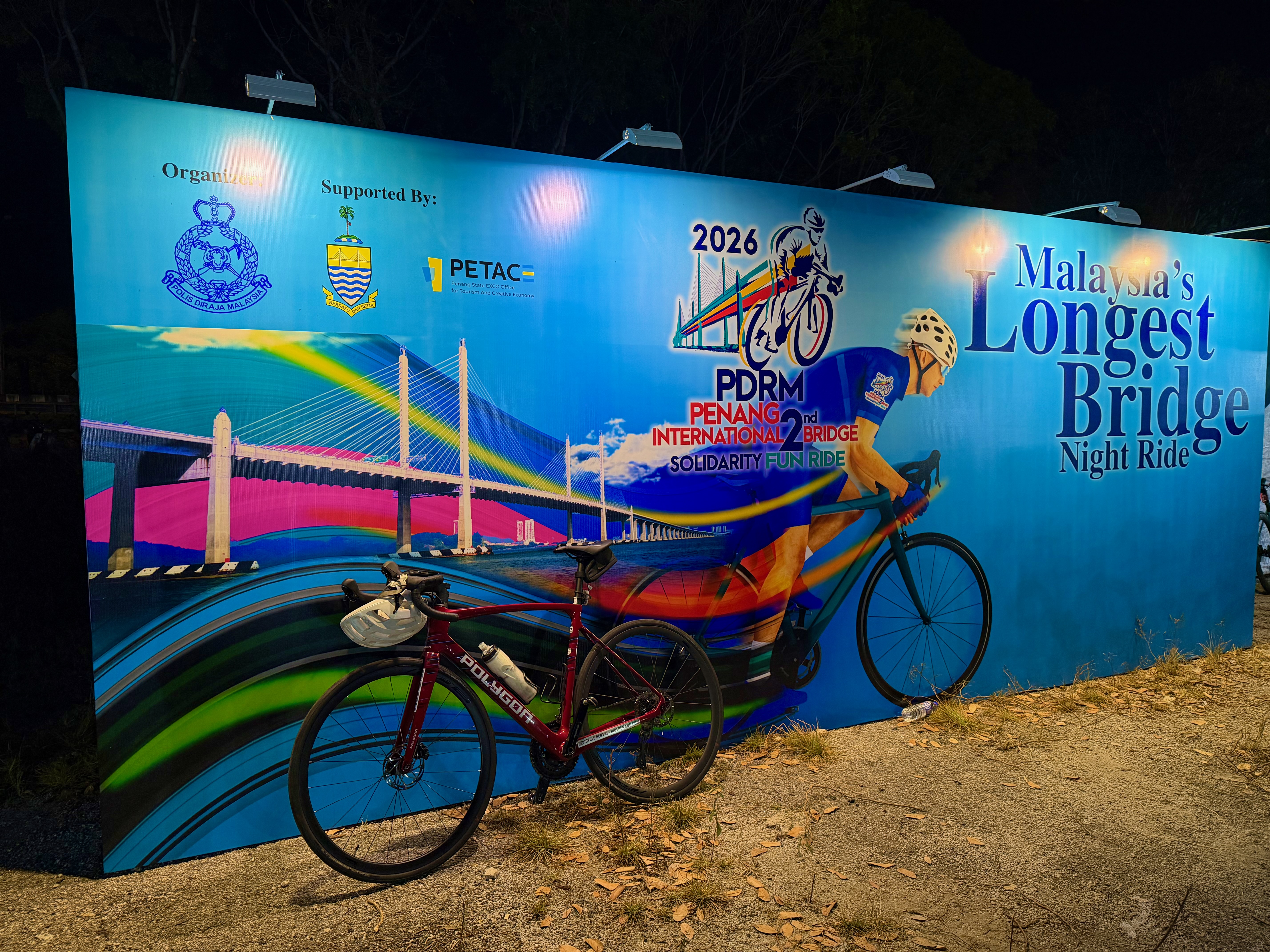
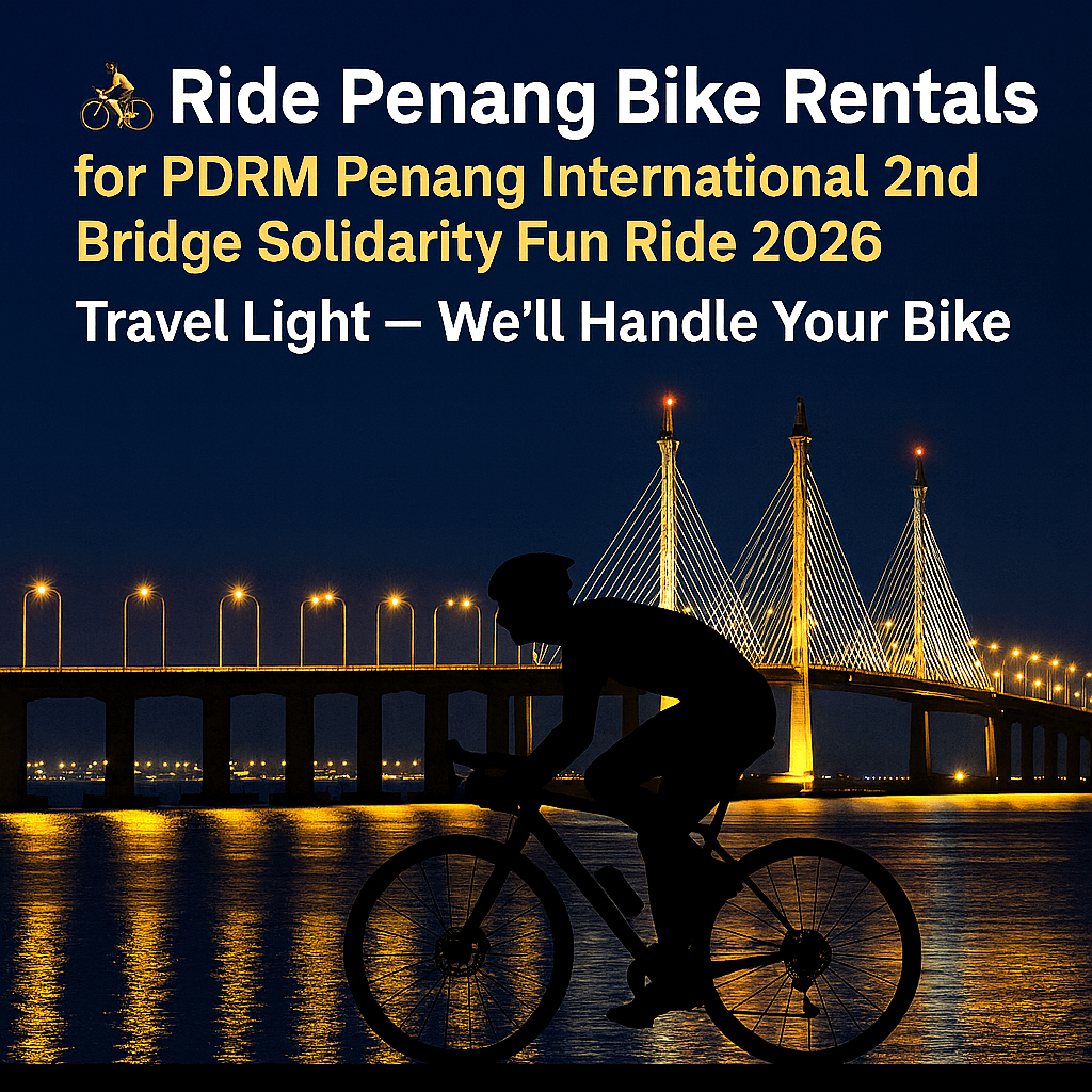
The Polis Diraja Malaysia (PDRM) or Royal Malaysia Police in Penang organize an annual ride across the Penang Second Bridge as community outreach programme. The event offers participants a unique opportunity to cycle on the fully closed Penang Second Bridge at night, an experience not typically available. The 2026 edition marks the event’s sixth run.
I registered for this ride in September 2005. As soon as I paid my entry fee, I started looking for a hotel. Penang is an extremely popular holiday destination over the Christmas and New Year period. Leave it too late and a hotel room, especially one close to the ride start point, would be hard to find.
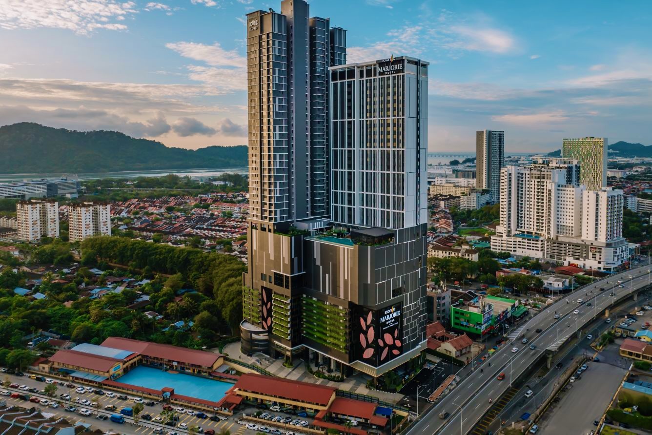
The ride would start at the Queensbay Mall. The Iconic Marjorie Hotel is a 2 km ride from the Queensbay Mall. The mall is visible on the left side of the photograph, just below the hills in the background.
Photograph courtesy of marriott.com
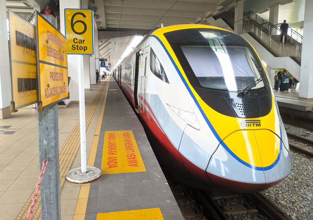
Booking return tickets on the Electric Train Service (ETS) from KL Sentral station to Butterworth was next. My Biker Chick and I decided against driving. The traffic back to Kuala Lumpur on the Sunday after the New Year was sure to be horrendous.
Photograph courtesy of urbanistwandred.com
The downside of taking the ETS is the hassle of transporting a bicycle. Baggage storage on the ETS is limited, but I would be able to get my Ritchey Break-Away, in its hard case, onto the train. That would be the first challenge. The next would be in Butterworth, where I would have to wheel and carry the case from the train station to the ferry port and then onto a ferry. Finally I would have to find a taxi or a Grab car big enough for the case to fit into.
That hassle would be worth it given that the ETS ride from Kuala Lumpur to Butterworth is a relaxing three and a half hour journey. Complete with a meal and an in-seat screen with internet access. As compared to a stressful drive of possibly seven hours or more.
All concerns about transporting my bike evaporated when I saw the Ride Penang webpage. I stumbled upon it by chance, and I am so glad that I did. I didn’t have to think about it for long before I booked a road bike and paid for delivery to the Iconic Marjorie Hotel and for pick-up after the event.
Logo courtesy of ridepenang.com
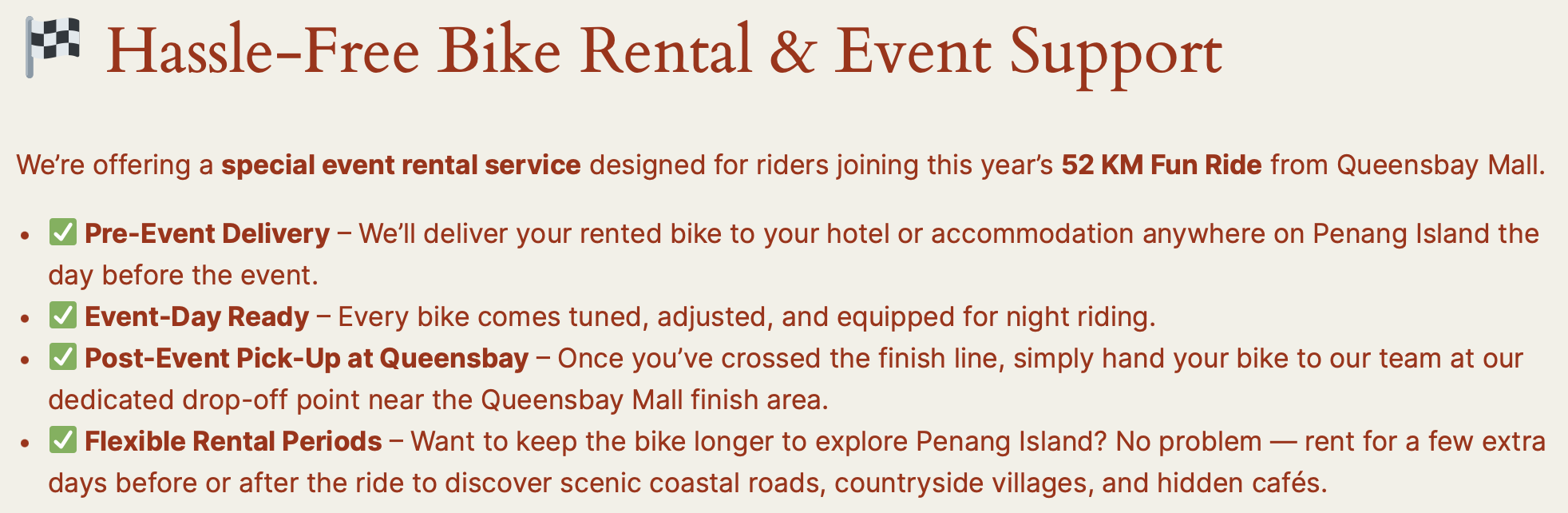
The experience the PDRM Penang has gained from organizing five previous Second Penang Bridge rides was evident from the moment regular updates about this year’s event started appearing on Facebook. Announcements about the programme for the day, where to park, how to qualify for a finisher’s medal and the Lucky Draw, etc. was frequent and thorough.
Unlike other events where ride pack collection was possible on just one day, ride pack collection was available on the three days prior to this ride. The collection itself was very efficient. I was impressed with the personalized bib numbers.
Graphic courtesy of GoSportz Event
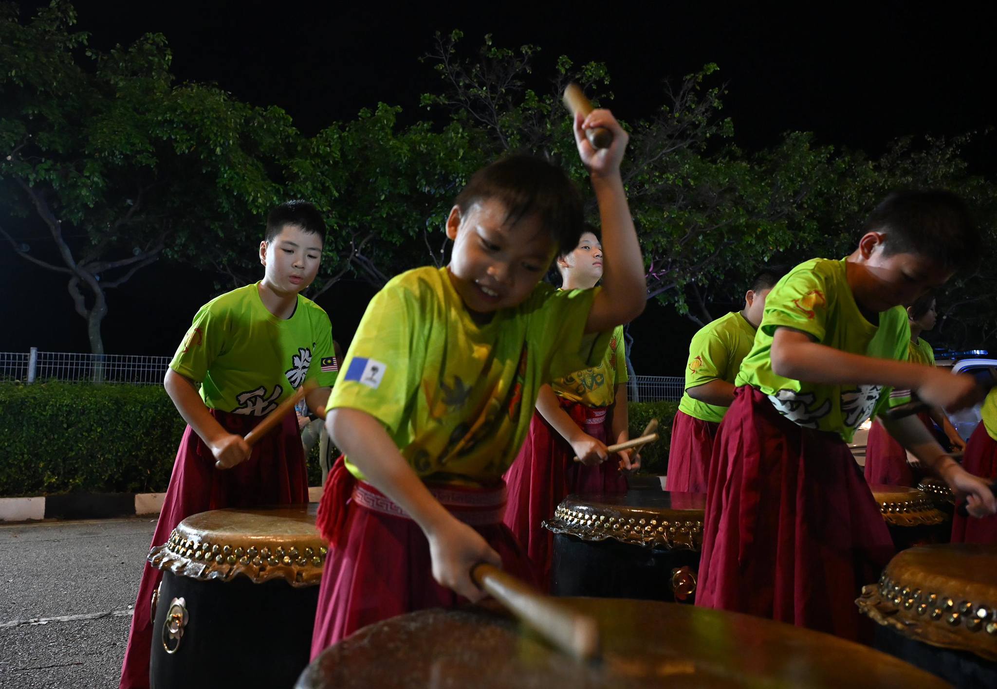
Some 2,500 participants from 17 countries gathered at the Queensbay Mall for the 9:30 pm start on Saturday 3rd January 2026.
While waiting we were entertained by the PDRM Penang Band and a group of young drummers.
Photograph courtesy of PDRM Pulau PinangPhotograph courtesy of Chon Kon Yeow
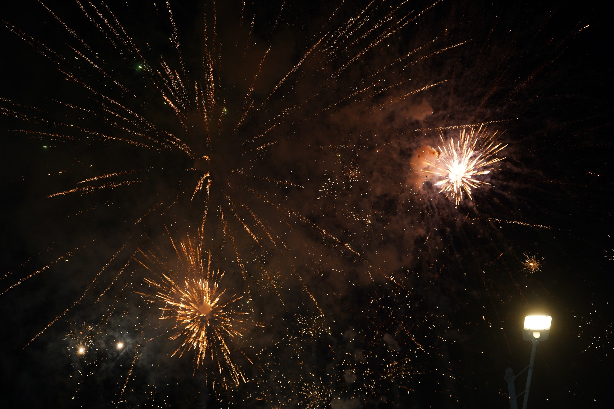
We were on our way ten minutes early, under a fireworks-lit sky, led by a group of VIPs that included the Governor of Penang, the Penang Chief Minister, the Penang Police Chief, the Deputy Inspector-General of Police and the Raja Muda of Kedah, underscoring the event’s significance.
Photograph courtesy of GoSportz Event
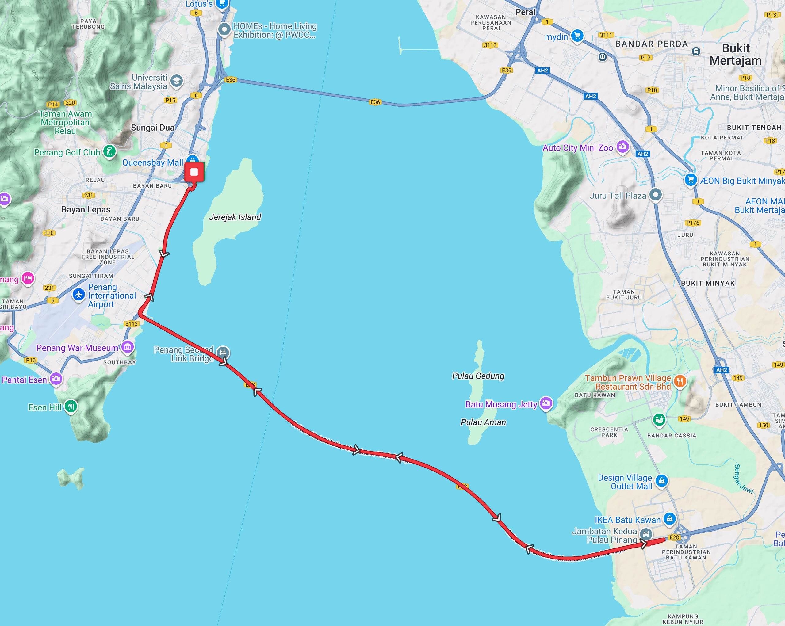
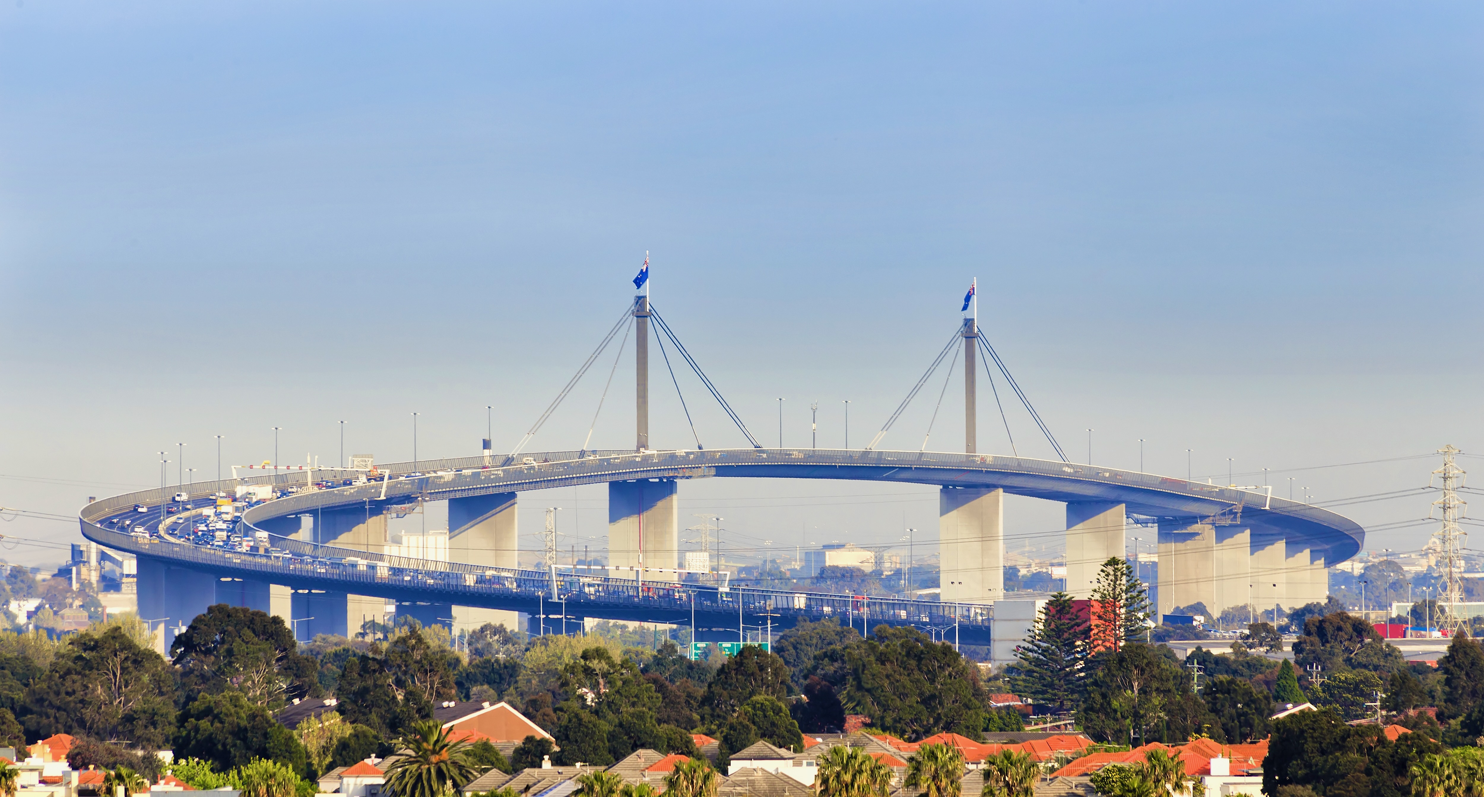
The route ran south from the Queensbay Mall for 4.5 km before the 90 degree left turn onto the ramp to the Sultan Abdul Halim Muadzam Shah Bridge.
Map courtesy of ridewithgps.com
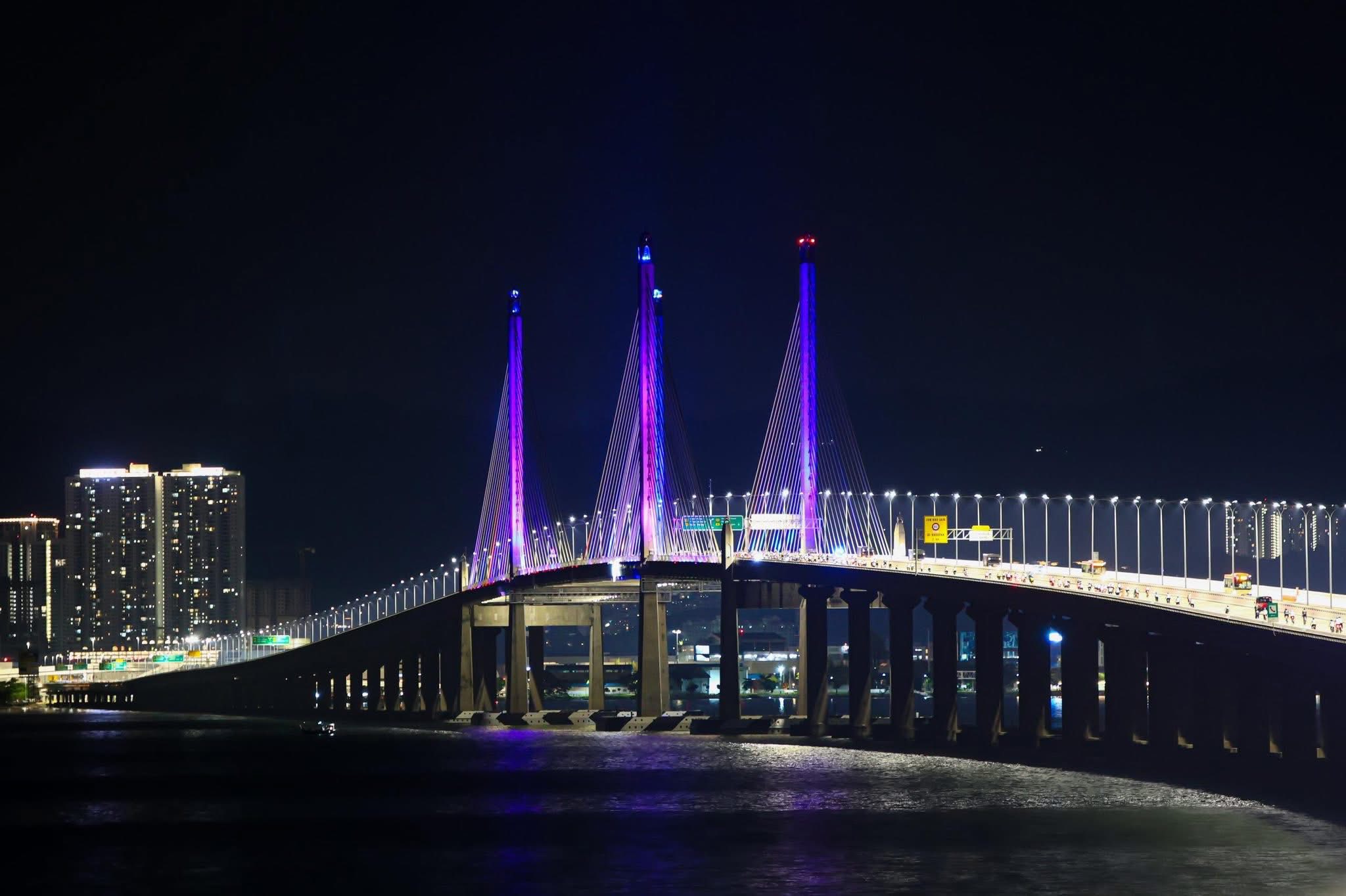
The 240 metre cable-stayed main section featuring twin H-shaped pylons is on the island side of the bridge.
Photograph courtesy of PDRM Pulau Pinang
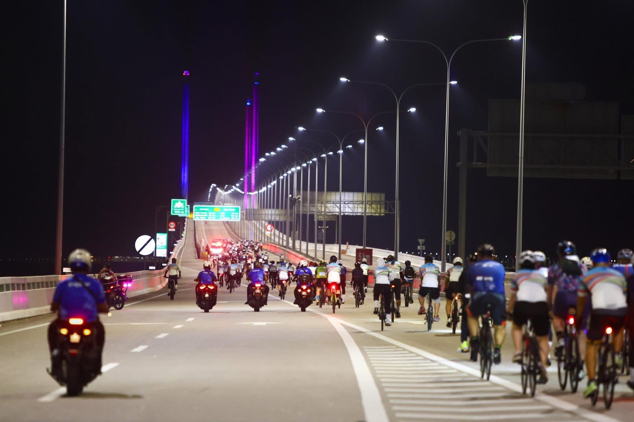
We followed the pace car and the group of VIPs over the cable-stayed section and to the middle of the bridge. At that point the pace car and the VIPs pulled over, and the speed ramped up, despite the headwind.
Photograph courtesy of PDRM Pulau Pinang
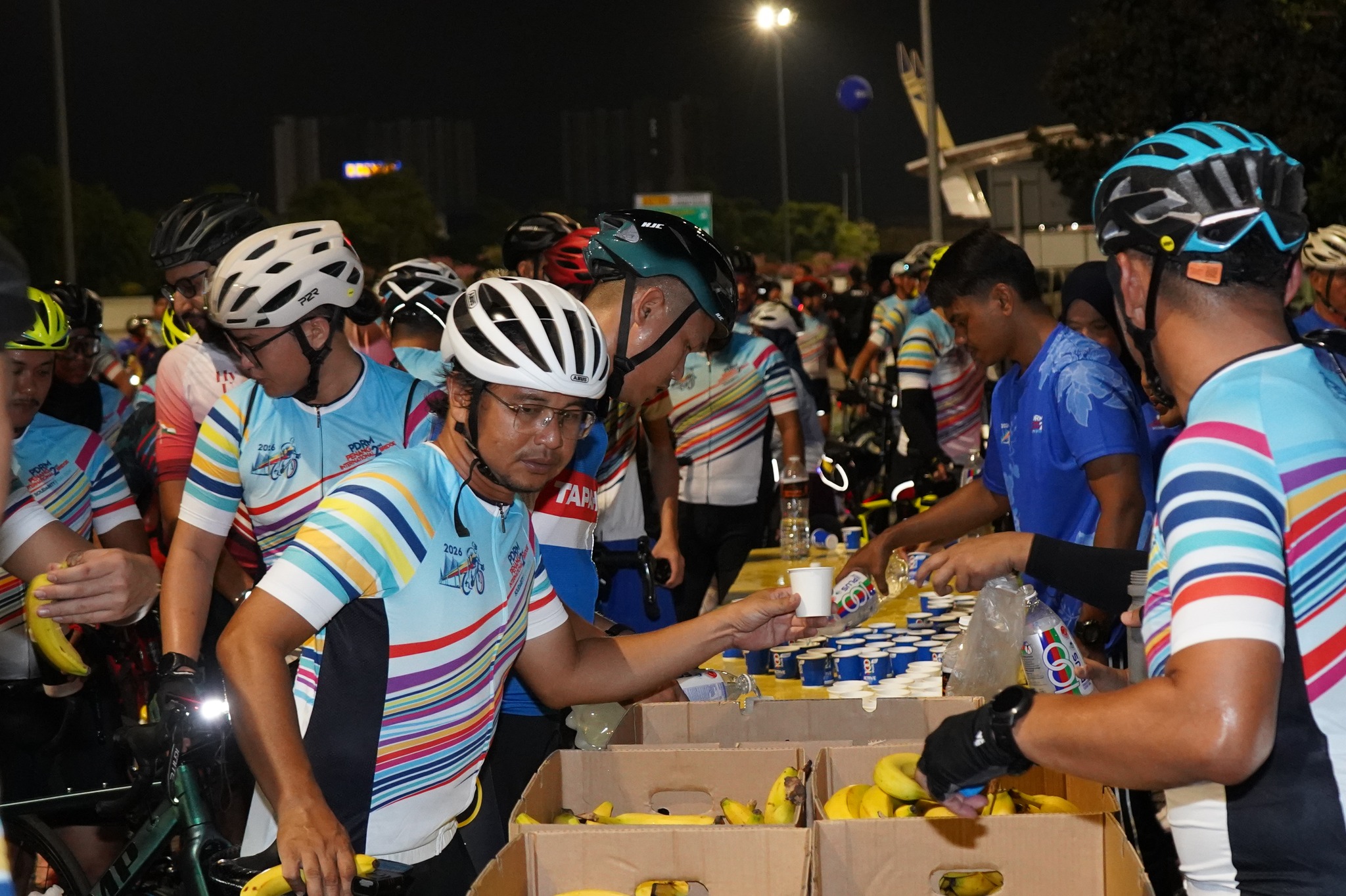
We did a U-turn onto the opposite side of the bridge at the mainland end. The rest stop was 500 metres after the U-turn, at the Toll Plaza Complex. I refilled my bidon with 100 PLUS and ate a banana before heading back to the island. This time with a tailwind helping me.
Photograph courtesy of GoSportz Event
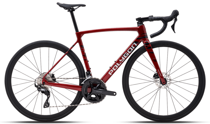
My rental bike, a Polygon Strattos S7D, served me well. It was well worth the money.
Speaking of being worth the money, the MYR160 it cost me to participate in this event was also well-worth it. The entire event was very well managed. It was a treat to ride on a closed Penang Second Bridge. Then there was the swag. We all got a cycling jersey in our ride packs before the event. We also got a goody bag at the finish. In the goody bag were a finisher’s medal, a finisher’s T-shirt, a hand towel, and food: a curry puff, two egg salad sandwiches, a pack of nasi lemak, a slice of butter cake and a bottle of water.
If that wasn’t enough to tide you over until the Lucky Draw, there were food trucks and food stalls at the finish area. Starbuck’s, Krispy Kreme, a burger stall, an apam balik stall, a fresh fruit stall among them.
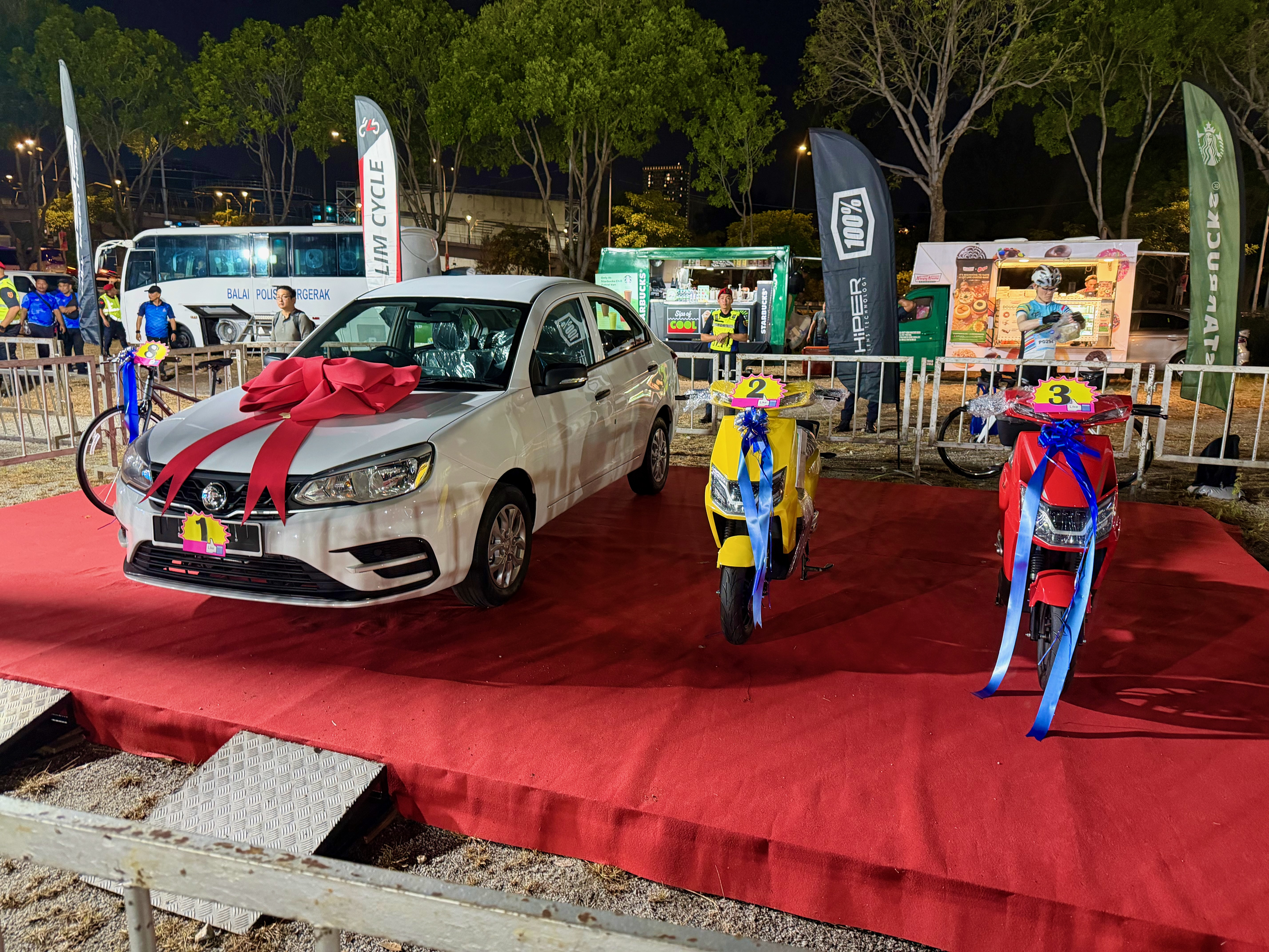
Most of the participants stayed for the Lucky Draw at 12:30 am. The prizes incuded a MYR1,000 travel voucher, an Apple iPad, three bicycles, two e-bikes, a scooter, and a motorbike. The Grand prize was a car.
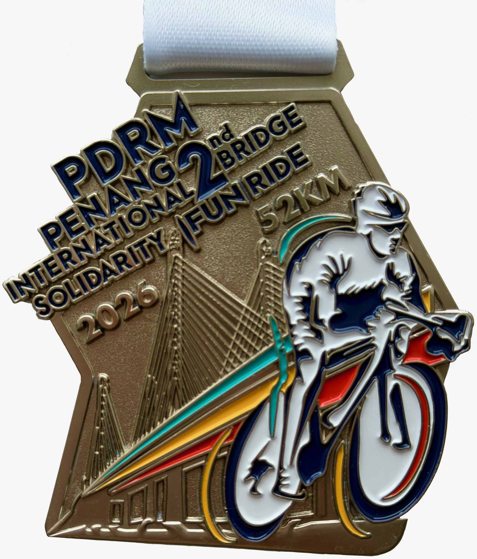
I didn’t leave with a prize. Not that it matters. The experience and the finisher’s medal made the entire weekend worthwhile.
Postscript
The ETS trip back to KL Sentral the next day ran 20 minutes longer than scheduled. It was 3 hours 55 minutes long. A friend drove from Penang to Kuala Lumpur on the same day. It took her almost 8 hours.
Click on the logo below to read about Ride Penang.
I found out about Ride Penang by chance. I was searching on-line for PDRM Penang International 2nd Bridge Solidarity Fun Ride 2026.
I clicked on a link containing that search term and was taken to the Ride Penang website. This was the first thing I saw on that website:
Graphic courtesy of ridepenang.com
I had already registered for the 2nd Penang Bridge ride, booked a hotel room in Penang and paid for a train ticket to Butterworth. I was concerned about how much hassle it would be to get my Ritchey Break-Away, in its hard case, onto a train, a ferry and a taxi.
So I was delighted to read this note below the graphic on the Ride Penang website:
Courtesy of ridepenang.com
Renting a bicycle had not occurred to me. The last time I looked for a bike rental service in Penang, admittedly a few years ago, the options were very slim. A few places offered city bikes and/or mountain bikes, but not road bikes.
Now here was a provider offering not just a range of road bikes in a number of frame sizes, but delivery and pick-up as well. I booked a Polygon Strattos S7D with a Shimano 105 groupset and a Garmin mount, and paid for delivery and pick-up.
Photograph courtesy of ridepenang.com
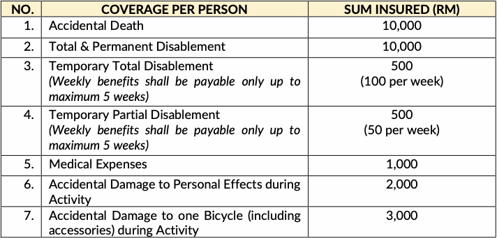
I also paid for one-day insurance:
Table courtesy of Etiqa General Insurance
All this was done in November. I received a prompt email confirmation which included important information about safety and what to expect on delivery. So far so good.
A few weeks before the event I WhatsApped Ride Penang to ask if the person delivering and picking up the bike would have an 8mm hex key for installing and removing my Wahoo Speedplay pedals. Matt sent me back a quick “Yes.” One less item I had to bring with me.
I also asked what saddle comes with the Polygon Strattos, and how wide that saddle is. Matt sent me another quick reply and included a photograph of the saddle with a ruler showing the saddle width. Perfect!
Come the day of the event. Matt was at my hotel at the appointed hour. He had three other bikes to deliver at that hotel, and a few more to send to other locations.
The bikes come with rechargeable front and rear lights, and a saddle bag holding a spare inner tube, a CO2 cartridge and inflator, and a multi-tool. Matt will even provide a cleaned and sanitized helmet if you need one.
The Polygon Strattos S7D performed flawlessly. The saddle was really good, as Matt had said it was. I really enjoyed riding that bike.
I highly recommend renting a bicycle from Ride Penang, and I may well use their Bike Packing service one day.
This is what Matt has to say about what his team offers:
Ride Penang (ridepenang.com) is a rider focused bicycle rental and cycling services provider based on Penang Island, Malaysia, specializing in road bike rental, event bike hire, and hotel delivery & collection for visiting cyclists.
Ride Penang operates a fleet of high-quality bikes—including performance road bikes, e-bikes, mountain bikes, folding bikes, cargo bikes, and even pet-friendly options—each professionally maintained and event-ready.
Our unique concierge-style service allows bikes to be delivered directly to hotels or accommodations across Penang Island and collected after the ride, removing all transport and logistics barriers for travellers.
We actively support local cycling and multi-sport events in Penang and also throughout Malaysia with our sister brand goracebikes.com were we aim to serve overseas and local riders seeking reliable, safe and high-quality equipment to aid them in achieving their sporting goals!
Photograph courtesy of ridepenang.com
Ride Penang is a welcome and much-needed addition to the cycling scene in Penang. Click the Ride Penang logo below to visit their website. You will not be disappointed.
Taiping originated as a Chinese mining settlement in the Larut district, where large-scale tin mining developed in the 1840s. In 1874, it was the first town in the Federated Malay States to be officially designated as a city. Taiping became the capital of the state of Perak until 1937. Well-preserved colonial architecture bears witness to Taiping’s political and economic importance.
The Heritage Ride Taiping 2025 is one of several events held to mark the 150th anniversary of the city. A group of us registered for this ride and planned a weekend in Taiping. We booked rooms in the Flemington Hotel. The Flemington Hotel was where we stayed during two rides to Penang. Once in 2020 and again in 2023. We like the Flemington, and it had the added benefit of being close to where the Heritage Ride would start.
Photograph courtesy of flemingtonhotel.com.my
The hotel faces the Taiping Lake Gardens. The Taiping Lake Gardens dates back to 1880 and is the first public garden established during the British rule in Malaya. The iconic angsana trees have been there for more than 100 years.
Photograph courtesy of GK
The week before the ride was a very wet one across the country. There were floods in several areas, and the Malaysian Meteorological Department issued a Tropical Storm Warning the day before we were scheduled to travel to Taiping. We went anyway.
V took the train to Taiping. My biker chick and I drove through continuous rain. J was also driving up on Saturday. G and T decided to defer driving to Taiping until the next day.
We had planned to have dinner at the Hu Jing Ge Chinese restaurant in the Flemington Hotel, reputedly the best Chinese restaurant in Taiping, but changed our minds because there were only three of us in Taiping that Friday night.
I had asked a friend who lived in Taiping for restaurant and café recommendations. He gave me a list of places.
The Double Tap Café is 350 metres from the Flemington. We walked there for coffee and a long chat. We then took a Grab car to Sri Annapoorana Curry House for dinner. My capati and my biker chick’s Maggi mee goreng were very good. V’s thosai was less so.
The rain had finally stopped, so we decided to go to the Taiping Zoo Night Safari. The Taiping Zoo was established in 1961 and is the oldest zoo in Malaysia. I think it is the only zoo in the country to operate night safaris.
You take a tram ride through the 36-acre zoo while the driver points out many of the 140 species of wildlife in the various sizeable enclosures. We were very impressed with the variety of nocturnal wildlife we saw in the special lighting, which mimics moonlight.
Photograph courtesy of NH at media.siraplimau.com
The zoo is on the other side of the Lake Gardens from the Flemington. We had a nice walk under the angsana trees back to the hotel, where we finished the evening with potato wedges and teh tarik at the hotel’s Raintree Café.
Photograph courtesy of VV
I had plotted a cycling route for Saturday morning. However, V’s bike was in T’s car, which hadn’t left KL. So I rode on my own.
Map courtesy of Ride With GPS
My route included crossing Jalan Air Kuning on a bicycle-accessible bridge. We need more of these bridges across our main roads.
Photograph courtesy of Google Street View
The three of us walked the 650 metres from the Flemington to adaruang for brunch. Everything we ordered, except for the pau, was nice. The pau was reheated rather than freshly steamed.
G and T arrived in Taiping at about 2:00 pm. V and I took a Grab car to the Larut Matang Hawker Centre, where G and T were eating lunch. That hawker centre is a short walk from the Taiping Mall, where we collected our goodie bags and ride numbers. The ride organisers had a sizeable team on hand to ensure the goodie bag distribution was efficient.
Photograph courtesy of The Heritage Ride Taiping
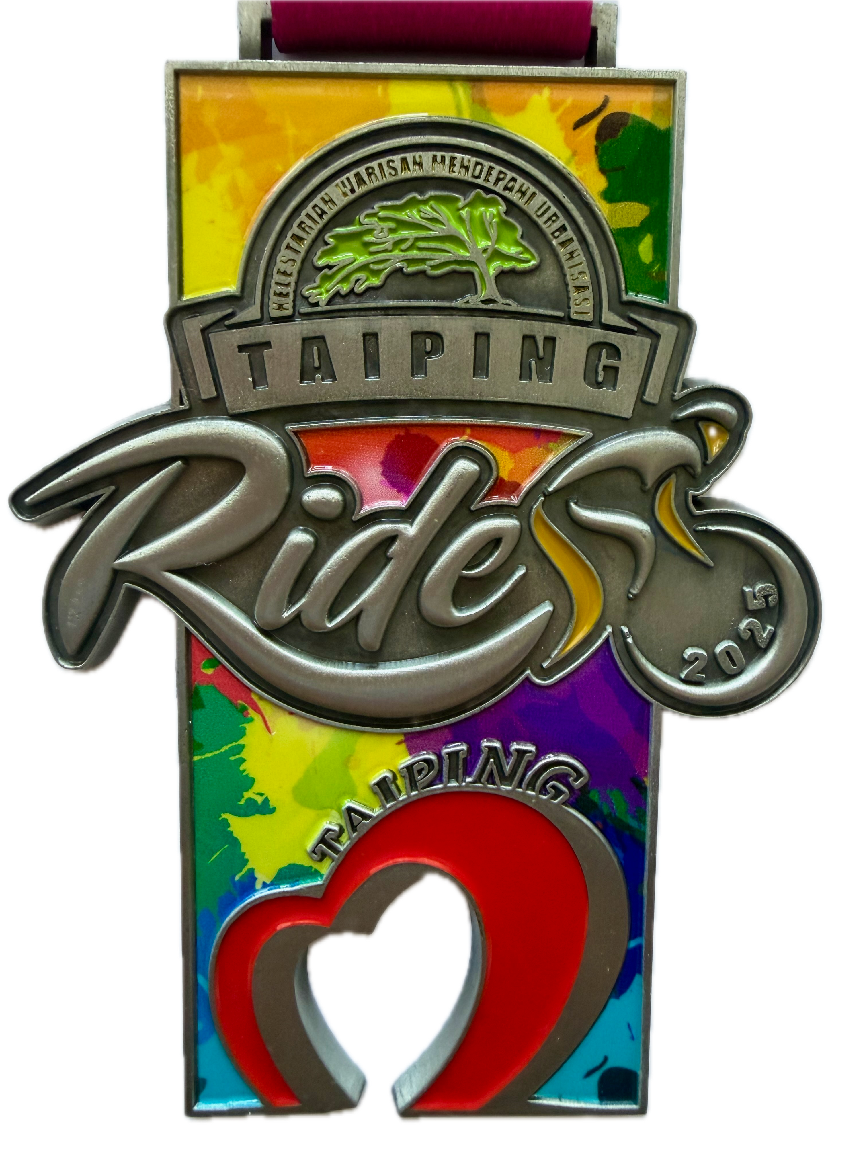
We all got an Event T-Shirt. Green ones for the 60 km participants, blue ones for the 90 km cyclists, and pink ones for the 20 km riders.
Photograph courtesy of The Heritage Ride Taiping
V and I walked back to the hotel. By the time J arrived, most of us were too lazy to leave the hotel for dinner. G and T went to a nearby seafood restaurant while the rest of us ate at the Raintree Café.
The Flag Off for the 60 km event was 7:15 am. We left the hotel at 7:00 am to make the 1.5 km ride to the Dataran Warisan Taiping (Taiping Heritage Square).
The Dataran Warisan Taiping is fronted by the Larut Matang & Selama Land and District Office building. Initially called the New Government Office, it was completed in 1897. The then State Engineer, Francis Caulfield, designed the building in the shape of the letter ‘C’ after his last name.
Photograph courtesy of ipohecho.com.my
We arrived at the start line as the last of the 90 km riders got underway. We joined the back of the queue for the 60 km event. While we were waiting, a person came around to check that everyone had an official participant’s number. This was to stop unregistered individuals, aka ghost riders, from taking part.
Photograph courtesy of GK
We were flagged off on time at 7:15 am. Our route was actually about 65 km long.
Map courtesy of Ride With GPS
We had hardly gone more than one kilometre when I had a puncture. I pulled over to the side of the road and was getting ready to replace an inner tube when the event support van pulled up. I just watched as two gentlemen replaced the punctured inner tube, got the tyre up to pressure with an electric compressor and put the wheel back on the bike.
I was ready to roll in less than three minutes. Kudos to Izuwan Automobile and Jami Bike Centre for providing such rapid neutral service support.
My four ride companions pedalled away around this corner.
Photograph courtesy of VV
I wasn’t with them. I had a dropped chain. When I got going, I was the last person on the road. With a course marshal with a flashing light beside me.
I wanted to lose that marshal and his flashing light. The chase was on. I caught up to my four companions, and we set off to overtake the tail-enders ahead of us.
15 km later, we started to reel in the slower riders ahead of us. By the time we got to the first water stop at 30.5 km, J, V and I were comfortably ahead of the average pace needed to finish the ride before the cutoff time of 11:00 am.
Photograph courtesy of SJ at facebook.com
We refilled our bottles with water or 100 Plus isotonic drink and went on our way. We decided not to wait for G and T. The route was clearly signposted, so we were not worried that G and T would get lost. What we didn’t know was that brake rub had slowed T down for the first 20 km or so. G slowed down and waited for T to catch up with her. She had had the same brake rub issue herself in the past, and was able to fix T’s problem brake.
There was a second water stop after 40 km. I still had a lot in my bottle and decided to keep going. I should have stopped to collect a banana or two. J and V were disappointed that I didn’t stop.
As is often the case with organised rides, there were a few hills to climb in the last 20 km. Including a 500 metre kicker before the final right turn into the finish. We all rode under the Start/Finish arch within the cutoff time.
The Dataran Warisan was lined with the event sponsor’s booths.
Including ChekHup and McDonald’s. ChekHup iced coffees, McChicken sandwiches and hash browns before we rode back to the hotel.
Photograph courtesy of VV
Remember the Hu Jing Ge Chinese restaurant in the Flemington Hotel? We couldn’t eat there on Saturday because it was fully booked for a wedding lunch and dinner. Fortunately, it was only partially booked for a wedding luncheon on Sunday, so we had lunch there. The ikan bilis fried rice, the seafood fried rice, the crispy duck and the orange chicken were highlights.
All that was left for the group was to hit the road out of Taiping. One went to Penang. Two went to Ipoh. And three drove back to KL. The trip to KL was very slow, as it usually is on a Sunday afternoon. The traffic was not helped by someone who had crashed into the back of a police car. Oops!
In closing I must mention my experience of how this event was run. There has been some criticism of the event organisers on social media. Some participants complained abut the lack of route marshalling and poor signage. That was not my experience, but I can only speak about the 60 km event. I wasn’t racing for a podium spot, either.
The 60 km event started on time. I have already told you about my positive experience with the neutral service support. All the road junctions were manned. The directional arrows were easy to see. There were many marshals all along the route. One marshal even checked that I was okay while I was putting arm screens on at a Caltex station at the 42 km point. The two rest stops were well-stocked with water, 100 Plus, and bananas in the case of the second stop.
There was plenty of space to put bikes, to relax and to enjoy the aforementioned free drinks and food at the Dataran Warisan Taiping after the ride. I would come back if there is a Taiping ride next year.
I started using a Garmin Edge cycling computer in 2010. My Edge 705 served me well until 2016, when I upgraded to an Edge 1000. A design fault with the power button made me retire the Edge 1000 and start using an Edge 1030 in February 2018. A crash in July 2024 snapped one of the tabs on the quarter-turn mount interface on the underside of my Edge 1030. You can read about that adventure by clicking here.
I continued to use the 1030 despite it popping off the out-front mount whenever I hit a bump. The screen damage incurred during the same crash worsened progressively over the next two months. My son got me a good deal on an Edge 1050 in September 2024.
I very much like the Edge 1050.
Each generation has progressively gotten larger and heavier. Interestingly, each generation is thinner than the previous one, which illustrates the increasing miniaturisation of components. The ever-larger width and height are due to the display size nearly doubling from the Edge 705 to the Edge 1030/1050.
The key improvements of the Edge 1050 over the Edge 1030 are the increased screen resolution and the switch from a transflective LCD to a transmissive LCD with a screen brightness of 1,000 nits. The Edge 1050 has a bright, high-resolution touch screen with more vivid colours.
Specification
Edge 705
Edge 1000
Edge 1030
Edge 1050
Physical Dimensions (W × H × D)
51mm × 109mm × 25mm
58mm × 112mm × 20mm
58mm × 114mm × 19mm
60.2mm × 118.5mm × 16.3mm
Display Size (Diagonal)
5.6 cm
7.6 cm
8.9 cm
8.9 cm
Display Resolution (Pixels)
176 × 220
240 × 400
282 × 470
480 × 800
Weight
104g
114.5g
124g
161g
There are also improvements inside the Edge 1050. Hardware changes include a much faster processor that delivers a smoother, more smartphone-like experience when scrolling, zooming maps, and navigating menus. The inclusion of Multi-band GNSS offers more precise tracking and positional accuracy. The basic beeper in previous devices has been replaced by a built-in speaker with an electronic bell and audio prompts.
Software improvements let you download and update maps via WiFi on the device and make contactless payments. There are hazard alerts and improved group-ride features. Lastly, the User Interface has been redesigned and is more responsive.
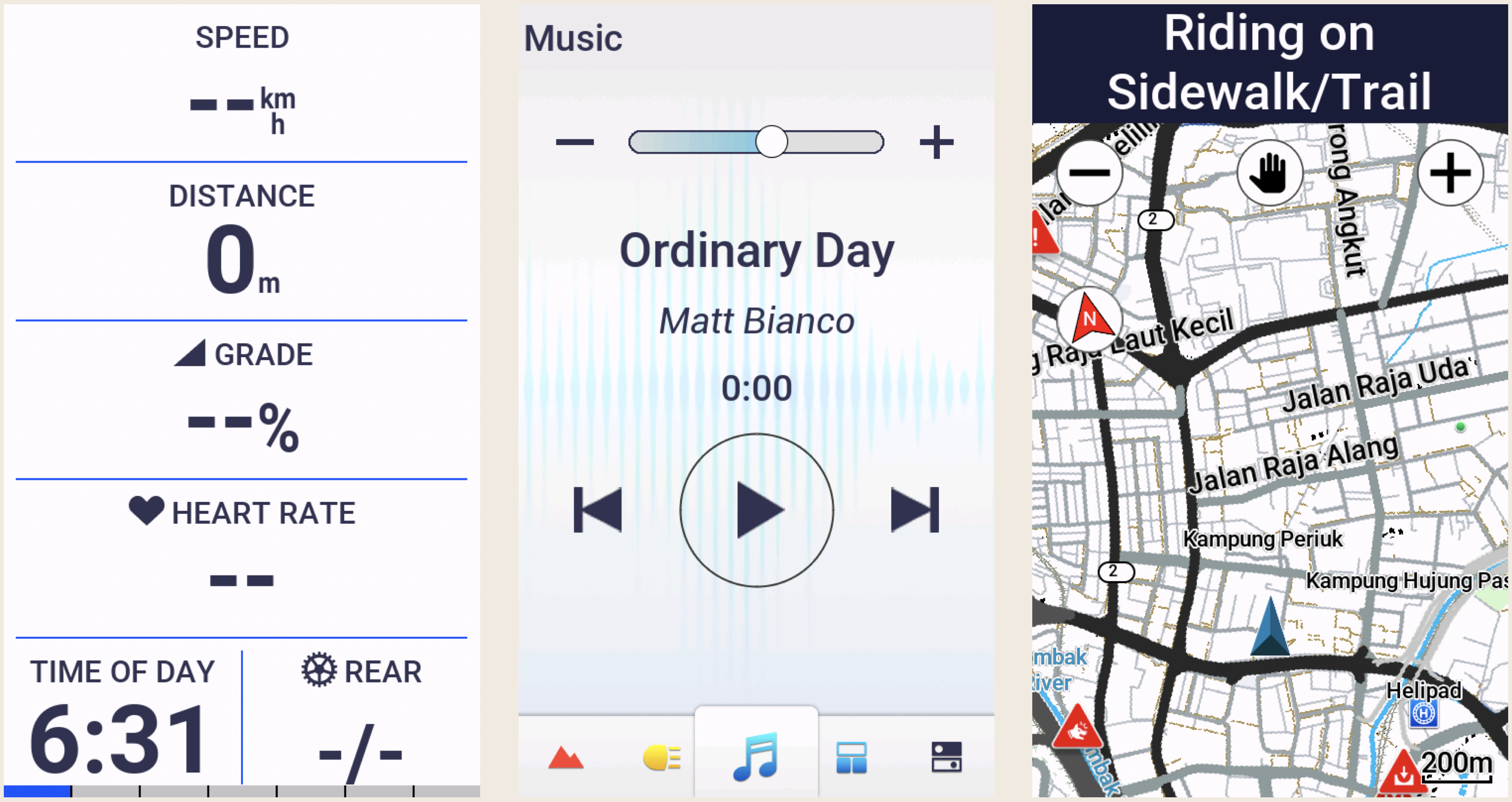
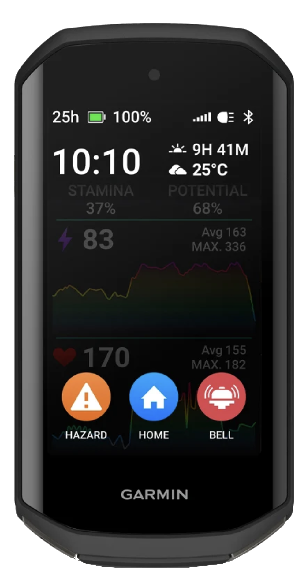
I progress through these three screens at the start of every ride. On the left is the Home screen that usually displays after the device has booted up.
In the centre is the Status widget screen. Widgets provide at-a-glance information like weather and notifications. Swiping down from the Home screen reveals the Widget screen. I usually turn on my Edge 1050 inside a car park. I use the Widget screen to confirm that my Edge 1050 has acquired a GPS satellite signal.
Touching the light icon at the bottom of the Widget screen reveals the Light screen. I control my Garmin Varia UT800 front light from the Light screen.
Swiping up from any Widget screen returns the display to the Home screen. From the Home screen, I can start a ride by touching the large ROAD activity profile button, start navigating by touching the NAVIGATION button, or access the system settings by touching the MENU button.
Touching the ROAD activity profile button goes to the data screen on the left below. Data screens, widget screens and activity profiles are all easily customisable. I have customised this screen to show the data fields I use the most.
I swipe left from my preferred data screen to reveal the Music screen. I ride with Shokz bone conduction headphones. The open-ear design lets me listen to music and navigation prompts without drowning out or masking the sounds around me. I can still hear a vehicle approaching me from behind and be in conversations while using the headohones.
I use the Music screen to control which track is playing and to adjust the playback volume.
I swipe right from the data screen to access the Map screen when I want to see the layout of the roads around me.
I often follow pre-loaded routes or courses that I created using the Route Planner on ridewithgps.com. I upload these custom courses wirelessly to my Edge 1050. The Map screen below is in navigation mode. The course is highlighted and a directional arrow is displayed.
If the navigation screen is not already displayed while following a course, it will pop up automatically about 100 metres before an upcoming turn.
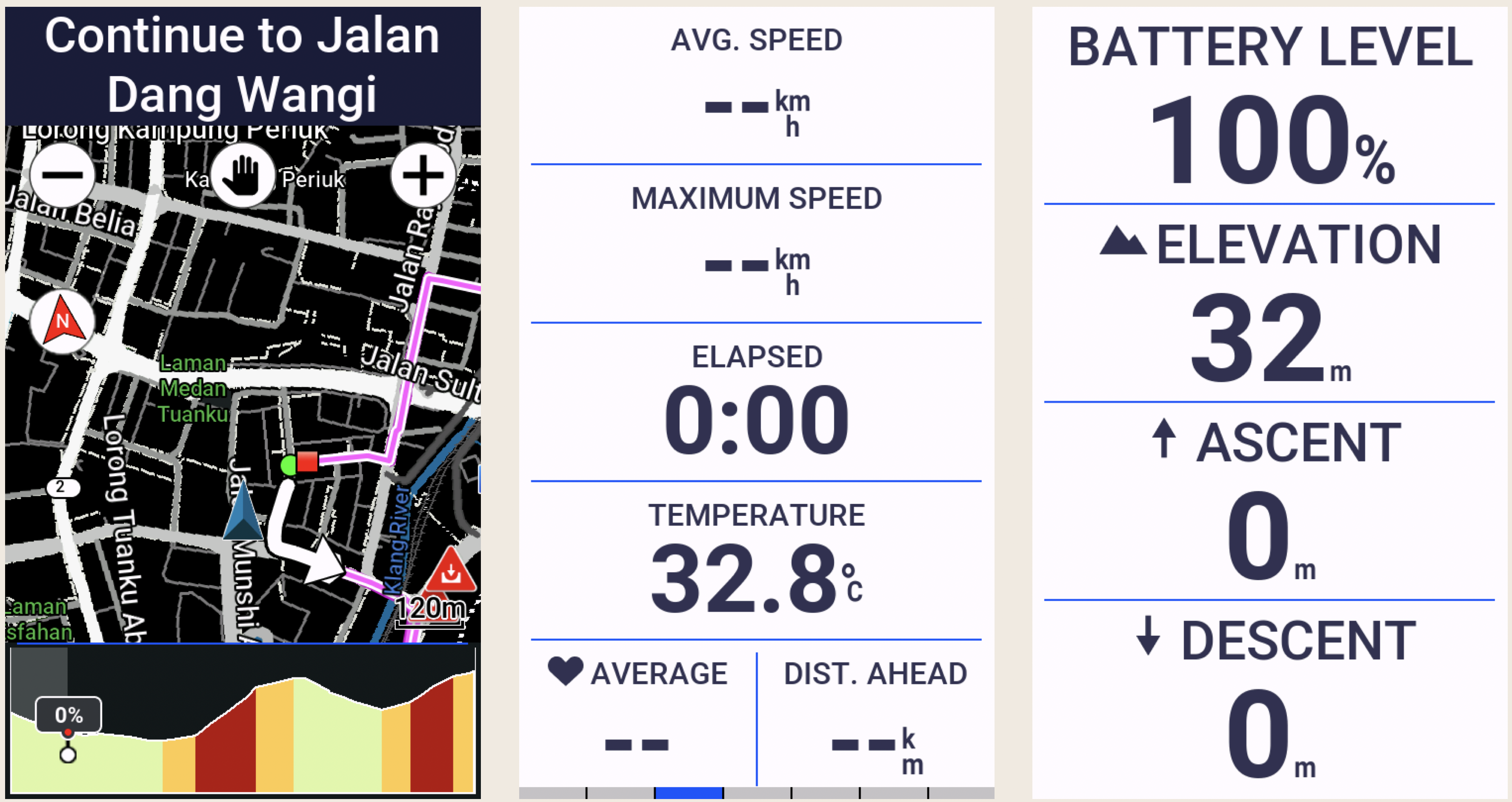
The other two data screens display data fields that I occasionally refer to. I most often want to know the current temperature and how much climbing I have done.
I mentioned that the data screens are customisable. You can create up to 10 custom data screens for each activity profile on an Edge 1050. Each of these screens can be customised to display up to 10 data fields by default. While 100 data fields per activity profile sounds like a lot, Garmin provides 151 data fields to choose from, across the following categories, in alphabetical order:
Data Type
Number of Fields
Examples
Cadence
3
Average cadence, Lap cadence
Cycling Dynamics
19
Time seated, Time standing
eBike
5
Assist mode, Travel range
Elevation
12
Average ascent velocity, Grade
Gears
8
Di2 shift mode, Gear ratio
Graphical
13
Graphs showing Current Power Zone, Current Cadence Range
Heart Rate
17
% of Heart Rate Reserve, Heart Rate Zone
Lights
4
Light mode, Battery status
MTB Performance
6
Grit, Lap flow
Navigation
14
Next waypoint, Time to destination
Other
11
Temperature, Number of laps completed
Power
32
current power output, Average left/right power balance
Smart Trainer
1
Trainer controls
Speed
5
Average speed, Lap speed
Stamina
4
Current remaining stamina, Remaining potential stamina
Timer
7
Elapsed Time, Lap Time
1
12
Distance to go, Step Distance
The Edge 1050 is capable of much more than I use it for. I don’t use features like Event Adaptive Training, Livetrack, Cycling Dynamics, and Garmin Group Ride Radio.
The features I do use work very well. Heart rate tracking, turn-by-turn navigation, Bluetooth, Wi-Fi and ANT+ connectivity, and the built-in speaker.
The bell, which can be rung from the Timer overlay screen, is an appealing new feature. The initial implementation of this feature was a bit clunky. It required tapping the screen to view the timer overlay, and then tapping the Bell icon in the bottom right corner of the main menu. It often took a few pokes to accurately hit the Bell icon.
The latest software update simplifies ringing the bell. Now, double-tapping on any data screen rings the bell. Oddly, double-tapping does not work on widget screens. Nevertheless, a welcome improvement that fixes the only niggle I had with my Edge 1050.
The thing everyone wants to read about in a cycling computer review is battery life. The Edge 1050 has a claimed 20-hour battery life when used with sensors connected, navigation running, etc. This stretches out to 30 hours with the screen brightness lowered to about 20-30%.
Enabling Battery Saver Mode, which lets you reduce backlighting, hide the map screen and allow the device to enter sleep mode during an activity, extends the claimed battery life to about 70 hours.
I highly recommend the Edge 1050. Some may quibble over the size and weight of this device. I want a large, bright and high-resolution screen on my cycling computer. The Edge 1050 gives me that display in a package that weighs less than a McDonald’s Big Mac.
In closing, one feature of the Edge 1050 that I hope to never use is the replaceable quarter-turn mount interface. I would rather not hit another wild boar.
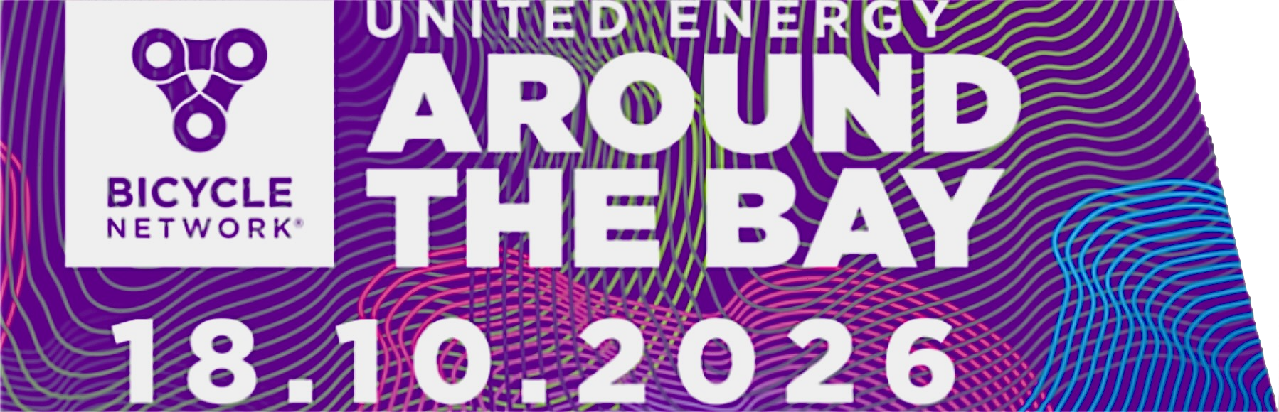
This was the 31st edition of Around The Bay. My son A opted for postal delivery of our Rider Packs. In the packs were our bike number plates and two jerseys each.
Jersey graphic courtesy of bicyclenetwork.com.au
There were five ride options – the 220km classic, the 135km Geelong start, the 100km, 50km, and Lap the Track family routes. We chose the 100km route. Which was 120 km in total because we rode from A’s house to the event village and then back home again after the ride.
The event village was beside Albert Park Lake. The organisers planned a day of live entertainment at the event village with DJs, bands, a circus, a marching band, and roving performers. There would be food trucks and a fully stocked bar with a wide range of alcoholic and non-alcoholic drinks.
Photograph courtesy of bicyclenetwork.com.au
The same entertainment theme was planned for the rest stops. In addition to providing plenty of water, electrolytes, snacks, gels, energy bars and porta-potties, the rest stops promised live music.
The spanner in the works was the weather forecast. Sunday’s forecast indicated rain at 11:00 am and continuing into the afternoon.
We left A’s home just before 6:00 am to get to Albert Park in time for the 6:45 am start of the 100km event. The 220km classic had started at 5:30 am in the rain. The rain had stopped, but the roads were still wet.
We joined a few hundred riders at the start line. The route took us around Albert Park Lake and north-west on Bay Trail toward the West Gate Bridge.
Map courtesy of ridewithgps.com
The West Gate Bridge crosses the Yarra River where the river flows into Hobsons Bay. The bridge is 2.6 km long and 58 metres above water at its highest point.
Photograph courtesy of raevictoria.com
After we crossed the West Gate Bridge, it wasn’t far to the first rest area at Williamstown. It wasn’t raining, but the skies over the city, as viewed from Gem Pier, looked ominous.
The rest area at Williamstown had bananas, water and porta-potties. I didn’t need to refill my bidon, but did take a banana to augment the Snickers Loaded bars I had with me.
The next rest area was back over the West Gate Bridge and 40 km into the ride. I had another banana and bought a chai latte from the coffee van at Elwood. It wasn’t raining, but the roads were damp and the sky was very cloudy.
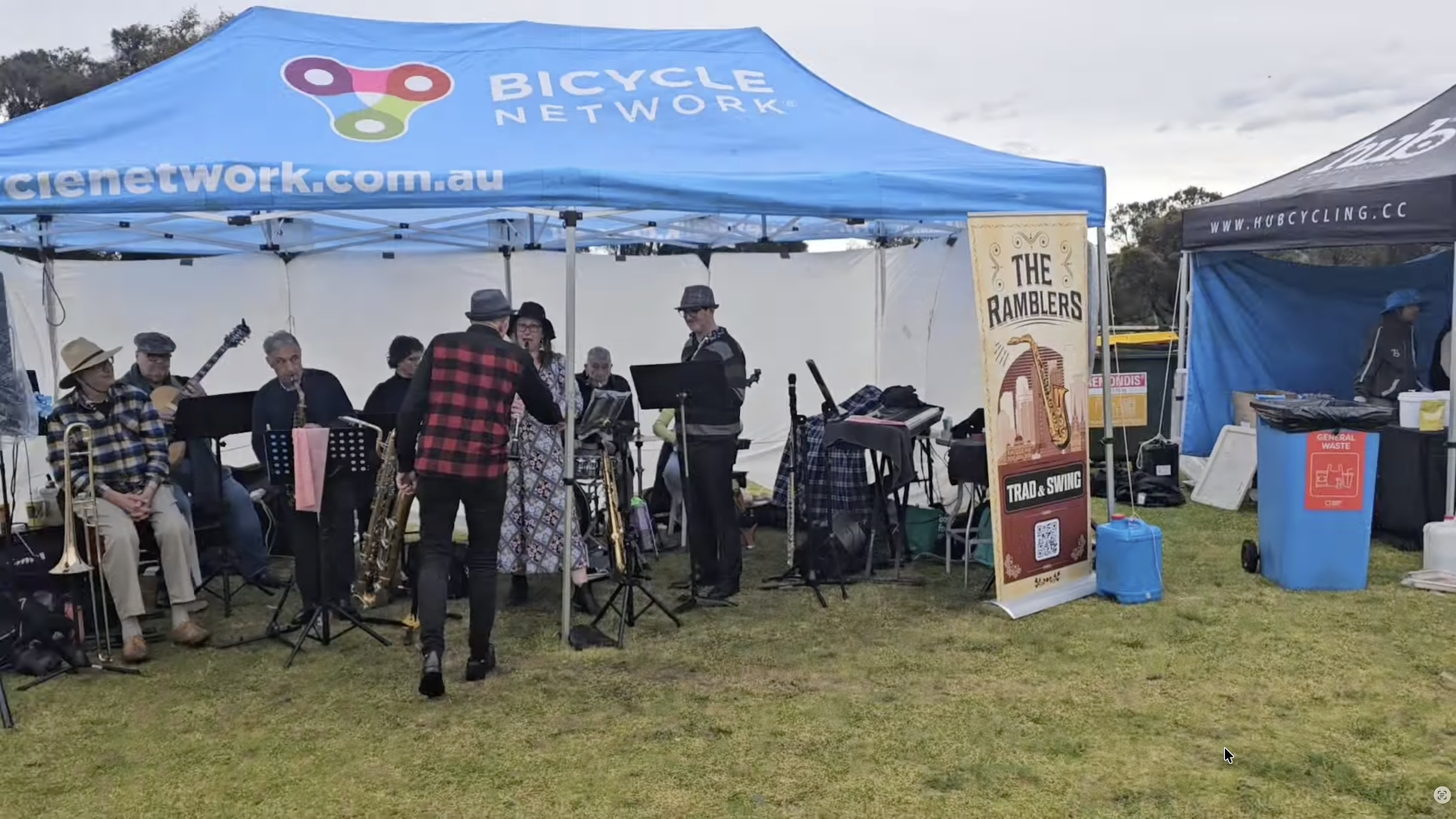
We arrived at the turnaround point at Mordialloc just before 11:00 am. As forecast, it was drizzling. That put a damper on The Ramblers performance.
Photograph courtesy of Dave D
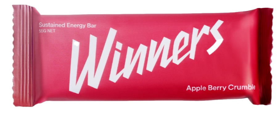
Despite the rain, the Ramblers were good, but the highlight for me at Mordialloc was the Winners bars being handed out. The Apple Berry Crumble ones were delicious. There were apples on offer, too. I put one in my pocket for later.
You can see the rain drops hitting the water in Mordialloc Creek.
It was pouring as we rode through Blackrock on the way back to Albert Park. I was doused a couple of times by cars driving through puddles beside me. The rain eased with about 10 km to go. A and I splashed our way across the finish line, soaked to the skin.
Photograph courtesy of northside.live
To their credit, volunteers were standing in the rain at the entrance to the event village, handing out finisher’s medals.
There weren’t many riders in the event village. The promised day of live entertainment and food was washed out by the incessant rain. Many finishers went straight to their cars and drove home rather than spend time in a wet and cold event village.
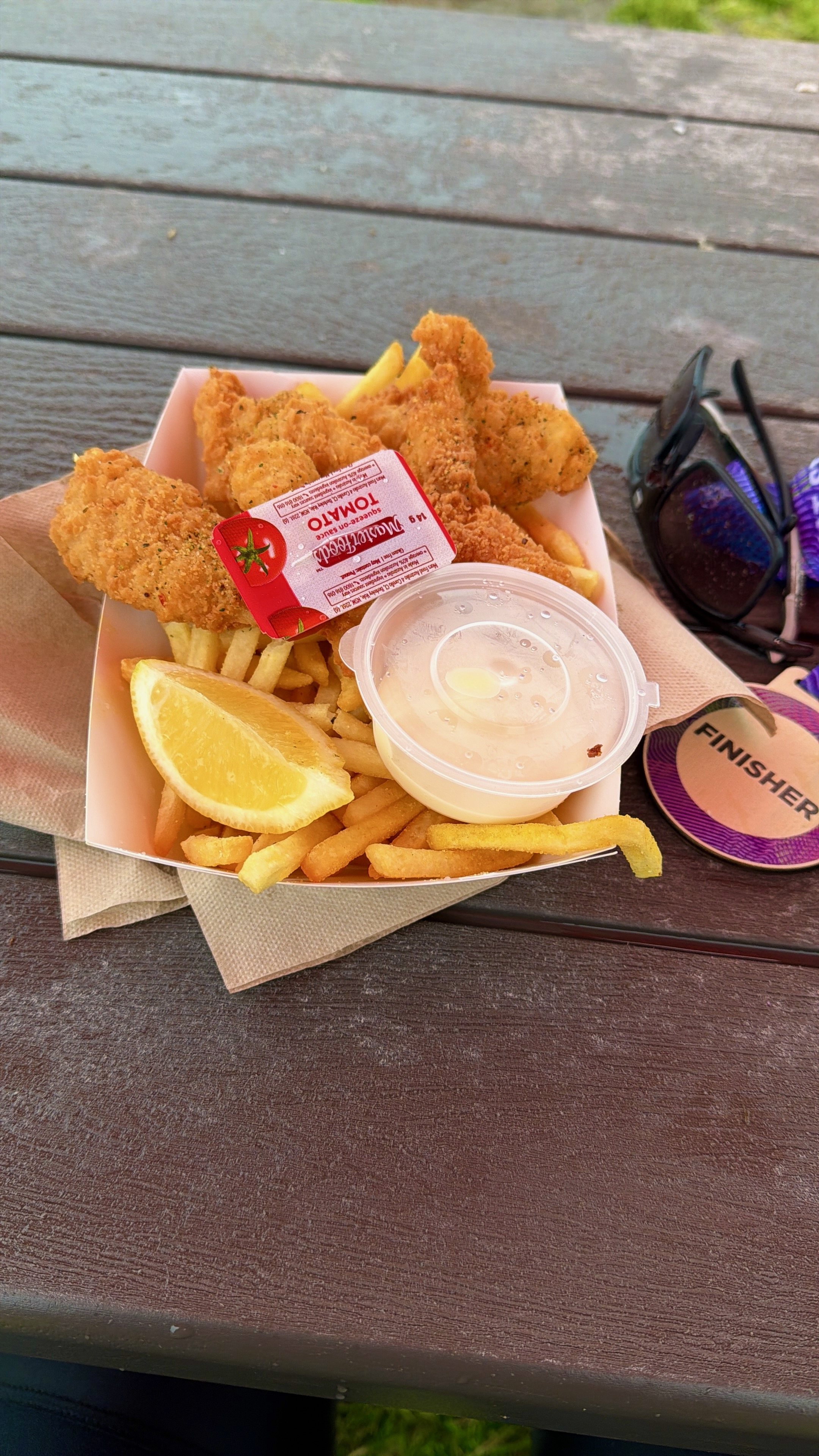
A and I wanted some hot food before we rode back to Ascot Vale. I ordered two fish and chips meals from the Chef Calamari food truck. The wind picked up as we were waiting for our food. We were dripping wet, and it was 15º Celsius. And shivering by the time our food was ready. I was shaking so hard that it was difficult for me to pick up my chips.
Unsurprisingly, I turned down an offer of free gelato from the Scoopcalicious truck. It was so cold that they couldn’t give their gelato away.
The fish and chips were yummy, but it did little to warm me up. I was shivering so badly that my bike was wobbling back and forth as we started our ride home.
People say Melbourne has famously unpredictable weather. They say right! It was still raining when we got home at 11:20 am. This was the view from A’s home at 3:00 pm. The weather was mocking me!
Despite finishing wet and cold, A and I are glad we did the ride. I really enjoyed riding with him that weekend. Will we do it again next year? Registration is already open for the 32nd edition of Around The Bay.
Image courtesy of race roster.com
If only the organiser could guarantee riding conditions like this:
Photograph courtesy of Gabriel Tan on unsplash.com
Some months ago my son A, who lives in Melbourne, Australia, suggested that we participate in the United Energy Around the Bay ride. I said “yes.”
I still own the Ritchey Break-Away and the S&S Edge Pull Butterfly Latch Hard Case that I wrote about in 2019. You can read that post by clicking here.
I pulled the case out of storage nine days before my flight to Melbourne. It has been years since I last travelled with my Break-Away. In that time, the hard rubber tyres on the case wheels had completely perished. Those nubs on the plastic cores of the wheels made rolling the case untenable.
A series of emails to S&S Machine culminated in the delivery of replacement wheels via DHL. Shipping via the United States Postal Service would have taken too long. As I expected, the courier charge was a lot more than the cost of the wheels, but it was desperate times.
The replacement wheels were easy to install. I then had to remind myself about how to fit my Break-Away into the case. It was a Tetris-like task, but I eventually fit everything in.
Once the compression members (the white plastic tubes with circular caps) are in place, there is space to fit in shoes, bottles, tools and other small items. The compression members protect the bike by preventing the outside faces of the case from being pushed inward and crushing the bicycle frame.
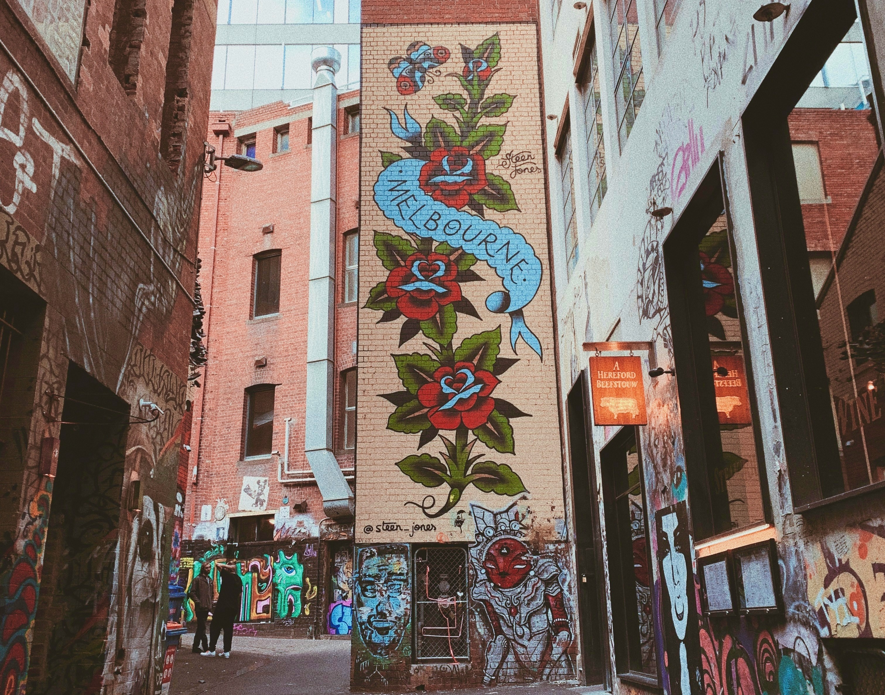
A’s home is within riding distance of the Capital City Trail. The Capital City Trail is a 29 km shared-use path for cyclists and pedestrians, which circles the Melbourne city centre and includes some inner eastern and northern suburbs.
The Capital City Trail incorporates sections of other trails, including the Merri Creek Trail, Main Yarra Trail, Moonee Ponds Creek Trail and Inner Circle Rail Trail.
The map below shows the Capital City Trail. The map on the right is the route A and I took. We followed the Capital City Trail for the most part, with two brief excursions you will read about.
Maps courtesy of ridewithgps.com
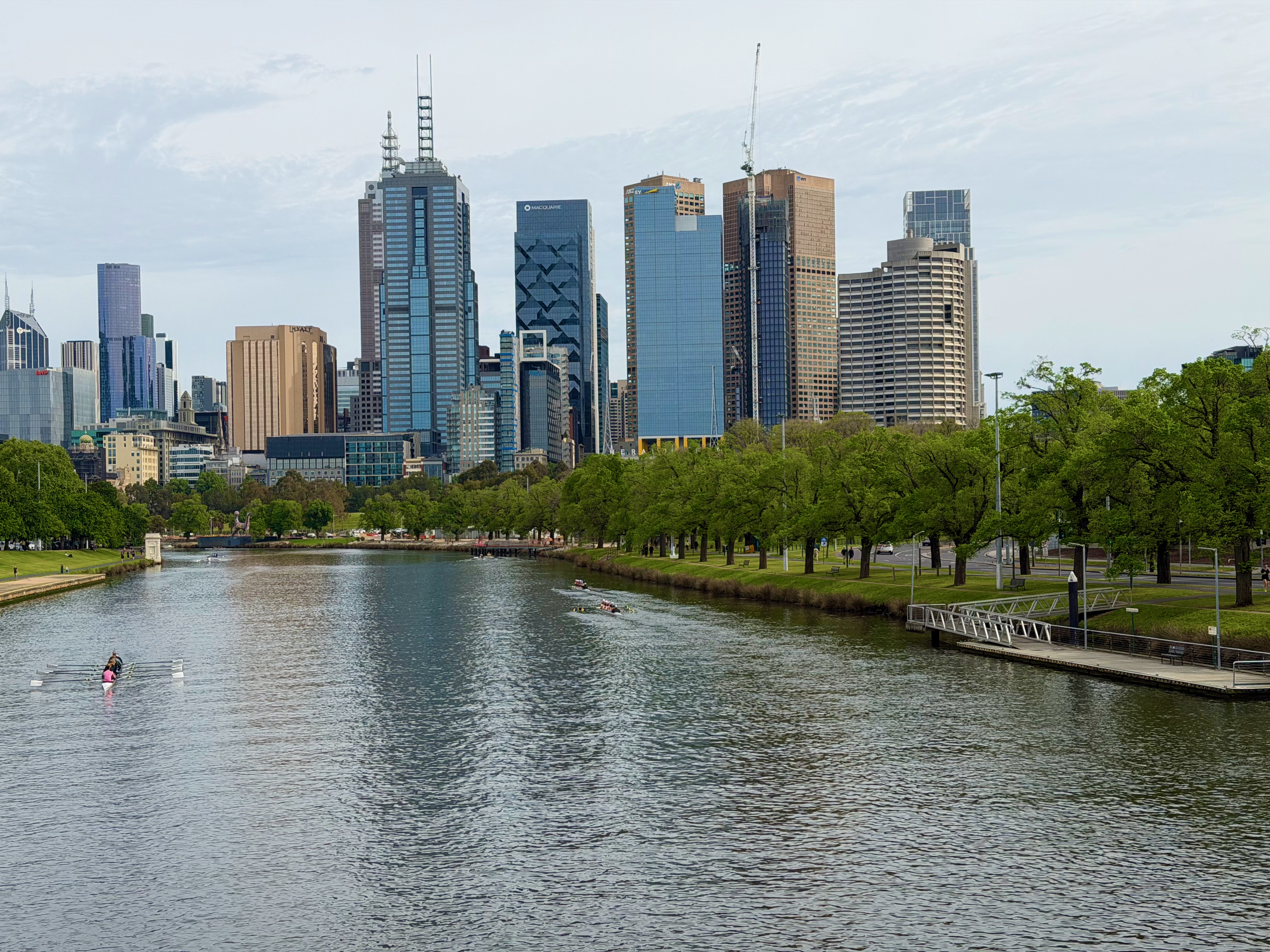
This is the view down the Yarra River toward the city centre. Lots of rowing clubs were running “Learn to Row” sessions on the river. These are just a few of the dozens of boats on the water that morning.
10 km upriver, and the Yarra is considerably narrower. No boats on the water here.
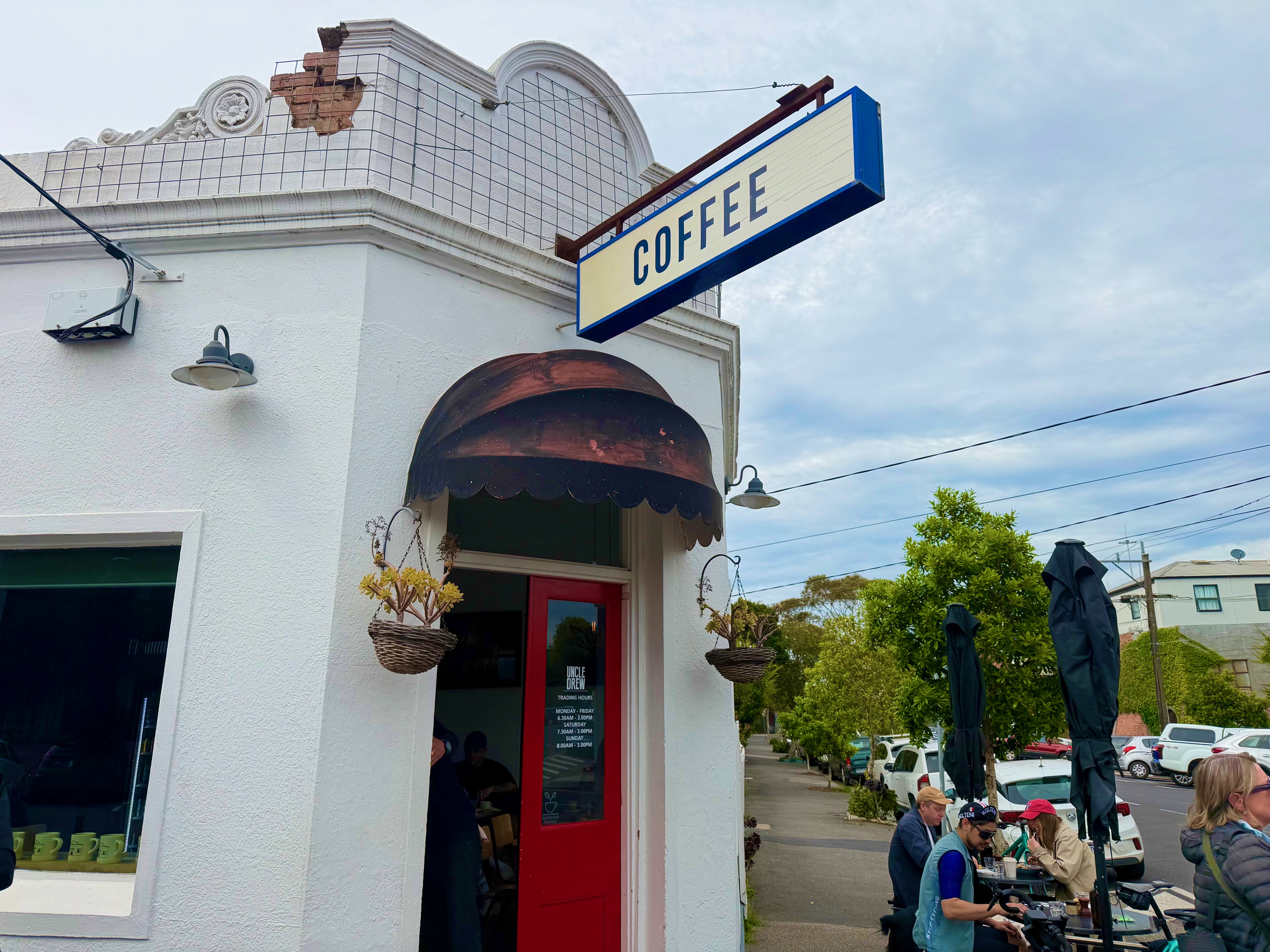
Our first excursion off the trail was to the Uncle Drew Café in Clifton Hill.
It wasn’t the warmest day with an average ride temperature of 18º Celsius, but it was dry and the air was still. We sat outside and enjoyed very nice breakfasts and coffees.
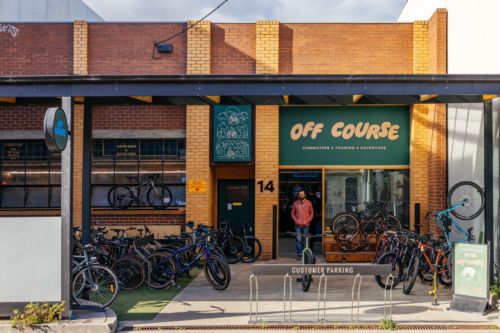
Our second excursion off-trail was after 19 km. We headed due north to the appropriately named Off Course Bike Shop in Brunswick.
Photograph courtesy of radavist.com
Rain was forecasted for the Around the Bay ride. A suggested that we get Ass Savers so we don’t spray rooster tails of water onto riders behind us. I also bought thicker and more water-resistant gloves than the thin pair I brought with me.
We were back home after a very pleasant 49 km. Notwithstanding the 750 metre drag up Walmer Street at an average grade of 6.1%. It was a good warm-up ride for the Around the Bay ride the following morning.
A fully supported cycling event typically takes place on closed roads, with the organiser providing water and food stops, medical support, mechanical assistance, and ride marshals to ensure safe riding conditions. These events often include a t-shirt or jersey, as well as a finisher’s medal. All for an entry fee, of course.
My first fully supported cycling event was the Humble Lions Club Ride in Houston in 2010. That was followed by the likes of the Gator Ride and the Space Race before I moved to the Netherlands and rode in events like the Gerrie Knetemann Classic and the Joop Zoetemelk Classic in 2011 and the Amstel Gold Race in 2012.
Gerrie Knetemann won the 1978 World Road Race Championship. Joop Zoetemelk won the Tour de France in 1980 and was World Road Race Champion in 1985.
I continued to participate in organised events after I returned to Malaysia in 2013. There was at least one event, usually 160 km long, per month. Each event offered the usual support – closed roads, water and food stops, ride marshals, and usually included a jersey and a finisher’s medal in the entry fee.
2016 was a watershed year for organised rides in Malaysia. For two reasons. That was the year that a ride organiser absconded with the entry fees collected from about 3,000 cyclists who had planned to ride in the Melaka International Century Ride. That ride was cancelled. To rub salt in the wound, many who registered for the event were liable for hotel and travel costs in addition to the lost entry fee.
My R@SKLs friends and I had non-refundable hotel reservations, so we spent the weekend in Melaka anyway. Click this link to read about The Replacement Melaka Century Ride 2016.
Unsurprisingly, cyclists were hesitant to pay in advance for events after the 2016 Melaka Century Ride fiasco. Organisers with a history of annual events, such as the Campaign for a Lane ride in Penang and the Janamanjung ride in Manjung, and events backed by a large organisation like a bank or a newspaper, continued to attract participants. First-time organisers fell by the wayside, so the total number of fully-supported events dropped in the following years.
2016 was also the year that Audax Randonneurs Malaysia (ARM) started organising official Brevets de Randonneurs Mondiaux (BRM) events in Malaysia. BRMs are long-distance events that require riders to complete a set route within a specific time limit. As the number of fully-supported events decreased, ARM went from organising two BRMs in 2016 to twelve BRMs in 2019.
BRMs differ from more traditional organised rides in two ways. The first is that BRMs are self-supported. There are no food and water stops, and no ride marshals to control traffic and to provide mechanical assistance.
The second is that BRM participants do not get free jerseys and medals. If you want a jersey or a medal, you pay extra. As a result, the entry fees for BRMs are lower than those for fully supported rides.
The requirement that each BRM rider must be self-sufficient, with personal support allowed only at checkpoints, makes BRMs less appealing to many recreational cyclists. I am not one of those. I have a few BRM medals. You would pay for one too after riding 200 km or more 😄.
Fully supported events might have made a comeback once cyclists forgot about what happened in 2016. But then COVID-19 happened. The Malaysian government imposed a series of Movement Control Orders (MCOs) from March 2020 until May 2022. These orders restricted movement and assembly, closed businesses and institutions, and limited national and international travel.
ARM continued to organise BRMs whenever the MCOs allowed. There were nine BRMs in 2020, eight in 2021 and 13 in 2022. In fact, BRMs were the only option then if you wanted to participate in an organised ride with a planned route. Even long-running events like the LEKAS Highway ride, whose first iteration was in 2013, were cancelled in 2020 and 2021.
By 2024, fully supported rides were returning in the form of the long-standing LEKAS Highway ride and OCBC Cycle Malaysia, as well as new events like L’Etape Melaka and GFNY Kuala Lumpur.
2025 appears to confirm the return of the fully-supported cycling event. I found at least eight, scattered throughout the year and around the country. Some friends and I did one of these rides in August, and we have signed up for another in November.
ARM is still going strong. There are twelve BRMs on the 2025 ARM calendar. Long-distance cyclists have a lot of choice again after a long dry spell.
Some friends and I have already signed up for ARM’s first offering in 2026.
Image courtesy of Audax Randonneurs Malaysia
Now, if only I could get all of the old crew back on their bicycles . . .
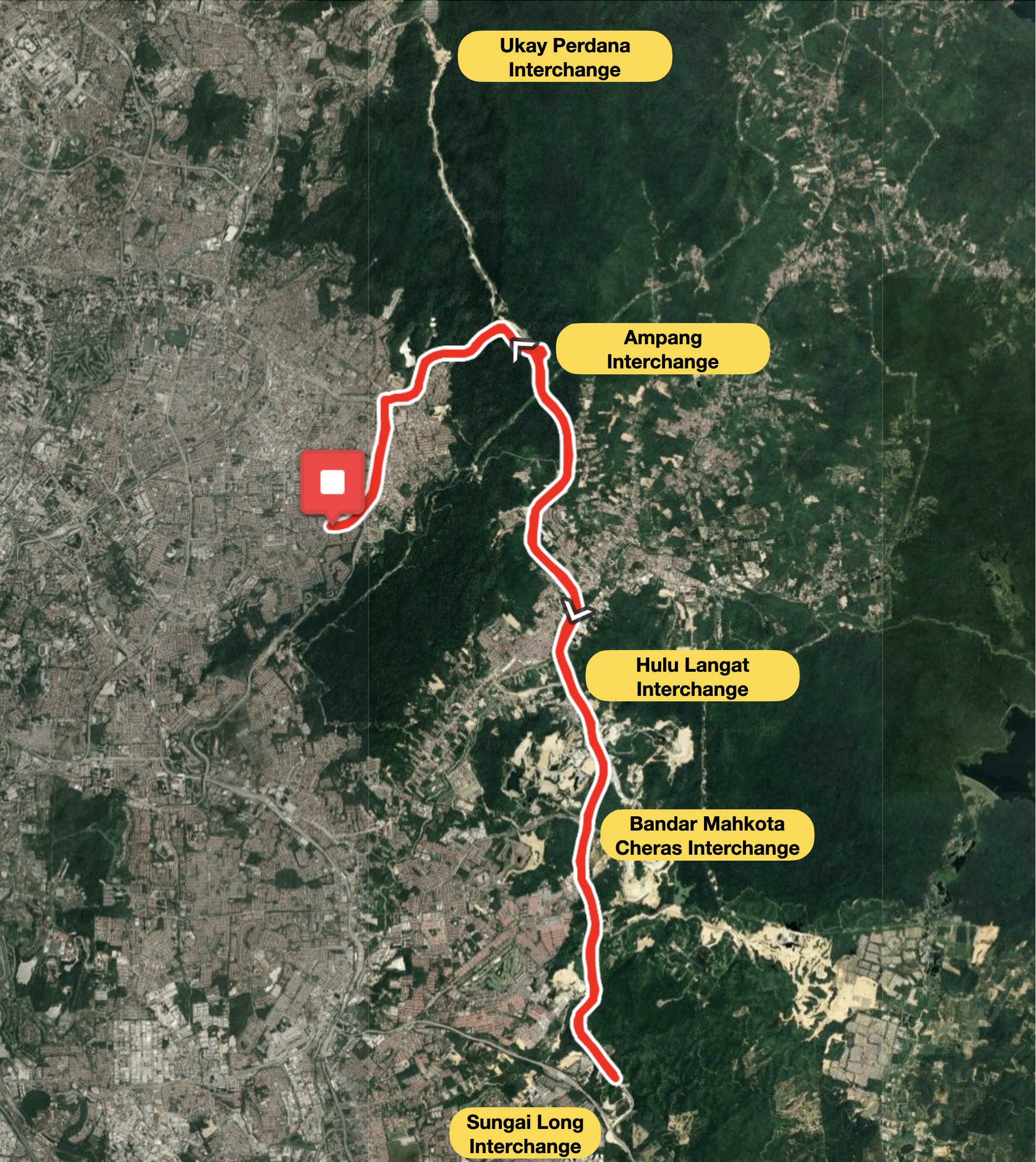
The East Klang Valley Expressway (EKVE) is a new elevated expressway that connects Ukay Perdana in Ampang, Selangor and Bandar Sungai Long in Kajang. The 39.5-kilometre-long (24.5 mi) expressway will open to motor vehicles shortly.
Poster courtesy of Majlis Perbandaran Ampang Jaya
The Majlis Perbandaran Ampang Jaya (Ampang Jaya Town Council), in partnership with the MCC Ampang community cycling club, organised a bicycle ride along the EKVE on Sunday morning, 10th August.
Photograph courtesy of Sungai Long Hill Info and Sharing Station
This was the only opportunity to cycle on the EKVE before it opens to the public. That sounded like it would be fun. G, V and I signed up.
Photograph courtesy of VV
V went to the start point at Laman Tasek Tambahan on Saturday afternoon to collect our number plates and event t-shirts.
Photograph courtesy of VV
The ladies got their number plates. Mine couldn’t be found, so I was told to check with the organizers in the morning.
The ladies and I agreed to meet at Laman Tasek Tambahan at 6:30 am. V realised that with more than 1,000 cyclists registered for this ride, parking would be in short supply. I rode from home to the start. One less car trying to find a parking spot, the better.
Photograph courtesy of VV
My number plate still couldn’t be found, so I got a VIP plate instead. With that, we were ready to roll.
As often happens at these events, the advertised start time came and went. As the minutes ticked by, the sun rose higher in the sky. It has been very hot during the past week. 36ºC / 97ºF hot. V had discovered that there was more than 600 metres / 1,970 feet of elevation ahead of us. That surprised me. It sounded like a lot for a 50 km ride. Whatever the elevation would be, we didn’t fancy climbing under a hot sun.
We started the ride at the back of the group. Just as experience taught me to expect delayed starts, I also knew that, despite this being a fun ride, there would be people who came to race. We did not want to be their way.
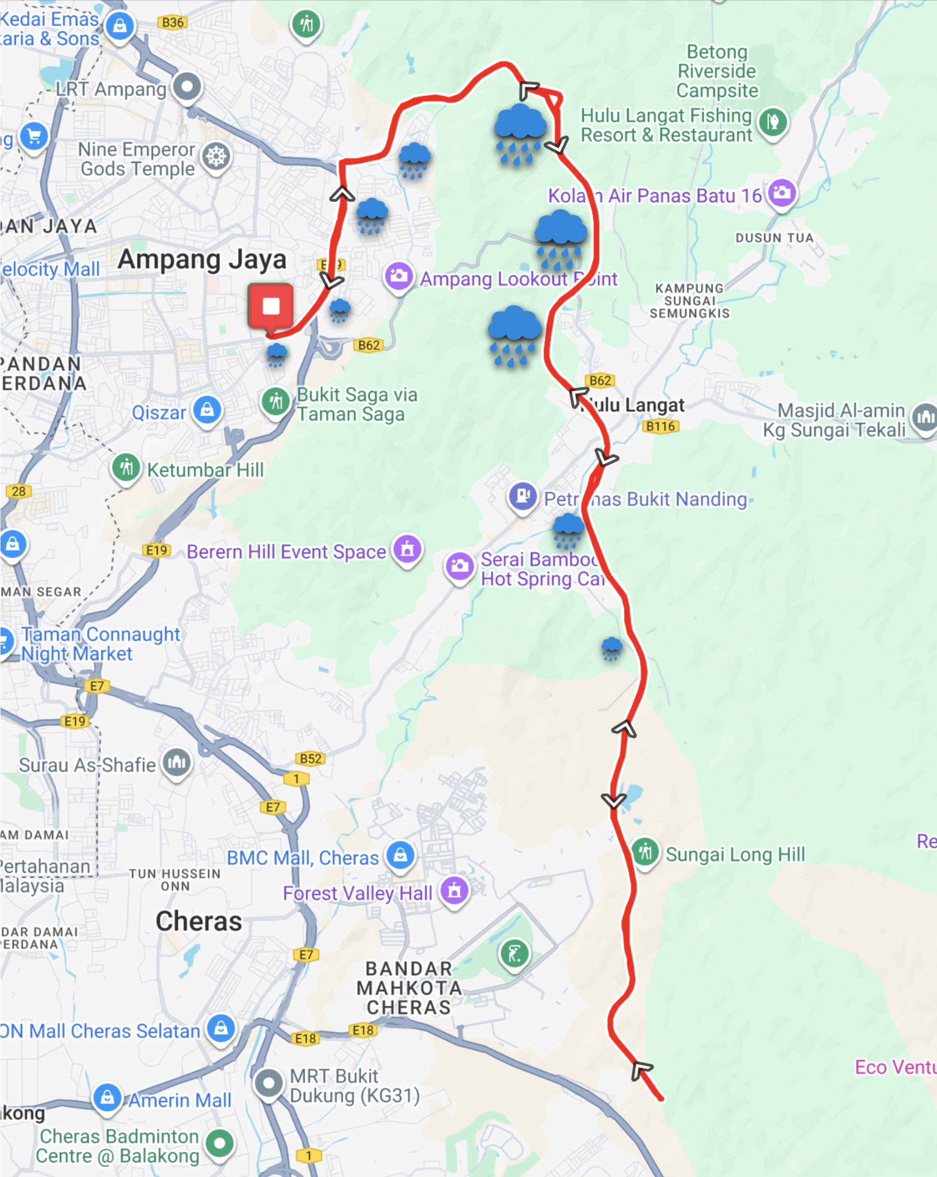
We got moving at 7:55 am. The climbing started immediately. It was 4.3 km to the Ampang toll plaza, incorporating 105 metres of elevation. The next 2.3 km to the Ampang Interchange holds another 130 metres of elevation. We had 135 metres of elevation under our wheels as we rode onto the EKVE. And as V said we would, we did climb more than 600 metres overall.
Map courtesy of Ride With GPS
The expressway is so new that it isn’t on Google Maps. You need Google Satellite view to see the expressway winding through the Ampang Forest Reserve. The route through this ecologically sensitive area was the source of much controversy.
Photograph courtesy of Babyboss Michael Sin
The sun had disappeared behind clouds as we rode onto the expressway. The route through forested hillsides helped keep the temperature down.
There were water stops at the Rest and Recreation Centres on both sides of the highway, as well as at the Sungai Long toll plaza, between the Ampang interchange and the U-turn point 16 km later. In anticipation of a hot morning, I had two bidons on my bike, so I didn’t need to stop for water.
The concern about it being a hot morning was unfounded.
Map courtesy of Ride With GPS
It started to drizzle about 15 minutes after the U-turn. Five minutes later, it was raining hard enough that I stopped to put on my rain jacket.
Photograph courtesy of MCC Ampang
The rain was heavy until the Ampang Interchange. It then became progressively lighter as I cycled through the Ampang toll plaza and arrived at the Laman Tasek Tambahan.
There was the usual queue at the finish as riders waited to collect complimentary food packs and finisher’s medals. I had to convince the person handing out the goodies that, despite my VIP number plate, I had paid to participate and was entitled to a medal.
A collection of vendors was present in the finish area, selling food and drinks. Things like burgers, murtabak (a stuffed flatbread), apam balik (a crispy pancake filled with roasted peanuts, sugar, creamy sweet corn, butter and folded in half), fried noodles, and a variety of coffees and juices.
The covered seating areas quickly filled up, so most of us sat at tables in the drizzle. The wet didn’t dampen anyone’s spirits. Everyone I spoke to enjoyed the ride. Staying cool in the rain is preferable to overheating in the sun.
G, V and I ate some murtabak and more apam balik (we had some before we started riding), checked if our plate numbers had come up in the lucky draw (not even my VIP number plate was a winner), and then headed home after a pleasant morning.
Thank you, MPAJ, MCC Ampang and EKVE for the opportunity to ride along the Klang Valley’s latest expressway.