Monthly Archives: August 2024

I am not a Grimpeur

Graphic courtesy of shutterstock.com

A grimpeur is a climbing specialist. A lightweight cyclist who can ride especially well up inclines. I am not one of those. I am more Magnus Backstedt, a retired professional cyclist who raced weighing 95 kg (209 lb), than Tadej Pogačar, who won this year’s Tour de France weighing 66 kg (146 lb).

Perhaps fortuitously, I started road cycling in Houston. A city where the only climbs are on overpasses.

Map courtesy of en-gb.topographic-map.com

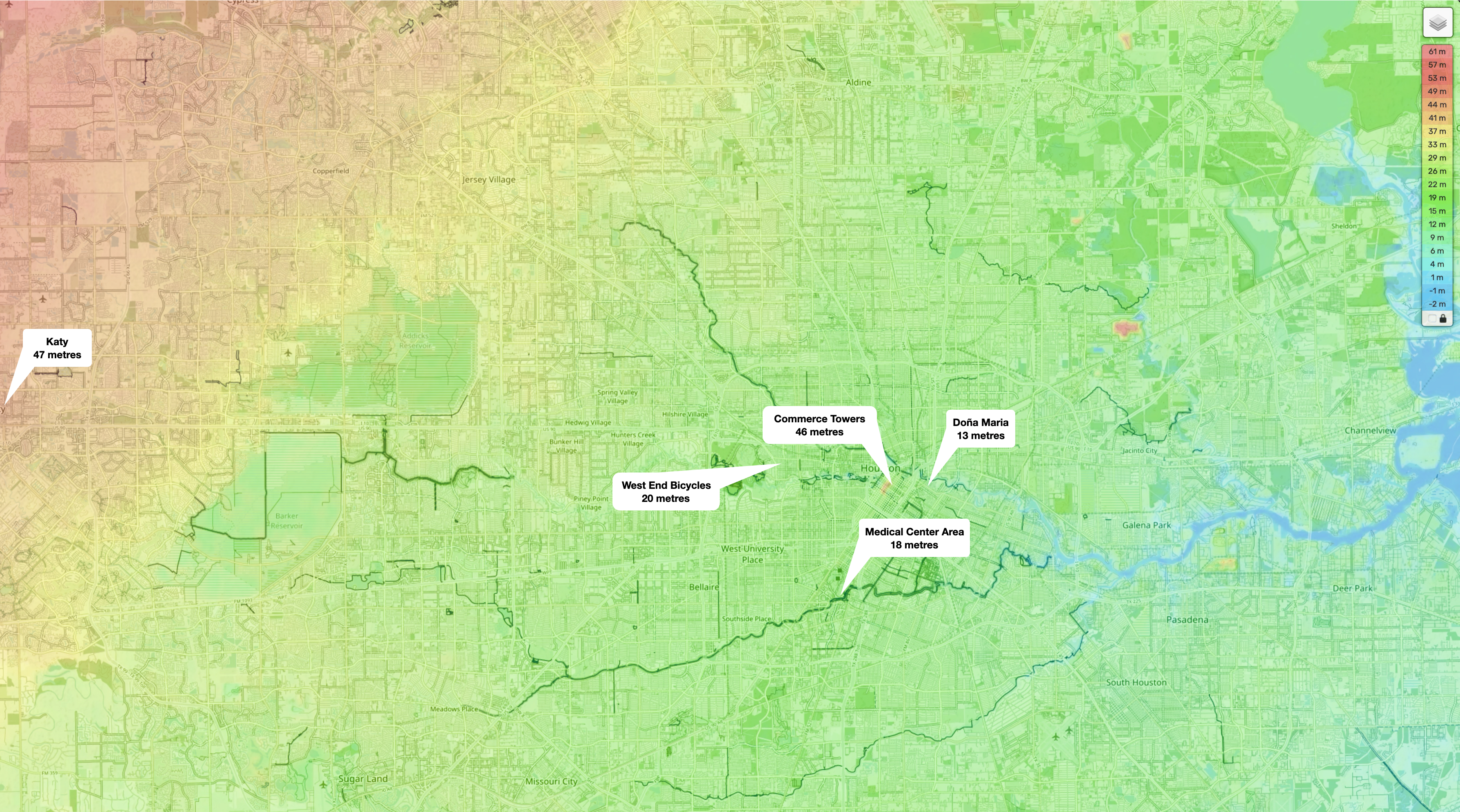
This topographic map shows just how flat Houston and the surrounding area are. I hadn’t realised that Commerce Towers, where I lived in Houston, is in the highest part of the city, at 46 m (151 ft) above sea level. It is downhill from there to West End Bicycles where my group rides started. Doña Maria, our Sunday destination for breakfast tacos, is even lower.

You must drive about 48 km (30 mi) west to Katy and onward another 43 km (27 mi) to Bellville (elevation 92 m) to do any hill cycling.

I moved from Houston to Den Haag. Another city not noted for hills. Much of the surrounding area is below sea level.

Map courtesy of en-gb.topographic-map.com

I lived on Van Hougenhoucklaan which is 5 m (16 ft) above sea level. The sand dunes to the west are a natural form of coastal defence. They form the highest parts of the west of the country. You go 43 km (27 mi) east to Ruiterberg to find land twice as high as Noordwijk. Or 170 km (106 mi) south to Valkenberg which sits at 137 m (450 ft) above sea level.

I moved back to Kuala Lumpur after two years of pan-flat cycling in the western Netherlands.

Map courtesy of en-gb.topographic-map.com

My first ride in Malaysia was to Genting Sempah which is 637 m (2,090 ft) above sea level. That was a shock to my system.

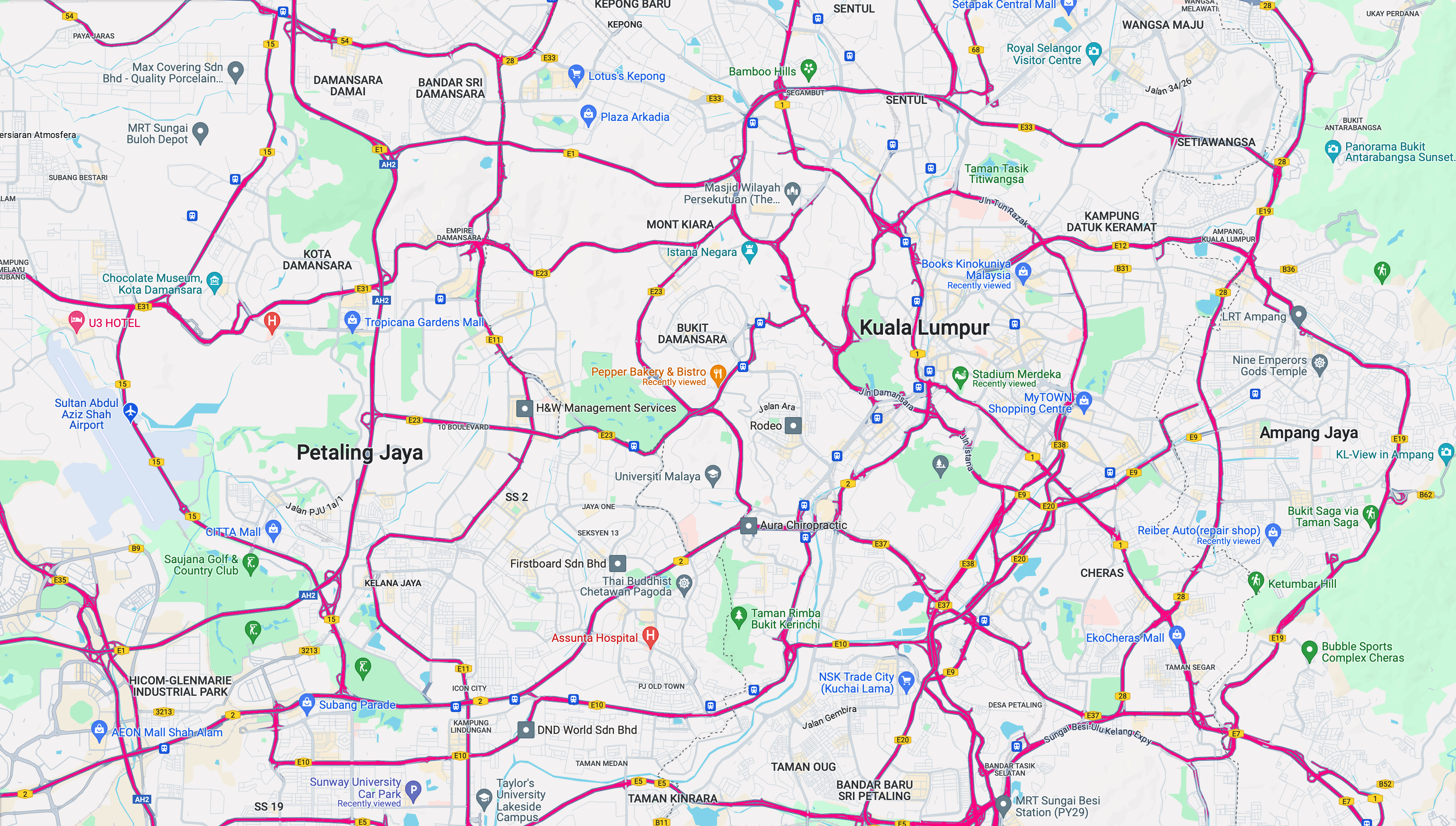
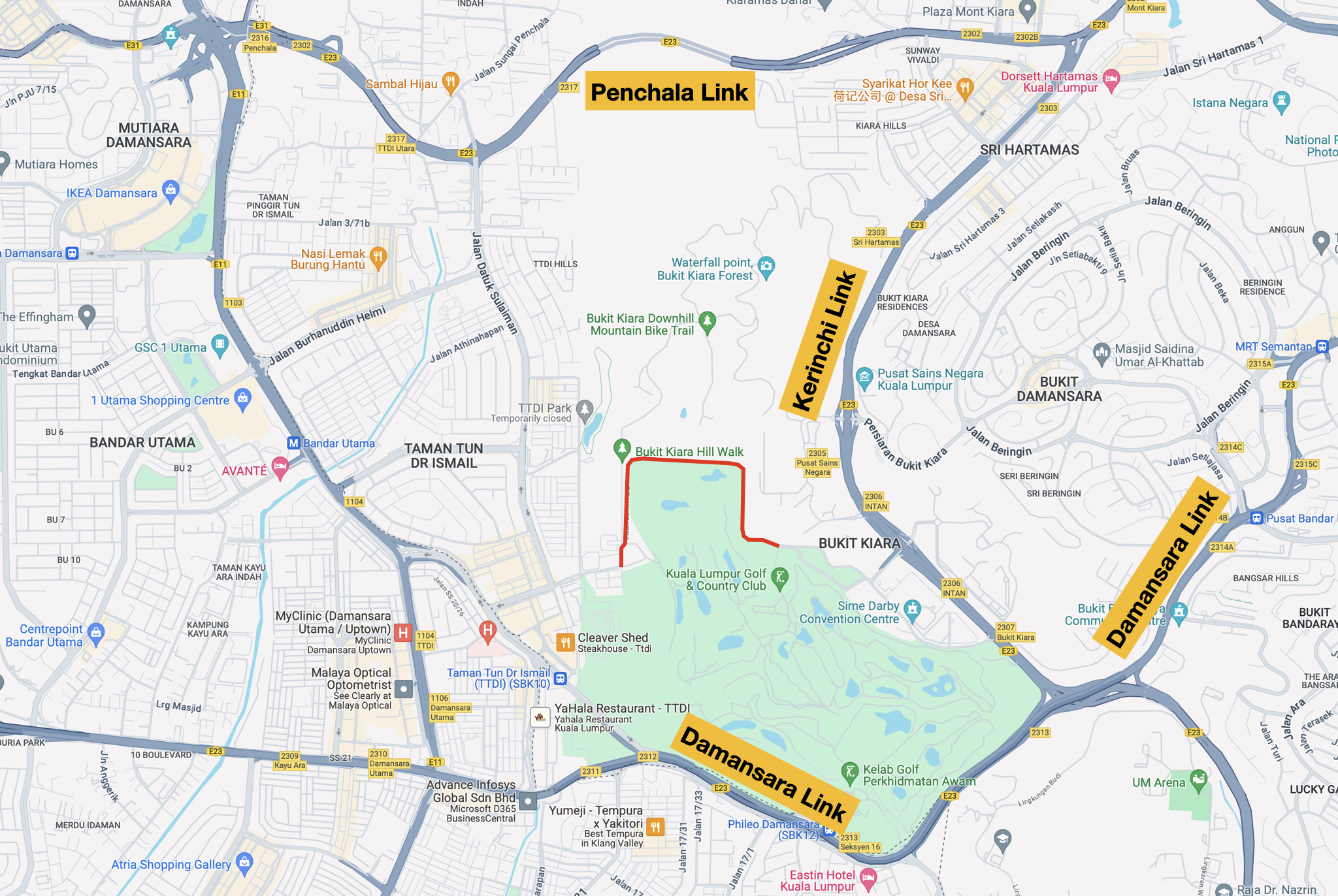
I don’t have to go far from home to find a hill. Bukit Damansara is 6 km (4 mi) west of Anggun Residences. I climb 80 m (262 ft) to get there. Higher climbs lie to the east. Anything from 158 m (518 ft) above sea level to 500 m (1,640 ft) above sea level.

The terrain to the west isn’t as high, but it is rolling. An 18.7 km (11.6 mi) ride along the Guthrie Corridor Expressway (GCE) can include 361 m (1,184 ft) of climbing as you cycle up and down between 16 m (52 ft) and 70 m (230 ft) above sea level.

Map courtesy of ridewithgps.com

I can’t avoid hills, especially if I start riding from home. Climbing is hard work. In my case, the effort is worth it. I enjoy the payoff a lot.

Image courtesy of designer.microsoft.com

Another Road No Longer Accessible to Cyclists

Image courtesy of Microsoft Designer

Like other big cities, Kuala Lumpur is crisscrossed with major roads. Some are accessible to cyclists. Others increasingly less so.

Map courtesy of Google Maps

Over the years, several popular cycling roads in and around the city have been closed to cyclists.

The LATAR Expressway (E25), or Lebuhraya Assamjawa Taman Rimba Expressway, links Templer’s Park in Gombak district to Ijok in Kuala Selangor district. LATAR opened in 2011.

Map courtesy of klia2.info

LATAR became popular with cyclists after the Guthrie Corridor Expressway (E35) opened in 2015. The motorcycle lanes of the GCE provide easy access from Bukit Jelutong to the Kuang Interchange with LATAR. Most cyclists headed west on LATAR to Kundang, Puncak Alam and further afield to Ijok and Kuala Selangor. Cyclists could also ride east to Rawang.

These were the toll rates when LATAR opened. It was free for bicycles.

Table courtesy of klia2.info

My friends and I rode along LATAR many times. Including at the start of a ride to Teluk Intan in 2016.

Photo courtesy of M Lai

Rides on LATAR ended in 2020, when the highway concessionaire, KL-Kuala Selangor Expressway Berhad, banned cycling on safety grounds.

The Maju Expressway (E20) opened in 2007. MEX links Kuala Lumpur with Cyberjaya and Putrajaya.

Map courtesy of klia2.info

MEX gave me easy access to the motorcycle lanes on the KESAS Highway (E5) via the Bukit Jalil Interchange. Those motorcycle lanes took me from Bukit Jalil to Bandar Sunway, Kota Kemuning, Bandar Botanic and Federal Route 5.

MEX was also free for bicycles when it opened.

Table courtesy of klia2.info

My friends and I rode the full length of MEX a few times, including in 2018. MEX was the starting leg of rides south to Port Dickson and Melaka.

Photograph courtesy of M Lim

The concessionaire, Maju Expressway Sdn Bhd, banned cyclists from MEX in 2020. At about the same time that cyclists were banned from LATAR.

The latest highway concessionaire to ban cyclists is Sistem Penyuraian Trafik KL Barat Sdn Bhd (SPRINT). In their case, from the SPRINT Highway (E23).

SPRINT has three parts. The Kerinchi Link and the Damansara Link were opened in 2001, followed by the Penchala Link in 2004.

Map courtesy of klia2.info

A favourite route of mine is from home through Bukit Tunku to Sri Hartamas to Damansara Heights. I ride on the Kerinchi Link and Damansara Link from the Sri Hartamas interchange (2303) to the Jalan Setiapuspa exit and the back roads to Damansara Heights.

Last Sunday at about 7:30 am, I was on the Kerinchi Link about 200 metres from the Sri Hartamas interchange. Two SPRINT Auxiliary Police officers on motorbikes, blue lights flashing, saw me from the other side of the highway. They made a U-turn at the Sri Hartamas interchange, caught up to me, and flagged me down.

Photograph courtesy of litrak.com.my

The officer was very polite. He apologised while telling me that cyclists are prohibited on the SPRINT Highway. So I had to exit at the Pusat Sains Negara Interchange (E2305) and climb the Science Centre hill. The hill that I avoid by riding to the Jalan Setiapuspa exit.

Map courtesy of Google Maps

 This ban will be hard on cyclists who live in Taman Tun Dr Ismail (TTDI) and Bandar Utama. Since Jalan Bukit Kiara 1, along the edge of the Kuala Lumpur Golf & Country Club (in red below), was closed, the only way cyclists had of getting from TTDI and Bandar Utama to Bukit Damansara and other popular cycling spots further east was either along the Damansara Link or the Penchala Link.

Map courtesy of Google Maps

Those options are now not available. That means no more cycling from TTDI and Bandar Utama to Damansara Heights.

I am stuck too. I can get to Damansara Heights via Jalan Parlimen, Jalan Tuanku Abdul Halim and Jalan Semantan. However, that requires crossing multiple lanes of traffic before turning left onto Jalan Semantan. That is much more dangerous than using the Kerinchi Link and the Damansara Link, where all the turns are to the left and do not require crossing lanes.

I may have to drive my bicycle to Damansara Heights from now on.

Image courtesy of Microsoft Designer